Showing posts with label Ancient Illinois. Show all posts

Sunday, February 28, 2021

The Prehistoric Old Stone Fort, Saline County, Illinois.

The Stone Forts of Illinois.
One of the unique prehistoric phenomena of Southern Illinois is the ruins of stone walls which have traditionally been known as "stone forts." They appear in the rough east-west alignment across the hill country and appear to form a broken chain between the Ohio and Mississippi Rivers. These ruins have similar geographic site characteristics. They are generally located on bluffs, which are often finger-like promontories of land with steep cliffs on three sides and a gradual incline on the fourth. It was across these inclines leading to the top of the bluff that these stone walls are most generally located, hence the theory of a pound or game trap, has been advanced.

Many of the walls have long been torn down and removed for building purposes. Early settlers, in most instances, removed the better slab-like stones for building foundations, leaving only the rubble. These early white pioneers saw the walls and thought of them in terms of their own experiences, particularly from the standpoint of defense against the Indians. Though they called them stone forts, these sites would be very poor places to carry on prolonged fights.

If a small band took refuge behind the wall, they might be pushed over the cliff by a larger attacking force. Or a larger force could lay siege to the place, and the band would be cut off from both food and water and soon starve to death. Although they called them "forts," many people did not accept such a theory, and speculation continued.

Archaeologists believe that particularly in Ohio, the Hopewellian Indians probably were responsible for some of the walls, but the identity is not known. These walls represent a major accomplishment for a people who had only primitive digging implements and methods of carrying or moving heavy stones. These unknown builders piled rock completely across summits, leaving inside enclosures sometimes as large as 50 acres, depending upon the size of the bluff.
The Old Stone Fort in Southern Illinois lies between the Ohio and Mississippi Rivers.


Another fort built almost exactly as the Makanda Fort is the fort that lies southwest of Carrier Mills in Saline County. The old fort site is found four miles east of the present town of Stonefort in Williamson County and seven miles east of Creal Springs, Illinois. Its area is almost the same as Makanda's Fort and research into the Archivo General de Indias at Seville, Spain (the repository of extremely valuable archival documents illustrating the history of the Spanish Empire in the Americas) shows that such a fort was spoken of by DeSoto in 1542. 


This old fort is on top of a hill, which is almost inaccessible. The walls are constructed of large stones and the whole reminds one of the ruins of a once well-constructed fortification. It has gone to ruin more or less within the past one or two years. The first house in the vicinity was one built in 1831 by J. Robinson. The village of Stonefort is situated atop a ridge that rises above the South Fork Saline River valley to the north and the Little Saline River valley to the south. The village of Stonefort was established in late 1858 and was originally located about a mile to the southeast, near the edge of the bluff. There were houses there earlier. 
Some scholarly visitor named the ruins Cyclop Walls, but most people simply call it old Stone Fort.


When the Cairo and Vincennes Railroad was completed through the area in the 1870s, Stonefort's public buildings were dismantled and moved to the village's present location, which was adjacent to the railroad tracks. The former site of the village is now listed as "Oldtown" on maps which is 1.8 miles northwest of Stonefort.

Compiled by Dr. Neil Gale, Ph.D.

Saturday, February 27, 2021

The Prehistoric Makanda Stone Fort, Jackson County, Illinois.

The Stone Forts of Illinois.
One of the unique prehistoric phenomena of Southern Illinois is the ruins of stone walls which have traditionally been known as "stone forts." They appear in the rough east-west alignment across the hill country and appear to form a broken chain between the Ohio and Mississippi Rivers. These ruins have similar geographic site characteristics. They are generally located on bluffs, which are often finger-like promontories of land with steep cliffs on three sides and a gradual incline on the fourth. It was across these inclines leading to the top of the bluff that these stone walls are most generally located, hence the theory of a pound or game trap, has been advanced.

Many of the walls have long been torn down and removed for building purposes. Early settlers, in most instances, removed the better slab-like stones for building foundations, leaving only the rubble. These early white pioneers saw the walls and thought of them in terms of their own experiences, particularly from the standpoint of defense against the Indians. Though they called them stone forts, these sites would be very poor places to carry on prolonged fights.

If a small band took refuge behind the wall, they might be pushed over the cliff by a larger attacking force. Or a larger force could lay siege to the place, and the band would be cut off from both food and water and soon starve to death. Although they called them "forts," many people did not accept such a theory, and speculation continued.

Archaeologists believe that particularly in Ohio, the Hopewellian Indians probably were responsible for some of the walls, but the identity is not known. These walls represent a major accomplishment for a people who had only primitive digging implements and methods of carrying or moving heavy stones. These unknown builders piled rock completely across summits, leaving inside enclosures sometimes as large as 50 acres, depending upon the size of the bluff.
The Makanda Township Stone Fort in Southern Illinois lies between the Ohio and Mississippi Rivers.


The Makanda Stone Fort is a quarter of a mile northeast of the village of Makanda, Jackson County, Illinois, and is a part of Giant City State Park.

About 1000 years ago, when Indian cultures were enjoying the area’s abundant resources (water, wildlife, nuts, berries, and roots) in the Shawnee National Forest, a stone fort was found. It is thought to have been built during the Late Woodland Period (1000 BC - 1000 AD), probably between 600 to 900 AD. 
A Shawnee National Forest Overlook.
These prehistoric forts were constructed on a raised mass of land known as a promontory (a point of high land that juts out into a large body of water), while some others were built on hilltops that provided an excellent overlook giving them a vantage point to see for miles across Illinois' premier forest.

The massive stone wall was at one time 285 feet long, six feet high, and nine feet thick on 1.4 acres of land. The appearance of a “stone fort” or stone wall located in Giant City State Park, which is part of the Shawnee National Forest, sits atop a sloped ridge
There are actually about ten of these old structures in the southern Illinois area, and they are believed to have been either a military fortification as a meeting place or a ceremonial temple.

Most of these sites were not habitation sites (villages) in the usual sense. There was only a modest amount of artifacts, which is common among places of sporadic use for short periods of time. Debris found on this site includes sherds of grit or grog-tempered cord-marked pottery and stone tools, like projectile points. Many Late Woodland tribes lived in large, intensively occupied villages located near major rivers and streams such as Cahokia and East St. Louis. They had a mixed economy of hunting, gathering, and cultivated a series of native plants like barley, sumpweed, maygrass, and squash.
For years archaeologists have wondered about the stone fort’s usage. Some say that these were “sacred spaces” reserved for periodic activity. Archaeological digs have located items that prove that the Indians of Southern Illinois were part of an extensive trading network. They believe the trading network followed the trails in Southern Illinois that became the early pioneer roads centuries later. Archaeologists suggest the possibility that stone forts were designated areas where different tribes or sub-tribes could meet, socialize, and trade on neutral ground.

The original wall was dismantled by European settlers, who used the stones in order to build their own structures; the stone base is all that remains of the original wall. It was reconstructed in 1934 by the CCC (Civilian Conservation Corp) workforce gathered the scattered stone and rebuilt the wall in its original location, but has since fallen into ruins again.
The location of this wall leads one to believe it was built for a fortification of some kind and as the building must have required a great deal of time and labor. It was surely built for more than just temporary use. The distance to the edge of the bluff in front is over 500 feet, thus affording room for quite a party taking refuge therein. The bluffs that form three sides of the enclosures are unscalable without the use of ropes and ladders except in two places, and these are easily protected from above for they are just narrow crevices up which one could, with difficulty, climb and then only by the aid of the jagged edges of the protruding rocks. One man could lie behind boulders at either place and easily protect it against a number of his enemies with crude stone-age weapons, traces of which were found everywhere in the vicinity and all through this section. Several pieces of flint and arrowheads have been picked up on the top of the bluff. 

Another reason for believing that this fortification was built as a defense against tribesmen is that it is at the upper end of the valley where the opposite bluff is not over 200 yards distant, and is higher, though not so precipitous. From this bluff, one with a rifle could easily shoot into the fort, but with bows and arrows, very little damage could be done. In fact, it is by far the best location in the valley. Water is easily accessible and flows from a little stream within 100 feet of the cliff where it is scalable and at several places in the brooks are springs. 

Ancient features more closely related to a seasonal hunting camp where hunters would take advantage of game resources, then move on.

Other theories included the notion it was actually early European explorers, such as DeSoto, who created the rock fortresses while making inroads to conquer the land. No such evidence of European construction exists, of course.

The oldest settlers in Jackson County say that the area was covered with bushes when they first came here. No one knows the early history of the fort as a certainty and there is little likelihood of it ever coming to light. Parts of the wall of this fort were standing as late as 1870 and were torn down by a Doctor CalIon in hunting for relics. None were found which is more strong evidence that the fort was built by someone other than Indians. George W. Owens, still living in 1931, who came to Makanda in 1862, tells of a small, one-pounder cannon that was found in the wall of the old fort. It was used in Fourth-of-July celebrations around Makanda for 50 years and finally sold to a junk dealer. The French Lieutenant Aubrey, passed this way from Kaskaskia in 1720 with 30 French and 300 Indians on his way to Fort Massac on the Ohio River to thwart the English, who were reported to be on their way down the Ohio River toward Kaskaskia. Aubrey had three brass cannons of this description. This may have been one of them. 
The first professional archaeological investigation of the fort site was conducted in 1956 by archaeologists from Southern Illinois University. An explanation for the large hole in the front of the wall is unknown, although it most likely represents the work of treasure hunters. The hole was there when the site was officially recorded as an archaeological site in 1956.
In the fall of 2000, archaeologists from Southern Illinois University Carbondale conducted an investigation of the Stone Fort site. Of the 153 shovel tests executed south of the wall, all were positive for prehistoric artifacts. This led the scientists to nominate Giant City’s Stone Fort for the National Register of Historic Places. The Giant City Stone Fort Site was listed on the National Register of Historic Places on August 9, 2002
The Stone Fort Trail in Giant City State Park is a little-known path that leads to some truly intriguing ruins. It is less than half a mile in length and is a loop trail.

Compiled by Dr. Neil Gale, Ph.D.

Thursday, January 9, 2020

The History of the Paleo-Indian, the Hopewell Culture, of the Albany Mounds, in Albany, Illinois.

One of the most important archaeological sites in Illinois, Albany Mounds, contains continuous human occupation over the last 10,000 years. The Albany Mounds date from the Middle Woodland (Hopewell) period (200 BC to 500 AD), older than either the Cahokia Mounds (700 AD to 1650 AD) or Dickson Mounds (800 AD to 1250 AD) of the Mississippian period.

The indigenous people who lived here as early as 500 BC were part of the Hopewell culture, so named because their existence was first learned of on the Hopewell farm in Ohio, where similar mounds had been built. It is not known what the people called themselves or what language they spoke.

The region around Chillicothe, Ohio, was the center of the ancient Hopewell Culture. This Paleo-Indian culture had trade routes extending to the Rocky Mountains. They built earthen mounds for ceremonial and burial purposes.

The "Hopewell culture" doesn't refer to a particular Indian tribe; instead, it’s a name for a distinctive set of artifacts, earthworks, and burial practices characteristic of sites found in Ohio, Indiana, and Illinois.
These artifacts show significant artwork of the Hopewell-Havana phase.
Vessels A and B were about the size of a modern 5-gallon bucket.


While still obtaining food largely through hunting and gathering, Woodland peoples began practicing basic horticulture of native plants. Woodland peoples are distinguished from earlier inhabitants by developing pottery and the building of raised mounds near large villages for death and burial ceremonies.

It is believed that their culture seemed to decline somewhere about 350 AD. From about 200 BC to 300 AD, the Albany Hopewell constructed over 96 burial mounds at this site. It was, and still is, one of the largest mound groups in the nation. It is the largest Hopewell culture mound group in Illinois. The Albany Hopewell built their mounds on the bluff tops above the village and on the terraces adjacent to the village.
The site was well suited to the Hopewell culture, which was not an Indian tribe but rather a term referring to the period of time in Paleo-Indian history marked by trade, communication, and a sharing of ideas throughout an extensive area of the continent. They preferred to build their villages at the base of bluffs along the floodplains of major rivers, such as the Mississippi, that offered transportation. At Albany, with the adjacent Meredosia Slough, which served as flood drainage for the Mississippi and Rock Rivers, there was an abundant source of food and water. The waters, forest, and prairie provided food and fuel for the Hopewell.


Today, about 50 mounds remain; thirty-nine of the mounds remain in good condition, while eight have been partially destroyed through erosion, excavation, or cultivation. Other mounds were totally destroyed by agricultural activities, railroad, and highway construction, site looter. Still, others were destroyed in the process of being scientifically excavated in the early 1900s by the Davenport Academy of Natural Sciences.
Burial artifacts include non-local materials indicating the existence of trading networks with Indians from other areas. The site of the nearby village remains privately owned. The mounds were placed on the National Register of Historic Places in 1974.
In the 1990s, the site was “restored" to a natural appearance, and of about one hundred acres of the prairie was re-established.

Compiled by Dr. Neil Gale, Ph.D.

Friday, July 5, 2019

Ancient Illinois history beginning on the supercontinent of Pangaea.

We will follow the land that makes up modern Illinois, beginning from the Mesozoic era (250 to 65 million years ago ─ the Age of Dinosaurs).

Throughout the planet's 4 billion-year history, eight supercontinents (see list of the major supercontinents below) have formed and broken up due to the churning and circulation in the Earth's mantle, which makes up most of the planet's volume. The breakup and formation of supercontinents have dramatically altered the planet's history.

The hypothetical supercontinent called Pangaea (ancient Greek meaning "all lands") was assembled from earlier continental units approximately 335 million years ago and began to break apart during the Triassic period (250,000,000 BC ─ 205,000,000 BC) and the Jurassic Period (205,000,000 BC to 135,000,000 BC). 
The land that Illinois sits on is the moving North American tectonic plate. There are seven major tectonic plates. Other than the North American plate, there is the; African plate, Antarctic plate; Eurasian plate; Indo-Australian plate; Pacific plate; and South American plate. 

In fact, today's Illinois was south of Earth's equator twice! During these times, it was covered with tropical forests, forming coal deposits over the millennia. Some of the Mazon Creek fossils discovered in Illinois are found nowhere else in the world, like the "Tully Monster." 

Some ancient life represented is ferns, insects, shrimp, jellyfish, and fish scales - fossilized in rock 310,000,000 to 200,000,000 million years ago before continents formed Pangaea in the Paleozoic era.
From Pangaea to the Modern Continents.

Over 260,000,000 million years ago, a shallow ocean covered the area, forming layers of limestone from the calcium carbonate shells of abundant snails, clams, and other sea life. The local laminar limestone deposits can easily find fossils of trilobites, mollusks, sponges, corals, and crinoids. Shark teeth and starfish have also been discovered here. An amateur paleontologist from Eyler, just east of Pontiac, found two new fossil crinoid species in Wagner Quarry south of Pontiac. Her husband, also a crinoid expert, named one of the new species pontiacensis, and the other, Christine, after his wife. 

A mile-high block of ice through the Ice Age was atop the landscape. When it melted, Lake Ancona formed in where it is now east-central Illinois with a clean sand bottom. It eventually drained, and many smaller lakes were formed. As the climate became drier, Ice Age megafauna moved in. Local finds of wooly mammoth tusks and teeth, along with a 50-pound copper nugget transplanted by the ice from the Mesabi Range iron ore area of northern Minnesota. Buffalo (American Bison) covered the area during the Pleistocene Era (aka the Ice Age - 2.6 million to 11,700 years ago) and again 500 to 300 years ago, only to finally disappear in the early 1800s. 

Bison bones were found along the area's banks of the Vermilion River in 2011. They were only the third discovery of bison bones east of the Mississippi River from the Holocene Era (12,000 years ago to the present day), indicating only sparse, intermittent perhaps, distribution of the bison in this area then. The other two Holocene discoveries were near Ottawa in a silica quarry and Mapleton, 12 miles downstream from Peoria, where the mouth of a tributary stream emptied bison carcasses into the Illinois River.

About 14,000 years ago, the first humans (the original indigenous people) arrived. Only a few of their early spear points (Clovis points) have been found in Illinois, which were lost in hunting these large game mammals. The Archaic Period peoples (8,000 BC to 1,000 BC) were wandering hunter groups following the game. Living in small groups, they roamed for food, camping for several days to weeks and then moving on. They produced spearheads commonly found along rivers, creeks, and the prairie. Today's artifacts were made from flint and chert, a form of metamorphosed limestone, deposits of which are rare in this area. Some of their weapons and tools include copper spear points from the Old Copper Culture (4000 BC to 1000 BC). A 6-inch copper point was found in Dwight, Illinois. The Archaic people found rare copper nuggets dropped here by retreating glaciers they hammered into tools and weapons. 
One of the most unique tools from this period is called "banner stones." These pieces of stone were of varied shapes with a longitudinal hole drilled in the center. They were slid onto a throwing stick, called an Atlatl (an Indian word meaning: spear-thrower). This extra weight and the extended leverage of the throwing stick enabled a hunter to throw a spear at a much higher speed, thus improving the chance of bringing down their prey.
Atlatl Basics

The Woodland Period (1000 BC to 1000 AD) saw more advanced cultures of settled groups in villages with gardens of sunflowers, squash, pumpkins, and beans to supplement hunting for game. Trade routes to Florida, Michigan, North Dakota, and other far-flung states were established for obtaining scarce items such as suitable stone for tools and weapons, copper for axes, and mica from Carolina for mixing with clay for stronger pottery. Workable stones from neighboring states like Indiana, obsidian (lava glass) from Wyoming, and copper from Minnesota and Wisconsin are evidence of that trading in Illinois. About 3,000 years ago, pottery first appeared in North America. That early crude pottery has been found here. Other finds include bear teeth and elk antlers — both species disappeared from the area long ago.

John McGregor, a Pontiac native who became the Director of the Illinois State Museum, found a blade that he determined was made by the same person who made the Mackinaw Cache blades located in Tazewell County, a group of blades widely recognized as the finest examples of "chipped" stone ever found in North America. He was involved in many of the early archaeological efforts in the state. He directed the Washburn, Illinois, excavating a mass burial near a creek containing four pits with approximately 200 individuals each! 

The Mississippian Period (800 AD to 1600 AD) saw a higher level of culture develop in North America. Instead of isolated sustenance gardeners and gatherers, maize (corn) was more widely introduced, planted in larger tracts, and remains today the dominant driver of our county's culture and economy. Two flint hoes 11 inches long were found at two locations along Rooks Creek and a cache of 26 hoes south of Pontiac. Simpler hoes from this time are found throughout the area. The use of these hoes marked the beginning of agriculture as we know it today. 

sidebar
 
Flint Hoe
Mississippian Period "Flint Hoe" — This flaked chert hoe head commonly shows use and wear along the bit edge. They were used for gardening or construction activities. This tool was widely used throughout the midwest and the southeastern United States. They typically range in size from 3 to 12 inches long.
 

The Mississippians began using corn as their primary community resource rather than just another private family garden staple. Cahokia points are found here, named after the Cahokia Mounds complex near Collinsville, which contains the largest prehistoric earthen structure in the Americas; Monk's Mound. Larger at its base than Egypt's Great Pyramid, Monk's Mound was the home of the Chief of what was, at the time, the largest city in the Americas. 
Indian drinking vessels were found near Cahokia, Illinois.
A copper falcon headdress piece was found at the mouth of the Vermilion River near Ottawa. Area peoples used the river as their highway for trade and cultural exchanges. A smoking pipe in the shape of a fish head and one of a bird's head are examples of other Illinois artifacts from this period.

Nearly all the information we have of the prehistoric native human inhabitants of the area comes from discoveries of what they left behind; burials, tools, and weapons buried in campsites and villages, and earthen works like Monk's Mound in Cahokia. Burial mounds were common all over Illinois, mostly by rivers, streams, and other bodies of water.

Most mounds in Illinois are gone now, succumbed to tilling the soil for farming, treasure hunters and looters. In the early twentieth century, a banker named Payne from Springfield excavated the Billet Road mounds and stripped them of all their manmade items, now lost history. A mound north of Fairbury along the river was excavated while digging a basement for a house, and it contained one individual and burial tools. 

Indigenous people produced no written language other than petroglyphs or picture art (examples 1 and 2) that depicted events, surreal imagery, and early art. No translatable written record was left to us. Names of individuals, their tribal names, battles, migrations, food issues, and weather; none of this information is known first-hand. Only when the onset of European migration westward from the east coast and southwest from New France (Canada) did any historical records begin appearing to gain insight into the first 12,000 years of human history in Illinois. 

Compiled by Dr. Neil Gale, Ph.D.

Major Supercontinents

The list is written in reverse-chronological order ("stratolithic order"). Dates are given as the approximate beginning of the supercontinent's formation, then the approximate ending of the breakup. The Notes column provides the geologic period of the fully formed supercontinent.
 mya=Million years ago    bya=Billion years ago 
Name

Years Ago
NOTES & Geologic Period
Pangaea 0.335 mya – 0.173 mya Phanerozoic > Paleozoic > Permian
Pannotia, aka Vendian 0.62 mya – 0.555 mya Precambrian > Proterozoic > Neoproterozoic > Ediacaran
Rodinia 1.071 mya – 0.75 bya Precambrian > Proterozoic > Neoproterozoic > Tonian
Columbia, (aka Nuna) 1.82–1.35 bya Precambrian > Proterozoic > Paleoproterozoic > Statherian
Kenorland 2.72–2.1 bya Neoarchean sanukitoid cratons and new continental crust formed Kenorland. Protracted tectonic magma plume rifting occurred 2.48 to 2.4 bya and this contributed to the Paleoproterozoic glacial events in 2.4 to 2.22 bya. The final breakup occurred 2.1 bya.
Ur 3.0–2.803 bya Classified as the earliest known landmass, Ur was a continent that existed three billion years ago. While probably not a supercontinent, one can argue that Ur was a supercontinent for its time as it was possibly the only continent on Earth, even if it was smaller than Australia is today. Still, an older rock formation now in Greenland dates back to Hadean times.
Vaalbara 3.6–2.803 bya Possibly the first supercontinent.
Superior Craton 4.031 bya Existed when Vaalbara was formed.
THE SUPERCONTINENT OF PANGAEA


Saturday, June 29, 2019

Fossils of the "H Animal" and "Y Animal" discovered at Mazon Creek, near Braidwood, Illinois. A 310 million year old mystery.

The “H Animal," Etacystis Communis.
It was a soft-bodied invertebrate that lived in shallow tropical coastal waters of muddy estuaries (where the tide meets the stream) during the Pennsylvanian geological period, about 310 million years ago. Many exquisitely preserved specimens are found in the ironstone nodules that make up the deposits.
The majority of collecting areas are the spoil heaps of abandoned coal mines, the most famous of which is Peabody Coal Pit 11. Francis Creek shale pit 11 now serves as a cooling pond for the Braidwood nuclear power plant, but with over 100 other localities, specimens still come to light.

It is thought to be a filter-feeding organism that grew throughout its lifetime, achieving a maximum length of 4.3 inches.
A little hard to see, but look at the darker "H" in the center of the fossil.
The classification is uncertain. The animal had a unique H-shaped body ranging from 3/4 inch to 4.3 inches long, and researchers have suggested a hemichordate (wormlike marine invertebrates) or hydrozoan (relatives of jellyfish) affinity. Examples of the H Animal have been found only in the Mazon Creek (River) fossil beds in Illinois.

The “Y Animal," Escumasia Roryi.
It is a puzzling creature. It has only found in the Peabody Coal Pit 11 of the Mazon Creek formation. The only species of the subfamily, it is Y-shaped, bilaterally symmetrical, soft-bodied and is about 6 inches in length.
It appears to have a mouth slit on the top between the two arms and a second opening on one side of the main body, presumably an anus, though there is no proof that it is an anus. It is attached to the sea floor by a stalk attached to a round base. Oddly, a specimen appears to have a short tube-like structure in between the two arms near the mouth.
Because of the lack of complex structures or apparent internal organs, it is believed that it must have been related to coelenerates (cnidarians) and may have used stinging nematocysts on its arms to capture prey. However, because of its bilateral symmetry and second opening, it can’t fit the technical definition of a coelenerate. 

Therefore, it is considered a separate group that may have broken off of the cnidarians and gone extinct as a failed evolutionary experiment. If it were to be classified as a coelenerate, the definition of coelenerate would have to be changed and a new class would have to be added.

Compiled by Neil Gale, Ph.D.

Friday, June 28, 2019

Illinois' Greatest Fossil Mystery... Solved!

Since 1955, when amateur fossil hunter Francis Tully discovered an unlikely prehistoric creature in a coal mining area near Morris, Illinois, 55 miles south-west of Chicago, the 'thing' that was named Tullimonstrum (Tully monster) has presented one of the great puzzles in paleontology.
A Tully Monster in Motion.

Much as the people of Metropolis wondered whether Superman flying overhead was a bird or a plane. Scientists have struggled to classify these fossils that showed traits associated with several disparate animal types and such abnormalities as eyes mounted on an external bar and a long, toothy proboscis.

If you put a worm, a mollusk (snails, slugs, mussels, and octopuses), an arthropod (insects, spiders)
, and a fish in a box and shook it up, then you'd have a Tully monster, in the end. Paraphrased from Carmen Soriano, a paleontologist at Argonne National Laboratory.
Tullimonstrum gregarium, dorsal view, from an article titled, "The Tully monster is a vertebrate," in the Field Museum of Natural History's "Nature magazine."
The Tully's renown even stretched to the Illinois state legislature, which named it the official state fossil in 1989, some 308 million years after it inhabited the shallow salty waters that turned into Illinois' Mazon Creek geological deposits in Grundy County, one of the richest fossil troves on Earth.

sidebar
About 540 million years ago, between the Gondwana and the Laurasia supercontinent [1] periods, when the Earth was about 4 billion years old, Illinois was south of the equator for the second time. Illinois was part of a low-lying basin covered by a shallow, warm tropical sea. As land masses shifted over time, this saltwater became trapped in aquifers that still exist underground today.

However, Tullimonstrum gregarium has a home on the Tree of Life rather than in the biological category known as the "problematica." Utilizing the synchrotron X-ray machine at Argonne and the Field Museum's collection of 2,000 Tully specimens, a team from those two institutions, Yale University and the American Museum of Natural History announced in a paper published in the journal "Nature" on March 16, 2016, that "The Tully monster is a vertebrate."
Morphology and Phylogeny of Tullimonstrum.
CLICK FOR A FULL-SIZE VIEW.
a: Chordate phylogeny including Tullimonstrum gregarium; lampreys in yellow; hagfishes in orange.
b: Reconstruction of Tullimonstrum. 
c: Tullimonstrum, oblique lateral view: 
    Eyb; eyebar; 
    My; myomeres; 
    GP; gill pouches; 
    CF; caudal fin; 
    No; notochord; 
    OtL; otic lobe, and OpL; optic lobe of the brain and dorsal fin.
d: Line drawing: black, teeth; brown, lingual organ; light grey, eyebar; dark green, gut and oesophagus;  ed, notochord; light green, brain; orange, tectal cartilages; pink, naris; purple, gill pouches; yellow, arcualia; dark blue, myosepta; blue with black stripes, fins with fin rays.

Below that headline, the paper describes Tully as belonging "on the stem lineage to Lampreys (an ancient extant lineage of jawless fish)," a find that "resolves the nature of a soft-bodied fossil which has been debated for more than 50 years."

"This is one of the mysteries that I heard about since I was a kid," said Soriano. "To be able to study, to basically 'unmonsterize' the monster, is really exciting."

"Resolving this is a big deal," said Scott Lidgard, the Field Museum's associate curator of fossil invertebrates and another of the paper's authors. "It's one of the examples used in textbooks around the world as what is called 'problematica,' " creatures that defied ready classification and were sometimes thought to be examples of extinct phyla or animal categories.

"This is kind of a poster child for that sort of evolutionary puzzle," Lidgard said. The finding "changes it from a mystery to a fishlike organism that is probably on the lineage leading to what we would recognize as lampreys."
An artist's reconstruction shows the Tully Monster, a type of jawless fish called a lamprey, as it would have looked 310 million years ago in this image.
It's also a big moment for those who study lesser prehistoric animals and realize, said Lidgard, that "we're never going to be as popular as dinosaurs and fossil birds."

The Tully monster is named for its assemblage of features, not for any sort of fearsome size. The biggest of the many specimens that have been found suggested a maximum length of about 18 inches and a typical length of 12 inches.

But because Mazon Creek fossils are so well preserved, there is a lot of Tully to study. Skeletons have not survived, but detailed impressions in stone have.

"If you see the specimens, they are typically well preserved," Soriano said. "It's not that they are a blob in the rock."

Tully, a pipefitter for Texaco and lifelong fossil hound, described his find to the Tribune in a story in 1987, also the year of his death:

"I found two rocks that had cracked open from natural weathering. They held something completely different. I knew right away. I'd never seen anything like it. None of the books had it. I'd never seen it in museums or at rock clubs. So I brought it to Chicago to the Field Museum to see if they could figure out what the devil it was."
Another artist's artwork shows the Tully Monster.
The first scientific paper describing the Tully monster and its vivid Latin name came in the mid-1960s from one of Lidgard's predecessors at the museum, who "thought it was a worm," Lidgard said.

Later papers proposed that it was a "free-swimming shell-less snail," he said, and then a conodont, an extinct eel-like creature very rare in the fossil record.

"I've been looking at this thing for 30 years," said Lidgard. "Years ago, I had a stab at it, thinking it might be related to squids. We gave up. We didn't publish anything."

What got the ball rolling again was Lidgard hearing about Victoria McCoy, a Yale grad student exploring the Mazon Creek deposits who would become the paper's lead author.

They met at a 2014 conference, and the following year, an assembled team spent three weeks at the Field Museum studying its Tully specimens.

The Department of Energy's Argonne National Laboratory, southwest of Chicago, came into the picture because of its advanced imaging techniques using the Advanced Photon Source, an electron accelerator and storage ring that "provides ultra-bright, high-energy storage ring-generated x-ray beams for research in almost all scientific disciplines," according to Argonne.

"The thing with these machines is they are incredibly powerful microscopes," Soriano said. "We can get information not only on the morphology of the sample but also on the structure and composition."

It allows people "to see what no one saw before basically," she said.

What the scientists saw as they studied the Argonne imagery, digital photographs of the fossils, and the fossils themselves were characteristics that tied the Tully monster to lampreys.

For instance, a chemical analysis of the eyestalks showed the presence of zinc, "very similar to the material in the eyes of vertebrate fossil fishes," said Lidgard.

"Tully is usually preserved so that you're looking down on its back," he added. "Every so often, you can see its side. In those twisted fossils, we found very few where we think we can distinguish openings we interpret as openings to a particular kind of gill structure present in very primitive fishes like lampreys."
And they were able to find the animal's gut trace, as well as the shadow of its digestive system, in the lower part of the body, which suggested that what had previously been thought to be a gut trace up on the back was, in fact, a notochord, a flexible rod in the back.

That made it a primitive vertebrate, he said. He does not recall a moment where somebody said, "Hey, lamprey!" but recalls that "it became more and more clear," he said. "As those results started coming in, it was pretty convincing immediately."

So if the Tully monster is now a known vertebrate lamprey ancestor with a place in the historical animal record, that raises two big questions:

First, do all those specimens at the Field Museum move out of the invertebrate department?

Paul Mayer, collections manager of invertebrate fossils, laughed. "I've been talking with the vertebrate fossil collection manager," he said. "We'll wait a few years and make sure there's no rebuttal. It's a lot of work to move these things up the stairs to where his collection is."

Question two: Does the Tully monster need to be renamed?

"No, because it's still a monster," said Soriano. "It's something really different from anything we have seen. It's one of a kind. If you return to this idea of a monster as anything strange, it's still strange."

ADDITIONAL READING: Prehistoric Saltwater Shark Nursery Fossils Found in Illinois.

Compiled by Dr. Neil Gale, Ph.D. 


[1] EARTH'S SUPERCONTINENTS HISTORY:
Vaalbara...............3,636–2,803 (million years ago)
Ur.....................2,803–2,408 (million years ago)
Kenorland..............2,720–2,114 (million years ago)
Arctica................2,114–1,995 (million years ago)
Atlantica..............1,991-1,124 (million years ago)
Columbia(Nuna).........1,820–1,350 (million years ago)
Rodinia................1,130–750 (million years ago)
Pannotia...............633-573 (million years ago)
Gondwana...............596-578 (million years ago)
Laurasia & Gondwana....472-451 (million years ago)
Pangaea................335-175 (million years ago)


The Tully monster was a soft-bodied invertebrate found only in Illinois and is the official Illinois state fossil. Look how cute he is!
You can own your own cute 12" soft-bodied Tully monster plushy from Paleozoic Pals.

Thursday, June 20, 2019

The History of the Paleo-Indian migration to North America and the Jesse Ready Site/Lincoln Hills Site in Jersey County, Illinois.

The first people in North America arrived at least 14,000 years ago. Archaeologists call this period of North American history Paleo-Indian, meaning ancient Indian. Paleo-Indian people left distinctive spear points and stone tools at Illinois campsites behind.
A Paleo-Indian spear point; many have been found in Fulton County, Illinois.
Archaeologists have yet to find charcoal from which they could get an absolute date for these campsites, but spear points have been found in other parts of North America in 10,000 to 12,000-year-old deposits.

The Paleo-Indians arrived near the end of the Pleistocene epoch (2,600,000 BC to 11,700 BC), which is also known as the Ice Age. Archaeologists believe the first people crossed into North America when it was connected to Asia by land.

Geologists estimate that ocean levels were at least 280 feet lower during the late Ice Age. When the sea level fell, sections of the ocean floor became dry land. For example, large parts of the continental shelf were exposed along the coasts of North America and land-linked Asia and North America.

The earth's climate was colder during the ice age than it is today. During the ice age, the snow made up much of the earth's precipitation. Thick layers of snow slowly accumulated at higher latitudes and higher elevations. As snow accumulated, the bottom layers were compressed and transformed into ice and eventually glaciers, slow-moving masses of ice. In North America, glaciers once stretched from the Arctic to southern Illinois. As more and more of the earth's water was transformed into snow and ice, ocean levels fell, exposing large sections of the ocean bottom.
Map of Asia and North America showing 'Bering Sea Land Bridge' called the 'Beringia' and the possible route of Paleo-Indian people.
Asian people walked across this Asia-America "land bridge," perhaps while hunting animals like the Woolly Mammoth. Archaeologists call the land bridge "Beringia." About 12,000 years ago, rising seawater submerged Beringia, which lies beneath the Bering Sea today. When the earth's climate became warmer, glacial ice melted, sea level rose and submerged land along the edges of continents.

For many years, anthropologists believed that Indians were from Siberia. New evidence suggests that people from other Asian groups also came to North America at different times. Scientists who study the shape and size of skeletal remains are known as osteologists. Osteologists study human remains to learn about health, disease, and ancestry. Based on a recent study of Asian and Indian skeletons, osteologists believe that Indian ancestry includes more than one Asian group. Archaeologists have not found skeletal remains of Paleo-Indian people in Illinois. At present, we do not know much about the appearance of these people, how tall they were, how long they lived, or anything about their overall health.


During the Ice Age, complicated interactions between the earth's atmosphere and its oceans caused extensive glaciation. Mile-thick masses of glacial ice extended into Illinois, moving colossal amounts of rock and earth. When the ice retreated, it left broad, flat plains, some rolling topography, and gently flowing streams. Ice's power, weight, and movement shaped much of the Illinois landscape.

By the time Paleo-Indian people arrived in Illinois, the midcontinental glaciers had retreated northward into the upper Great Lakes and Canada. The glacial ice had begun to melt due to a slight increase in temperature, but the climate in Illinois was still cooler than today. Compared to our weather, the growing season (Spring and Summer) in a typical Paleo-Indian year may have been up to one month shorter; the annual snowfall was greater, and the mean July temperature may have been as much as 5° cooler than it is today.


In a large part, climate determines the plants and animals found in Illinois. Even slight changes in climate can result in major differences in the abundance and distribution of species. As the Ice Age ended, Illinois' landscape was transformed from tundra to spruce (Picea) and black ash (Fraxinus nigra) woodlands mixed with meadows. The annual average temperature continued to rise, and, by 11,000 years ago, a thick deciduous (shedding its broad leaves annually) forest of oak (Quercus), elm (Ulmus), ash (Fraxinus), and hickory (Carya), like that found in Illinois today.

Ice Age animals in Illinois included species such as mastodon (Mammut americanum), mammoth (Mammuthus), flat-headed peccary (Platygonus compressus), giant beaver (Castoroides ohioensis), long-horned bison (Bison latifrons), and giant stag-moose (Cervalces scotti). Paleo-Indian people saw some, if not all, of these animals, all of which would soon become extinct because of climate change and/or human hunting. They also saw and may have hunted caribou (Rangifer tarandus) and muskox (Bootherium bombifrons), forms of which still exist, but now in more northerly latitudes such as Canada and Alaska. With a warmer climate came species that are now common in Illinois, such as white-tailed deer (Odocoileus virginianus), squirrel (Sciurus), and woodchuck (Marmota monax).

The Paleo-Indian economy was based on hunting and gathering resources whose availability was largely influenced by the season of the year and geographic distribution. The availability of plants and animals depends on the season, especially the growing season during which plants produce fruits, seeds, and nuts. The distribution of plants and animals is also affected by the availability of water and by topography. Resources such as stones suitable for tool making were also not available everywhere. The hunter-gatherer economy is a matter of being at the right place to take advantage of a desirable resource at the right time.

Paleo-Indian people depended on foods available seasonally but may have supplemented their winter diet with dried foods. Research says they did not cultivate plants yet. Archaeologists have yet to find a Paleo-Indian site in Illinois with evidence of their food choices, but they did make an important discovery in eastern Missouri just south of St. Louis in 1979. While unearthing the pelvis of a mastodon at the Mastodon State Park - Kimmswick Site, a team of archaeologists and paleontologists discovered a Paleo-Indian spear point. The position of the point suggests that it was lodged in the mastodon's leg muscle. The discovery of the spear point with the leg bone is evidence that Paleo-Indian people hunted this mastodon. There is also evidence that they hunted white-tailed deer and smaller animals. They also may have fished, and they probably gathered a variety of seasonally available foods such as fruits, seeds, and nuts, but we have yet to find evidence for these foods in Illinois or at the Kimmswick Site in Missouri.

Paleo-Indian tools have been found that are made of stone found elsewhere, sometimes hundreds of miles away. At present, archaeologists believe the Paleo-Indian people obtained the stone by traveling to its source rather than trading for it. It may be that trade requires at least some permanent settlements, and Paleo-Indian groups moved from place to place too frequently.

Paleo-Indian technology was based on stone, bone, wood, and other natural materials. Many tools were fashioned by shaping stone using techniques like percussion--removing the unwanted stone by striking it with a hammerstone or hard bone baton--and pressure--applying pressure with a bone tool to carefully shape the edge of a knife. Most, if not all, Paleo-Indian technology was portable--personal possessions were often moved from camp to camp depending on the season and the availability of essential resources. And most, if not all, Paleo-Indian technology was flexible--with a limited number of tools, each tool was designed to be used for different tasks. A study of technology includes making a tool and construction that required tools to build, such as shelter.

Archaeologists find few artifacts at most Paleo- Indian sites. The artifacts generally consist of hunting tools such as stone spear points, scrapers, and flakes of stone produced in the production or repair of spear points and other tools. It is also likely that Paleo-Indian people made a variety of wooden and bone tools that have not survived for archaeologists to discover.

We have no evidence of Paleo-Indian containers like jars, pots, and bowls. They could have used animal skins, plant fiber, and wood to construct containers for carrying and storing material, but these materials are not readily preserved like bone and wood.

Stone spear points have been found at most Paleo-Indian sites in Illinois. Large spear points fastened to wooden shafts were effective hunting weapons and were also used as knives. They may have used antler, bone or wooden weapons, but archaeologists have yet to find them preserved. Paleo-Indian spear points have a distinctive flute or groove made by removing one or more flakes from the base of the point to improve their attachment to a wooden or bone foreshaft or handle.
Clovis point was found in St. Clair County, Illinois.

Like the native people living in the tundra today, Paleo-Indians may have lived in skin tents, which they could easily transport. When they arrived at a suitable location, they probably supported the skins with wood poles and branches collected from trees.

Paleo-Indians probably traveled by foot and transported most of their belongings in packs, which they carried, not having animals to do so. They may have left certain tools and containers at locations they repeatedly visited. Based on the small size of these camps and the small number of artifacts, archaeologists believe Paleo-Indian groups consisted of an extended family, parents, children, grandchildren, and perhaps aunts and uncles.

Archaeologists have yet to discover objects that can be attributed to Paleo-Indian beliefs. We can make educated inferences about their beliefs. Throughout the world, most hunters and gatherers believe in a spirit-filled world. Their lives include a variety of rituals to give respect to spirits and to learn from them.

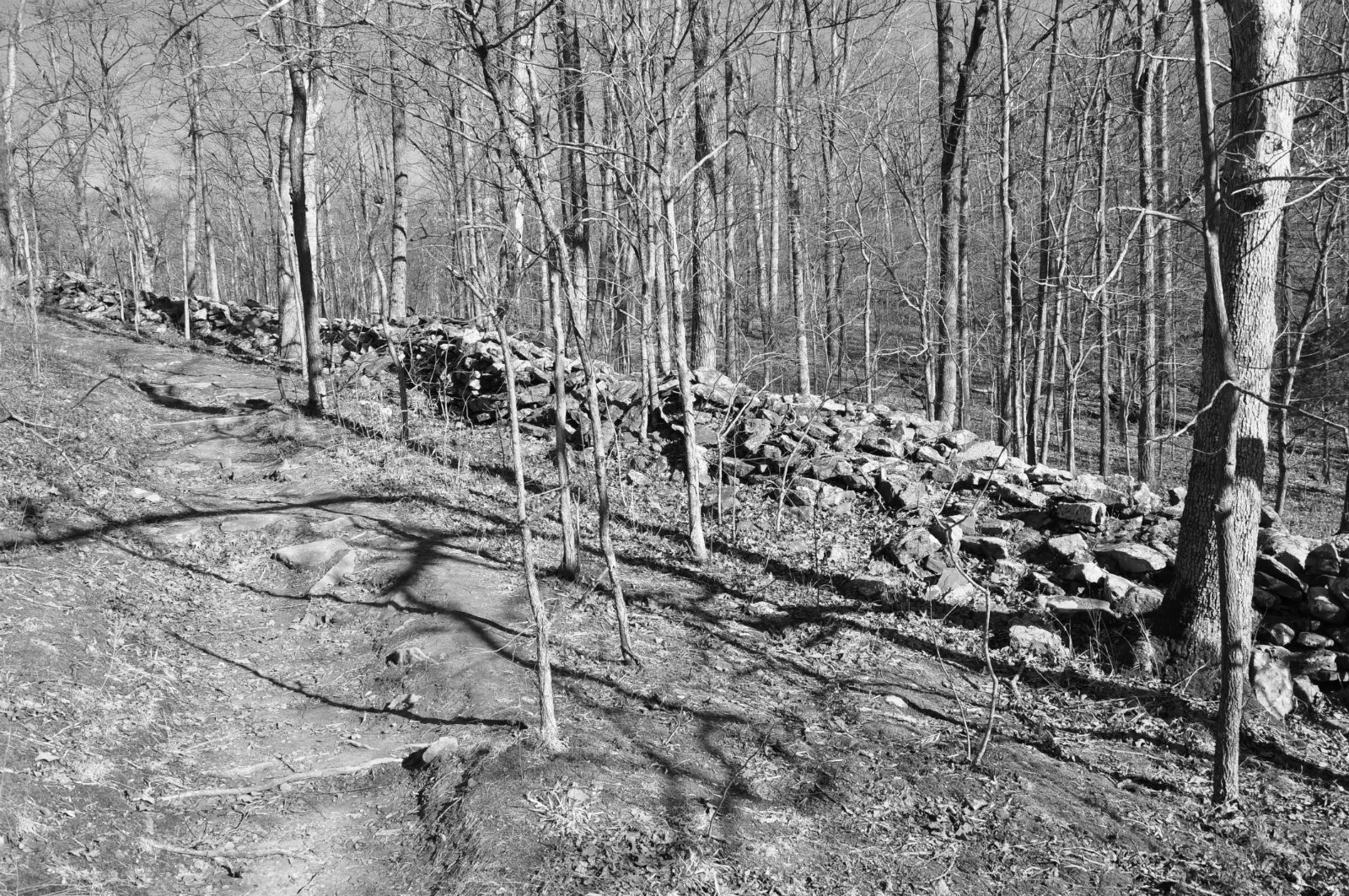
Jesse Ready Site / Lincoln Hills Site, Jersey County, Illinois.
Most Paleo-Indian sites in Illinois represent small, temporary, and rarely revisited camps, based on the small number of artifacts found at these sites.

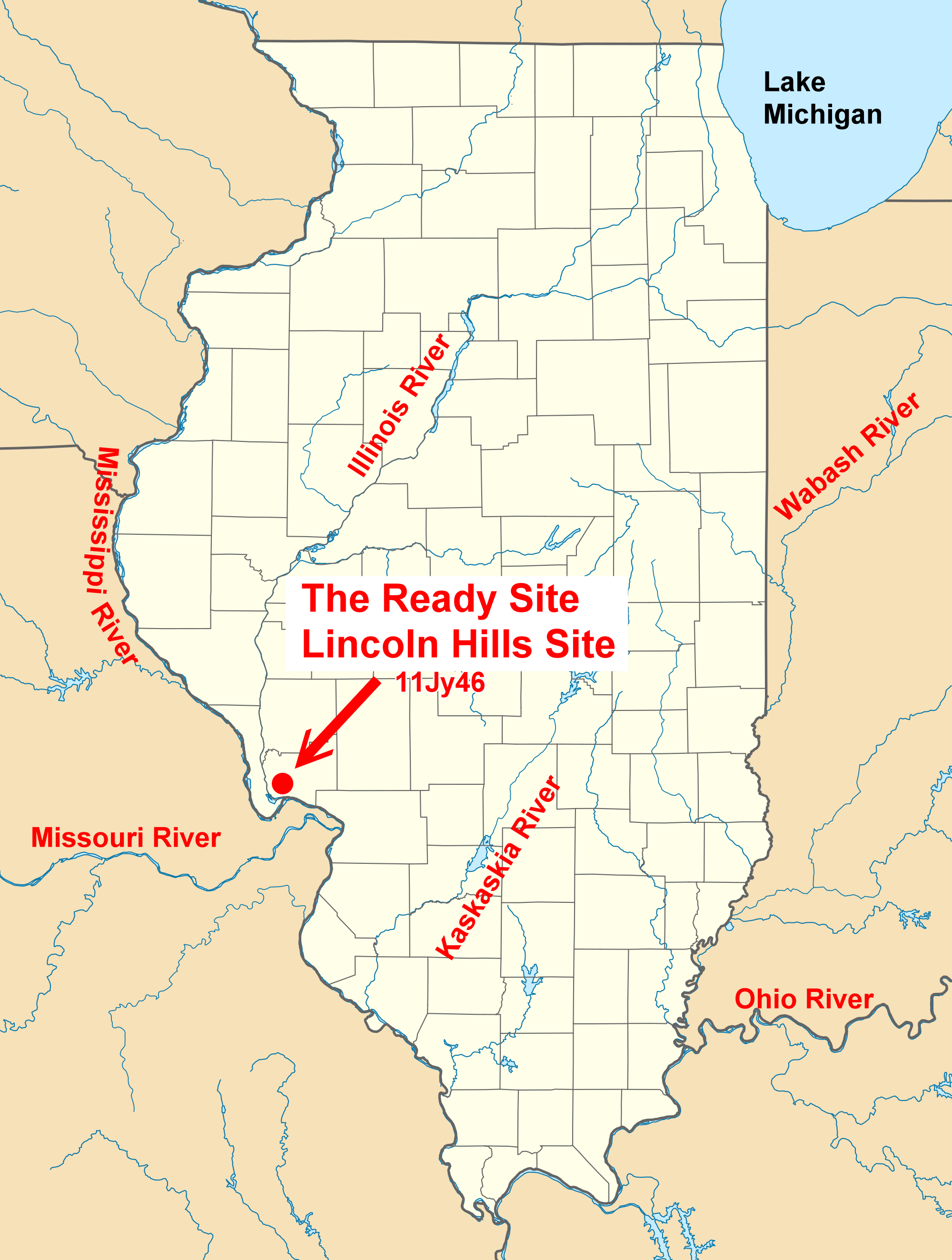
In contrast, the Ready/Lincoln Hills Site, located along the Mississippi River in Jersey County, Illinois, covers a large area and appears to have been visited many times and, perhaps, occupied for longer periods of time. Called the Ready Site because Jesse Ready discovered the site and surface collected there for many years, the site is best known locally as the Ready site.
Jesse Ready Site - Lincoln Hills Site location.
This location was attractive because stones used to make tools were readily available nearby. The surface of the site is littered with flakes of stone left from making spear points, scrapers, and other tools. Occasionally broken and used tools are found at the site. These were replaced with newly made tools. After a group repaired or replaced their tools, they moved on to another location that provided different resources. When they needed stone for tool making, they would return to Lincoln Hills or another location where the stone was available.

Compiled by Dr. Neil Gale, Ph.D.