Kampsville was initially known as Beeman's Landing after James L. Beeman, a ferry operator on the Illinois River. After Stephen Farrow purchased the Ferry from Beeman, the name was changed to Farrowtown. The name "Vedder" was used when the post office was established in 1857.

The name Kampsville was made official on March 6, 1872, and refers to Michael A. Kamp, who served as President of the village board and was also a postmaster at Silver Creek, north of Kampsville.
In 1863, German immigrant and Civil War veteran Captain M. L. Kamp moved into Calhoun County and set up a general store and post office in Silver Creek, just north of the site of present-day Kampsville. Kamp flourished as a farmer and merchant, and in 1869, Kamp purchased a tract of land south of Silver Creek and began to develop it.
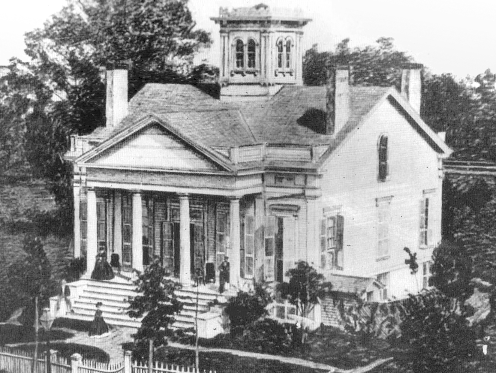
Initially named Farrow Town, the town was renamed Kampsville to honor Captain Kamp. The wealth and success of Kamp are reflected in the red brick home at the intersection of Routes 100 and 108 that he had built for his family in 1882.
In 1902, Captain Kamp gifted a newly constructed and completely supplied store, including one dollar in coins in the cash register for good luck to his son, Joseph A. Kamp. This store is one of the few surviving early commercial buildings in Calhoun County. The store was an important center of commerce for the County, and much of the business used the barter system, which allowed Kampsville to grow despite a shortage of money. Apples, peaches, lumber, and fish were traded at Kamp's store for supplies and later resold and shipped downriver to destinations such as St. Louis. The store was sold to the Capps family when Joseph Kamp died in 1952, and after several owners, it was acquired by the Center for American Archeology in 1991.
Kamp and other European settlers weren't the first people to find the bluffs and rolling hill country an attractive place to live. The area is located in one of the world's richest archeological regions, with recorded human habitation dating back to the Early Archaic period (8500-6000 BC). Kampsville is home to the Center of American Archeology (CAA), which conducts ongoing excavations and educates future archeologists and the public. The CAA features exhibits and displays in its Visitor's Center, a museum facility in Kamp's Store, and its administrative offices in the Kamp family's former home.
The village of Kampsville is the base of operations for the Center for American Archeology, an educational and research organization dedicated to the archeological understanding of the Indigenous People and European settlers in the region.
The Center of American Archeology building was added to the National Register of Historic Places in 1994. It contains exhibits demonstrating evidence of 7,000 years of human habitation excavated at the Koster Site, a prehistoric archaeological site in nearby Greene County.
 |
| The two ferries are FREE. There is 24/7 service. |
The Kampsville Ferry crosses the Illinois River at Route 108, connecting the east side of the river in Green County and the City of Carrollton on Rt. 108, a two-lane undivided surface highway for its entire length. It is one of two permanent ferries operated by the Illinois Department of Transportation.
The town hosts many annual events, including Old Settlers Days and a series of educational events organized by the CAA. Just south of town on the Great River Road (Route 100) is the McCully Heritage Project, with 12 miles of nature trails and other recreational activities.
The village of Kampsville is the base of operations for the Center for American Archeology, an educational and research organization dedicated to the archeological understanding of the Indigenous People and European settlers in the region. It exhibits evidence of 7,000 years of human habitation excavated from 3 acres at the Koster Site, 11 miles due east, a prehistoric archaeological site in nearby Greene County.
The Koster Site was discovered in 1967 on the farm fields of Theodore and Mary Koster and subsequently named after them. The discovery was made by Northwestern University (Evanston, Illinois) anthropologist Stuart Struever, who stumbled upon the farm and the rich trove of historically significant artifacts that lay beneath the cornfields after a tip from a local farmer. Struever had recently founded the Center for American Archeology, 101 Broadway, Kampsville, Illinois.
Compiled by Dr. Neil Gale, Ph.D.