Showing posts with label Forts - Posts - Camps. Show all posts

Monday, April 26, 2021

Camp Pine, a WWII German POW Camp in the Cook County forest preserves near Des Plaines, Illinois.

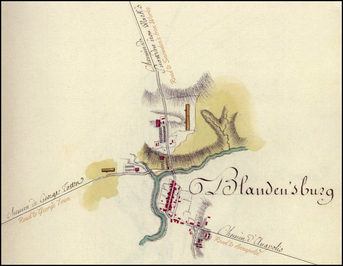
Camp Pine Woods is located south of Lake Avenue — east of the Des Plaines River — north of Central Road — west of Milwaukee Avenue in the Cook County forest preserves near Des Plaines, Illinois.
CLICK MAP FOR FULL SIZE


Camp Pine Forest Preserve was formerly a Nazi POW camp for German soldiers. During WWII (September 1, 1939 – September 2, 1945), the Americans realized that, because of the expenses of shipping food and supplies to overseas prisoners of war, it would actually be cheaper to bring prisoners to the States. Also, camps were overcrowded in Europe, and our ally Great Britain asked for our help. Lastly, POWs could help fill the labor shortage in vital industries such as farming.

WWII POW CAMPS IN ILLINOIS
The U.S. Army’s Fort Sheridan was utilized as an administrative headquarters for a system of 37 POW camps throughout Illinois, Wisconsin and Michigan. Four of the Illinois camps were located in the Cook County; Camp Pine; Camp Skokie Valley; Arlington Fields, and Camp Thornton

Fort Sheridan in Highwood, Lake County.

Camp Ellis, by Bernadotte, Fulton County.

Camp Galesburg, Knox County.

Camp Grant in Rockford, Winnebago County.

Camp Hampshire, Kane County.

Camp Hoopeston, Vermilion County.

Camp Washington, Washington County. 

Camp Pine was opened in what had been barracks constructed during the Great Depression to house the Works Progress Administration (WPA), a part of President Franklin D. Roosevelt's New Deal program. 

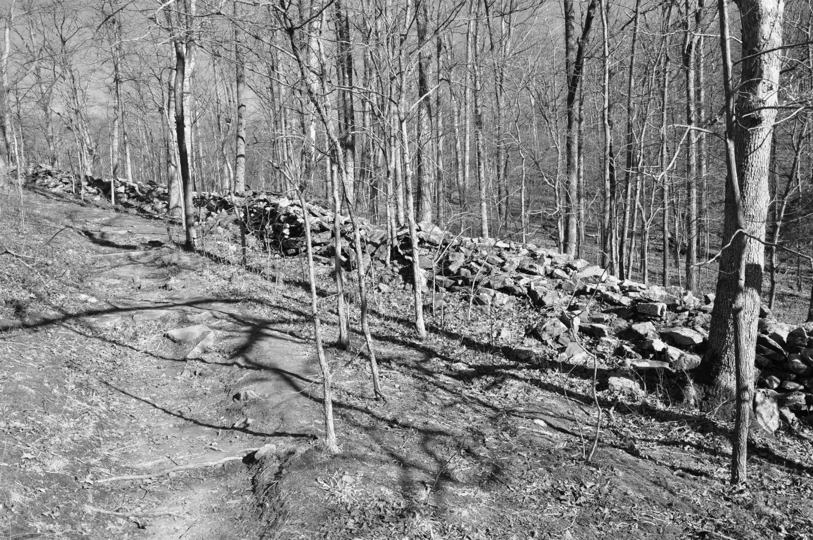
The German men lived in five crude barrack-styled buildings on the high ground along the Des Plaines River. Each building was heated by a single wood-burning stove. There were 8 outdoor privies to accommodate the 280 or so prisoners and guards there. Prisoners carried out public works projects near Dam № 2. 

The majority of German POWs were captured by U.S. forces in the North Africa and Italian campaigns. 

The North African campaign of WWII took place in North Africa from June 1940 to May 1943. 

The Italian campaign of WWII, also called the Liberation of Italy, consisted of Allied and Axis operations in and around Italy, from July 1943 to May 1945.

Prisoners were originally housed at Fort Sheridan in Highwood, Illinois, and their labor was used to turn the old WPA barracks into what would become Camp Pine. The camp was opened for German POWs in May 1945.
Aerial photograph of Camp Pine, 1938.


In conjunction with the Cook County Farm Labor Association, the US Government put the POWs to work at local farms and some businesses. A few even worked in Pesche's gardens in Des Plaines. The prisoners worked for 8¢ an hour ($1.50/hr today) and were paid in cash or canteen coupons.

The locals took well to having the POWs so close to home. The Germans took notice and often would wave at Des Plaines residents as they drove trucks of produce through town. One Des Plaines couple was so kind to the Germans that it almost landed them in trouble with the FBI. During the days of Camp Pine, the Daily Herald reported that FBI agents monitoring the camp had a run-in with two Des Plaines citizens who were driving three prisoners back to Camp Pine at 2 am. After the FBI found out that the couple had simply taken the Germans home for "a good supper," the feds decided no harm was done.

Security was lax enough that occasionally a German prisoner managed to escape. As one of the stories goes one prisoner who disappeared was found working in a Chicago bookstore, which he later purchased. According to another story, an escapee who had no interest in returning to Germany, where his hometown was held by the Soviets, made his way to California and became a tennis pro. Many of the prisoners liked living in this country so much that they returned at war’s end to become permanent residents.

Nationally, the U.S. government grossly underestimated how many German prisoners it would have to place in camps here. The number was thought to be 50,000 to 75,000 but ended up being 420,000 by the time the war was over.

By the time the camp closed in March of 1946, only around 30 POWs remaining of the nearly 200 that had been housed there. Many of the former prisoners returned home to Germany, but some were so enamored that they decided to stay in America. 

After the POWs were released from Camp Pine, it enjoyed a brief period as a Boy Scout and Girl Scout camps, who probably enjoyed their stays much more than their German predecessors. Not much is left of Camp Pine today except rubble and some rusty plumbing. 
The moss-covered foundation of one of Camp Pine barracks.


Compiled by Dr. Neil Gale, Ph.D. 

Open Prisoner of War Camp Near Des Plaines.
A branch German prisoner of war camp has been opened north of Des Plaines. Formerly used by the Civilian Consercation Corps. (CCC), it has been named Camp Pine and will house 75 prisoners who will work on truck farms in the Des Plaines vicinity.
                                                                           —Chicago Tribune, Sunday, May 6, 1945

175 German Prisoners III of Food Poisoning.
Army spokesmen disclosed last night that 175 German prisoners of war housed at Camp Pine, near Des Plaines, were stricken with food poisoning after the evening meal. Officers suspected potato salad and whiteiish as the possible cause. Maj. R. L. Hiatt, executive officer at Fort Sheridan hospital, said none of the prisoners was critically ill, altho many would be hospitalized for several days.
                                                                    —Chicago Tribune, Monday, August 13, 1945

Three German War Prisoners Escape Camp.
Three German prisoners of war escaped last night from Camp Pine, north of the village of Des Plaines. The prisoners were identified as Conrad Blum, 46; Irwin Koerkel, 20; and Waldemar Bogl, 30. Blum and Bogl are fair and blue eyed. Koerkel has dark hair and hazel eyes. Blum is 5 feet 6 inches tall; Bogl 5 feet 8 inches; and Koerkel 5 feet 9. All wore clothing  bearing the letters "PW" on the back.
                                                                    —Chicago Tribune, Saturday March 30, 1946

By 1949, Camp Pine hosted the first Fall Festival of Girl Scouts. The outing put on by eight suburban Girl Scout councils that maintain cabins at the site.


GERMAN FONDLY REVISITS POW SITE IN DES PLAINES, ILLINOIS.
The old German soldier buried his face in the carnations and summoned memories of his days as a prisoner of war at a Des Plaines greenhouse.

He calls his days as an American captive "the good life."

The experiences of Rudolf Velte and thousands of others who served in Hitler's army during World War II and ended up as POWs in the U.S. created a peculiar if little-known, historical footnote to the war. And a half-century later, the story continues to play out in the odd pilgrimages that Velte and others have made to the scenes of their imprisonment.

The comfortable incarcerations were a strategy by the U.S. military to encourage Hitler's regime to treat its 90,000 American POWs humanely, according to historians. Yet the tactic failed miserably, leaving the alternative notion that the program was an appalling and misguided benevolence toward the army of the Third Reich, even as liberating troops were exposing the horrors of Auschwitz and Dachau.

For Velte, at least, the episode was a surprising salvation from the tumult of a war that swept him up as a 20-year-old and ultimately landed him in Africa, unaware, he says, of what was happening to Jews in his native land.

Today, he remains effusively grateful for the American kindness, seemingly disinclined to view the historical ironies of his sojourn in the Chicago suburbs.

Unlike Allied POWs or Japanese-Americans held in California internment camps, Velte remembers his imprisonment fondly. He worked for pay picking carnations and ate until his belly was full. He played soccer and socialized with American guards and local families. Thousands of German soldiers in hundreds of camps nationwide had similar experiences, historians say.

In fact, Hitler's soldiers lived so well in these camps that thousands migrated back after the war and became U.S. citizens.

In 1945, Velte was one of 215 captured Germans assigned to Camp Pine, a tiny fortress nestled in the woods along the east bank of the Des Plaines River, a half-mile south of Euclid Avenue.

Now a 77-year-old retired baker from Niederweimar, Germany, Velte recently made his first trip to the United States since WW II, stopping in Des Plaines to walk the grounds at his old POW camp and, at the Pesche greenhouse, to meet the family of an American he considered a wartime friend.

"After 51 years, to be back, it's almost too much," Velte said as his wife of 48 years, Elisabeth, snapped photos in the greenhouse. "This has been a beautiful day for me."

Arnold Krammer, a Texas A&M history professor who interviewed 250 POWs for his book "Nazi Prisoners of War in America," said Velte's experience is far from unusual.

"Most of the German prisoners told me this was the greatest time in their lives. They were treated wonderfully, and they were out of the fighting," Krammer said.

"It may be galling for us to think about this now . . . but we have the misfortune of knowing how it all turned out. At the time, our greatest hatred was saved for the Japanese. And these prisoners were not the ones who were sealing the gas chambers. It was done by Germans, but it wasn't done by these Germans."

At the time, the U.S. military didn't widely advertise that it was holding some 425,000 German soldiers in 511 camps throughout the U.S.—a move driven by the shortage of American labor and the logistics of shipping food to Europe to feed a half-million POWs.

"I think the camps pretty much escaped the public eye," said Tom Kocher, who spent 12 years as the military museum curator at the now-closed Fort Sheridan in Highwood, Illinois, which served as a Midwest clearinghouse for 15,000 prisoners and 46 branch camps.

But even those Americans who worked with the POWs or watched them roll into town had a tough time summoning hatred for the young men in tattered Nazi uniforms.

"It was just too far removed from the horrors of war," Kocher said. "That's why the prisoners were viewed as victims of circumstance... kids caught fighting in a brown shirt with a swastika on their arm."

Added Krammer: "The American public was really kind of awestruck by the Germans. They seemed so much like us."

In this part of the Midwest, the branch camps were scattered throughout Wisconsin, Michigan, and the Illinois communities of Arlington Heights, Glenview, Thornton, and Des Plaines—locations that brought the German POWs closer to the towns that needed agricultural workers.

When news reports suggested that Nazi prisoners were coddled here—especially after the concentration camp atrocities were publicized in early 1945—the American military painted a harsher picture.

"If anyone thinks these prisoners are given a soft life, they should come on an inspection tour of these base camps," a Fort Sheridan officer wrote in a statement to the Des Plaines Journal printed April 12, 1945. "No special privileges or cuddling (sic) is being shown to these men . . . they dislike us and our country as much as we do them."

Like other prisoners, Velte spent nine months working on area farms. Though none of the work was back-breaking, he landed a particularly plum assignment: picking and delivering carnations for a friendly Des Plaines florist named Fred Pesche, a Luxembourg native who chatted with his prisoners in German and fed them hot lunches of bratwurst, black bread, and an occasional beer.

Velte said he doesn't believe his captors were soft, although he knows he might have encountered a different welcome had Americans seen their country devastated by Nazi bombs and invaded by the German forces.

"We had a lot of respect for the Americans, especially after the (D-Day) invasion," Velte, a stout man with young eyes and richly lined face, said through a translator. "We knew the war was going to end, and we would win our freedom."

Velte's war story started in 1939 when he was drafted at age 20 into the air force regiment of Hermann Goering. Velte said he fought because his country told him he must, not because he believed in the ideals of the Nazi Party or its leader, Adolf Hitler.

"Most of the soldiers were not pro-fanatic Nazis," Velte said. "We were forced into it. What actually went on (in the concentration camps), we didn't know. We had no idea."

He spent two years in Germany, then was sent to Africa in late 1942 to support the retreat of the Afrika Korps. On May 11, 1943, he was captured in Tunisia by the French army.

Velte almost died during this time from chronic diarrhea and malnutrition, he said and dropped to 93 pounds. Desperate, he escaped the French camp with a fellow prisoner.

He surrendered to English troops and was treated in their hospital. The Americans took control of the POWs in October 1943, and Velte was put on a military cargo ship to Virginia.

From there, he spent time at POW camps in Nebraska, Michigan, and Rockford. At one camp, Velte remembers watching films of Nazi concentration camp atrocities. His reaction then was a common one among the POWs: He did not believe it.

Velte was one of the first to arrive at Camp Pine, just a week after it opened in May 1945. And while nothing now remains from the camp except a rusty flagpole, Velte had no trouble recognizing the site during his visit 51 years later. With his American cousin, Art Bodenbender of Moline, Velte pointed to the spot where he once played cards with American guards.

Velte stayed at Camp Pine until February 1946, when he was sent home to Germany. He married, fathered four children, and spent his life running his own bakery.

Frank Pesche was 18 when he first met Velte and the other prisoners who worked for his dad. The camp was a novelty in the tiny farming community, and Frank and his young friends used to sneak into the camp some nights just to see if they could trip the searchlights.

"Most people in town didn't even know they were here," said Pesche, whose family business is one of the few former POW farm employers still intact after all these years.

Velte laughs when asked if he ever considered escaping.

"No. Why? We had a good life," he said. "We had almost total freedom."

Chicago Tribune, Wednesday, June 5, 1996
By Tracy Dell'Angela, Tribune Staff Writer

Tuesday, March 2, 2021

The Prehistoric Draper's Bluff Stone Fort, Union-Johnson County Line, Illinois.

The Stone Forts of Illinois.
One of the unique prehistoric phenomena of Southern Illinois is the ruins of stone walls which have traditionally been known as "stone forts." They appear in the rough east-west alignment across the hill country and appear to form a broken chain between the Ohio and Mississippi Rivers. These ruins have similar geographic site characteristics. They are generally located on bluffs, which are often finger-like promontories of land with steep cliffs on three sides and a gradual incline on the fourth. It was across these inclines leading to the top of the bluff that these stone walls are most generally located, hence the theory of a pound or game trap, has been advanced.

Many of the walls have long been torn down and removed for building purposes. Early settlers, in most instances, removed the better slab-like stones for building foundations, leaving only the rubble. These early white pioneers saw the walls and thought of them in terms of their own experiences, particularly from the standpoint of defense against the Indians. Though they called them stone forts, these sites would be very poor places to carry on prolonged fights.

If a small band took refuge behind the wall, they might be pushed over the cliff by a larger attacking force. Or a larger force could lay siege to the place, and the band would be cut off from both food and water and soon starve to death. Although they called them "forts," many people did not accept such a theory, and speculation continued.

Archaeologists believe that particularly in Ohio, the Hopewellian Indians probably were responsible for some of the walls, but the identity is not known. These walls represent a major accomplishment for a people who had only primitive digging implements and methods of carrying or moving heavy stones. These unknown builders piled rock completely across summits, leaving inside enclosures sometimes as large as 50 acres, depending upon the size of the bluff.
The Drapers Bluff Stone Fort in Southern Illinois lies between the Ohio and Mississippi Rivers.


Drapers Bluff


The most extensive of the prehistoric stone forts is that on Drapers Bluff on the Union-Johnson County line. This, by exact measurement, forms an enclosure of some 15 acres, is 120 feet high, still shows all the earmarks of the prehistoric man, the buffalo, etc. All of these forts are almost on a dead line east and west and on bluffs whose escarpments show that they were at one time the north bank of a mighty river, flowing from east to west. The breaks between Drapers and Turkey Bluff show very plainly where the mighty glacier broke through and piled its debris into the present-day Water Valley. 

Compiled by Dr. Neil Gale, Ph.D.

The Prehistoric War Bluff Stone Fort, Pope County, Illinois.

The Stone Forts of Illinois.
One of the unique prehistoric phenomena of Southern Illinois is the ruins of stone walls which have traditionally been known as "stone forts." They appear in the rough east-west alignment across the hill country and appear to form a broken chain between the Ohio and Mississippi Rivers. These ruins have similar geographic site characteristics. They are generally located on bluffs, which are often finger-like promontories of land with steep cliffs on three sides and a gradual incline on the fourth. It was across these inclines leading to the top of the bluff that these stone walls are most generally located, hence the theory of a pound or game trap, has been advanced.

Many of the walls have long been torn down and removed for building purposes. Early settlers, in most instances, removed the better slab-like stones for building foundations, leaving only the rubble. These early white pioneers saw the walls and thought of them in terms of their own experiences, particularly from the standpoint of defense against the Indians. Though they called them stone forts, these sites would be very poor places to carry on prolonged fights.

If a small band took refuge behind the wall, they might be pushed over the cliff by a larger attacking force. Or a larger force could lay siege to the place, and the band would be cut off from both food and water and soon starve to death. Although they called them "forts," many people did not accept such a theory, and speculation continued.

Archaeologists believe that particularly in Ohio, the Hopewellian Indians probably were responsible for some of the walls, but the identity is not known. These walls represent a major accomplishment for a people who had only primitive digging implements and methods of carrying or moving heavy stones. These unknown builders piled rock completely across summits, leaving inside enclosures sometimes as large as 50 acres, depending upon the size of the bluff.
The War Bluff Stone Fort in Southern Illinois lies between the Ohio and Mississippi Rivers.


The War Bluff Stone Fort site is in east-central Pope County, about six and one half miles due north of Golconda and about four and one half miles northwest of the Ohio River. It is about a mile and one-half east of the old village of Raum and about two miles southwest of the old village of Lusk. This fort site lies about one-half mile south of Farm Road 858, across a field, and up the bluff. 

War Bluff is about the most interesting one of its kind. Its wall, though toppled somewhat, is the best-preserved, and its area is large enough to give the visitor's imagination room to dream. There are fragments of records and a stock of legends, lore, and tradition to add interest. 

According to traditional accounts, this was a place to which the Indians retreated and were besieged by white men about 1800. According to the same story, the Indians escaped by way of a secret crevice that led downward through the rocks and out at the face of the bluff. The story relates that a white girl who lived with them led their escape. 

War Bluff also has its "Lovers Leap" on the northwest wall, along with the traditional story. According to this bit of legend, an Indian chief forbade his daughter's marriage to the brave she loved. She and her lover sought to escape but were overtaken at the highest point of the wall. Here their final plea was rejected. Thereupon they turned clasped hands and leaped to their death a hundred feet below. True or untrue, as one stands and looks, it is a good story. 

Then there is an account of buried treasure. According to a story told by an elderly man who grew up near the fort, a band of Indians led by a squaw came to dig for the treasured bars of gold shortly after 1900 and camped at his father's place. The map they carried showed a cave, the mouth of which had been filled. This entrance was found, cleaned out, and followed to a carving indicated on the map. Likewise, they dug through rubble-filled passages to a second marking. Here, squeezed and closed passages brought confusion. The gold bars were not found. 

The Indians despaired and returned to Oklahoma, leaving any treasure still buried at War Bluff. Later visitors with divining rods have likewise failed to locate the gold. Even yet, some visitors knowing the story keep a sharp lookout for any clue that might reveal the location of the hidden bars. 

A shelter cave on the west side also has its story. Once it was carefully walled and served as a home for the Sheridan family. Here their son, Thomas, was born. He later served as a county superintendent of schools and became a practicing attorney in Vienna, Johnson County. 

Before leaving War Bluff the visitor should pause to look carefully at the stone ruins outside the wall. Perhaps he can decide the use to which they were put. Some have said they were granaries, others that they were sentry posts. One explains that they were advance posts for besiegers and lastly that they mark the burial place of white men killed while besieging the Indians. Perhaps the reader will come up with a better explanation than either of these. 

The 1876 atlas shows an additional, old Indian fort on a line five miles northwest of War Bluff and Eight miles Southeast of Stone Fort.
War Bluff Stone Fort
Shawnee National Forest, Illinois

Compiled by Dr. Neil Gale, Ph.D.

Sunday, February 28, 2021

The Prehistoric Old Stone Fort, Saline County, Illinois.

The Stone Forts of Illinois.
One of the unique prehistoric phenomena of Southern Illinois is the ruins of stone walls which have traditionally been known as "stone forts." They appear in the rough east-west alignment across the hill country and appear to form a broken chain between the Ohio and Mississippi Rivers. These ruins have similar geographic site characteristics. They are generally located on bluffs, which are often finger-like promontories of land with steep cliffs on three sides and a gradual incline on the fourth. It was across these inclines leading to the top of the bluff that these stone walls are most generally located, hence the theory of a pound or game trap, has been advanced.

Many of the walls have long been torn down and removed for building purposes. Early settlers, in most instances, removed the better slab-like stones for building foundations, leaving only the rubble. These early white pioneers saw the walls and thought of them in terms of their own experiences, particularly from the standpoint of defense against the Indians. Though they called them stone forts, these sites would be very poor places to carry on prolonged fights.

If a small band took refuge behind the wall, they might be pushed over the cliff by a larger attacking force. Or a larger force could lay siege to the place, and the band would be cut off from both food and water and soon starve to death. Although they called them "forts," many people did not accept such a theory, and speculation continued.

Archaeologists believe that particularly in Ohio, the Hopewellian Indians probably were responsible for some of the walls, but the identity is not known. These walls represent a major accomplishment for a people who had only primitive digging implements and methods of carrying or moving heavy stones. These unknown builders piled rock completely across summits, leaving inside enclosures sometimes as large as 50 acres, depending upon the size of the bluff.
The Old Stone Fort in Southern Illinois lies between the Ohio and Mississippi Rivers.


Another fort built almost exactly as the Makanda Fort is the fort that lies southwest of Carrier Mills in Saline County. The old fort site is found four miles east of the present town of Stonefort in Williamson County and seven miles east of Creal Springs, Illinois. Its area is almost the same as Makanda's Fort and research into the Archivo General de Indias at Seville, Spain (the repository of extremely valuable archival documents illustrating the history of the Spanish Empire in the Americas) shows that such a fort was spoken of by DeSoto in 1542. 


This old fort is on top of a hill, which is almost inaccessible. The walls are constructed of large stones and the whole reminds one of the ruins of a once well-constructed fortification. It has gone to ruin more or less within the past one or two years. The first house in the vicinity was one built in 1831 by J. Robinson. The village of Stonefort is situated atop a ridge that rises above the South Fork Saline River valley to the north and the Little Saline River valley to the south. The village of Stonefort was established in late 1858 and was originally located about a mile to the southeast, near the edge of the bluff. There were houses there earlier. 
Some scholarly visitor named the ruins Cyclop Walls, but most people simply call it old Stone Fort.


When the Cairo and Vincennes Railroad was completed through the area in the 1870s, Stonefort's public buildings were dismantled and moved to the village's present location, which was adjacent to the railroad tracks. The former site of the village is now listed as "Oldtown" on maps which is 1.8 miles northwest of Stonefort.

Compiled by Dr. Neil Gale, Ph.D.

Saturday, February 27, 2021

The Prehistoric Makanda Stone Fort, Jackson County, Illinois.

The Stone Forts of Illinois.
One of the unique prehistoric phenomena of Southern Illinois is the ruins of stone walls which have traditionally been known as "stone forts." They appear in the rough east-west alignment across the hill country and appear to form a broken chain between the Ohio and Mississippi Rivers. These ruins have similar geographic site characteristics. They are generally located on bluffs, which are often finger-like promontories of land with steep cliffs on three sides and a gradual incline on the fourth. It was across these inclines leading to the top of the bluff that these stone walls are most generally located, hence the theory of a pound or game trap, has been advanced.

Many of the walls have long been torn down and removed for building purposes. Early settlers, in most instances, removed the better slab-like stones for building foundations, leaving only the rubble. These early white pioneers saw the walls and thought of them in terms of their own experiences, particularly from the standpoint of defense against the Indians. Though they called them stone forts, these sites would be very poor places to carry on prolonged fights.

If a small band took refuge behind the wall, they might be pushed over the cliff by a larger attacking force. Or a larger force could lay siege to the place, and the band would be cut off from both food and water and soon starve to death. Although they called them "forts," many people did not accept such a theory, and speculation continued.

Archaeologists believe that particularly in Ohio, the Hopewellian Indians probably were responsible for some of the walls, but the identity is not known. These walls represent a major accomplishment for a people who had only primitive digging implements and methods of carrying or moving heavy stones. These unknown builders piled rock completely across summits, leaving inside enclosures sometimes as large as 50 acres, depending upon the size of the bluff.
The Makanda Township Stone Fort in Southern Illinois lies between the Ohio and Mississippi Rivers.


The Makanda Stone Fort is a quarter of a mile northeast of the village of Makanda, Jackson County, Illinois, and is a part of Giant City State Park.

About 1000 years ago, when Indian cultures were enjoying the area’s abundant resources (water, wildlife, nuts, berries, and roots) in the Shawnee National Forest, a stone fort was found. It is thought to have been built during the Late Woodland Period (1000 BC - 1000 AD), probably between 600 to 900 AD. 
A Shawnee National Forest Overlook.
These prehistoric forts were constructed on a raised mass of land known as a promontory (a point of high land that juts out into a large body of water), while some others were built on hilltops that provided an excellent overlook giving them a vantage point to see for miles across Illinois' premier forest.

The massive stone wall was at one time 285 feet long, six feet high, and nine feet thick on 1.4 acres of land. The appearance of a “stone fort” or stone wall located in Giant City State Park, which is part of the Shawnee National Forest, sits atop a sloped ridge
There are actually about ten of these old structures in the southern Illinois area, and they are believed to have been either a military fortification as a meeting place or a ceremonial temple.

Most of these sites were not habitation sites (villages) in the usual sense. There was only a modest amount of artifacts, which is common among places of sporadic use for short periods of time. Debris found on this site includes sherds of grit or grog-tempered cord-marked pottery and stone tools, like projectile points. Many Late Woodland tribes lived in large, intensively occupied villages located near major rivers and streams such as Cahokia and East St. Louis. They had a mixed economy of hunting, gathering, and cultivated a series of native plants like barley, sumpweed, maygrass, and squash.
For years archaeologists have wondered about the stone fort’s usage. Some say that these were “sacred spaces” reserved for periodic activity. Archaeological digs have located items that prove that the Indians of Southern Illinois were part of an extensive trading network. They believe the trading network followed the trails in Southern Illinois that became the early pioneer roads centuries later. Archaeologists suggest the possibility that stone forts were designated areas where different tribes or sub-tribes could meet, socialize, and trade on neutral ground.

The original wall was dismantled by European settlers, who used the stones in order to build their own structures; the stone base is all that remains of the original wall. It was reconstructed in 1934 by the CCC (Civilian Conservation Corp) workforce gathered the scattered stone and rebuilt the wall in its original location, but has since fallen into ruins again.
The location of this wall leads one to believe it was built for a fortification of some kind and as the building must have required a great deal of time and labor. It was surely built for more than just temporary use. The distance to the edge of the bluff in front is over 500 feet, thus affording room for quite a party taking refuge therein. The bluffs that form three sides of the enclosures are unscalable without the use of ropes and ladders except in two places, and these are easily protected from above for they are just narrow crevices up which one could, with difficulty, climb and then only by the aid of the jagged edges of the protruding rocks. One man could lie behind boulders at either place and easily protect it against a number of his enemies with crude stone-age weapons, traces of which were found everywhere in the vicinity and all through this section. Several pieces of flint and arrowheads have been picked up on the top of the bluff. 

Another reason for believing that this fortification was built as a defense against tribesmen is that it is at the upper end of the valley where the opposite bluff is not over 200 yards distant, and is higher, though not so precipitous. From this bluff, one with a rifle could easily shoot into the fort, but with bows and arrows, very little damage could be done. In fact, it is by far the best location in the valley. Water is easily accessible and flows from a little stream within 100 feet of the cliff where it is scalable and at several places in the brooks are springs. 

Ancient features more closely related to a seasonal hunting camp where hunters would take advantage of game resources, then move on.

Other theories included the notion it was actually early European explorers, such as DeSoto, who created the rock fortresses while making inroads to conquer the land. No such evidence of European construction exists, of course.

The oldest settlers in Jackson County say that the area was covered with bushes when they first came here. No one knows the early history of the fort as a certainty and there is little likelihood of it ever coming to light. Parts of the wall of this fort were standing as late as 1870 and were torn down by a Doctor CalIon in hunting for relics. None were found which is more strong evidence that the fort was built by someone other than Indians. George W. Owens, still living in 1931, who came to Makanda in 1862, tells of a small, one-pounder cannon that was found in the wall of the old fort. It was used in Fourth-of-July celebrations around Makanda for 50 years and finally sold to a junk dealer. The French Lieutenant Aubrey, passed this way from Kaskaskia in 1720 with 30 French and 300 Indians on his way to Fort Massac on the Ohio River to thwart the English, who were reported to be on their way down the Ohio River toward Kaskaskia. Aubrey had three brass cannons of this description. This may have been one of them. 
The first professional archaeological investigation of the fort site was conducted in 1956 by archaeologists from Southern Illinois University. An explanation for the large hole in the front of the wall is unknown, although it most likely represents the work of treasure hunters. The hole was there when the site was officially recorded as an archaeological site in 1956.
In the fall of 2000, archaeologists from Southern Illinois University Carbondale conducted an investigation of the Stone Fort site. Of the 153 shovel tests executed south of the wall, all were positive for prehistoric artifacts. This led the scientists to nominate Giant City’s Stone Fort for the National Register of Historic Places. The Giant City Stone Fort Site was listed on the National Register of Historic Places on August 9, 2002
The Stone Fort Trail in Giant City State Park is a little-known path that leads to some truly intriguing ruins. It is less than half a mile in length and is a loop trail.

Compiled by Dr. Neil Gale, Ph.D.

Monday, November 9, 2020

The Complete History of the Fort Lincoln Cemetery Property in the Town of Colmar Manor, Maryland.

The History of the Town of Colmar Manor, Maryland
In 1632, George Crawford was given a tract of land in the area by King Charles I of England. Crawford's son, Cecelius, who was also known as the second Lord Baron of Baltimore, took possession of the land after his father's death and encouraged settlement upon it. Exactly who settled there at that time is uncertain, although the land on which Fort Lincoln Cemetery is situated was part of the original grant from Lord Baltimore to George Conn and remained in the Conn family for more than 200 years. It is believed that a Spring House was erected on the Conn land-grant in 1683 (discussed later in the article), making it one of the oldest structures in Maryland.

By the late 1700's Bladen'sburg, which included some land on the west side of the Anacostia River, was a thriving port town. 
In the early 1800s, the Baltimore and Washington Turnpike (Bladensburg Road) offered easy access from Washington to Bladensburg and beyond. On August 24, 1814, British troops advancing toward Washington, D.C., met resistance from American forces under the command of Brig. Gen. William H. Winder. The subsequent dash resulted in the American troops making a hasty retreat toward Washington D.C. Commodore Joshua Barney and a contingent of Marines and sailors fought a rearguard action on the heights (now the Fort Lincoln Cemetery) of what is now the Fort Lincoln Cemetery. Barney was wounded and captured. Many soldiers on both sides were killed on the battleground around Bladensburg and what is now Colmar Manor.

By 1861, it was another war that brought military forces to the area. During the Civil War, the land that is now Colmar Manor belonged in part to the Shreve Estate. It was there and on the same heights where Commodore Barney had unsuccessfully fought the British 47 years earlier that Union forces constructed a fort to serve as apart of the Ring of Civil War Union Forts to defend the City of Washington, D.C. 

Because Abraham Lincoln visited the heights often and partook of the cold water from the Old Spring House, the fort was named Fort Lincoln. During the war, the 3rd Massachusetts Heavy Artillery Battalion and Company E of the 4th Colored-troops reportedly encamped in and around the fort.

Fort Lincoln Cemetery, Colmar Manor, Maryland
There are three historically significant spots located on the Fort Lincoln Cemetery property. The first is one of the oldest colonial-era structures in the state of Maryland, the Old Spring House. The second is the location of the Battle of Bladensburg during the War of 1812 which is located in the cemetery marked by a plaque. And the third historical spot is the Civil War defense, Fort Lincoln, an earthworks fortification marked today with cannons. 

The Old Spring House
The Spring House, built on the spot of a natural spring, is the oldest standing building on the cemetery property and maybe the oldest structure still standing in Maryland. Tradition says a Spring House was erected on the George Conn property in 1683, however, the Spring House was probably not constructed until around 1765 after one of Conn's kin actually bought the land.
The Spring House is reportedly one of the oldest buildings still standing in Maryland.
The Spring House served two purposes, first to keep leaves and dirt away from the spring water, which was sometimes thought to have healing powers, and to keep milk, butter, and other dairy products cool. The cool spring water was fed into a trough inside the structure—in this case just 300 square feet—where it cooled the air. The thick stone walls kept heat from escaping.

President Abraham Lincoln visited the heights (now the Fort Lincoln Cemetery) often meeting with troops to discuss strategy, sitting under the old oak tree, and drinking the cold water from the Spring House.

Today, the spring still feeds cool water through the inside of the Spring House.

The Location of the Battle of Bladensburg during the War of 1812
The Battle of Bladensburg was fought in Maryland on August 24, 1814, and this British victory left Washington D.C. perilously open to the British invasion. The embarrassing defeat of American forces under General William Winder allowed British Army Officer Robert Ross’ men to subsequently march into nearby Washington D.C. and set fire to public buildings, including the presidential mansion (later to be rebuilt and renamed as the White House) over August 24th and 25th. Devastating American morale by destroying the very symbols of American democracy and spirit, the British sought to swiftly end an increasingly unpopular war.

Though neither side had gained a clear advantage in the first two years of the War of 1812, that changed in the spring of 1814 when Britain was able to disentangle itself from fighting France in the Napoleonic Wars. After Napoleon’s exile in April 1814, British forces could be replenished with thousands of veterans. These soldiers were different than the soldiers Americans had faced in Upper Canada; these men had fought against Napoleon and his Imperial Guard and wanted a quick end to this war against a young country.  

British military leaders drew up a plan to decisively end the war, crafting a strategy to take control of the New England states and focus an attack on New Orleans, thereby separating north and south by cutting off critical transportation routes in both regions. In addition to destroying American trade, the British also planned to degrade American morale by arranging attacks on coastal cities such as Washington, Baltimore, Charleston, and Savannah.

With this in mind, General Robert Ross arrived in Maryland, fresh from the Napoleonic Wars. Despite having recently been wounded in February at the Battle of Orthes, Ross returned to take charge of British troops on the east coast. Ross marched his 4,500 men from Benedict, Maryland towards Washington, D.C. with a goal of weakening American resolve.

American General William Winder organized his forces, believing that Washington, D.C., and Baltimore would need to be defended. Because Bladensburg, just northeast of D.C., was key to both Washington and Baltimore’s defense, Winder deployed across the roads that led into the young nation’s capital. Though Winder had around 6,500 men at his disposal, most of his men at Bladensburg were poorly trained militia and their resolve would crumble in the face of the war-weary British. 

Though Americans positioned themselves well against an attack with artillery covering a bridge over the eastern branch of the Anacostia River, they were overwhelmed when the British attacked at noon on August 24th. Fording the river above the bridge and beating back troops who defended the bridge, British General Ross’ 4,500 men steadily advanced against American artillery and rifle fire, gaining control of the west bank. Under heavy British pressure, the left flank of the American line of defense crumbled. As the left flank was enveloped, Americans fled the scene. Their general, Winder, had not prepared a plan for American retreat and his panicked men ran from the battle instead of maneuvering in a controlled retreat to defend Washington D.C. against the impending attack. With American forces scattered, the road to America’s capital was now wide open.

As the British marched into Washington in 1814, they held in their memory the bitter date of April 27th1813—the day Americans had burned of the Canadian capital, York. They carried vengeful appetites as they entered Washington, D.C. the evening of August 24, 1814.

President Madison and his cabinet had fled the city, Dolly Madison and White House slave Paul Jennings famously saving critical relics of their new republic, among them a portrait of George Washington. It was a good thing that the first lady and Jennings saved these symbols of American democracy as British forces wasted no time in setting the presidential mansion, the Capitol, the Treasury, and the War Office ablaze in the evening of August 24th.

The embarrassing defeat at Bladensburg, coupled with the destruction of Washington, D.C., depleted American morale. For both sides, the Battle of Bladensburg helped usher in a conclusion to a costly and frustrating war.
Detailed Map of the Battle of Bladensburg on August 24, 1814.
CLICK TO VIEW IN FULL-SIZE
The burning of Washington went down in history as the only foreign attack on the nation’s capital until the terrorist attacks on September 11, 2001. 

The cemetery property was an active part of the Bladensburg Dueling Grounds until 1820. 

The Bladensburg Dueling Grounds
The general reason for dueling was almost always the same–a man in public life felt that his honor and ability to command respect in public life had been impugned, leading him to believe that the only way to defend this reputation was to challenge his antagonist to a duel. 

A small creek meanders toward the Anacostia Riveron the north side what is now the Fort Lincoln Cemetery. The creek is sandwiched between two hills and was lined with many trees. It was along this creek, according to various accounts, that “gentlemen of the area have settled their political and personal differences since 1732."

The Dueling Grounds, as the area came to be known, is a small spit of land, a fraction of its original size, along Dueling Creek, formerly in the town of Bladensburg, Maryland, and now within the town of Colmar Manor, just to the northeast of Washington, D.C. Dueling Creek, formerly known as '"Blood Run" and "The Dark and Bloody Grounds," was a tributary of the Anacostia River, which used to be called the East Branch Potomac River.
Ravine at Bladensburg, Maryland, famed for fatal duels. 1904
One-half of a stereograph card.
From 1808 the grove witnessed approximately 50 duels by gentlemen, military officers, and politicians, settling "affairs of honor." A formalized set of rules and etiquette, called "the code duello" was usually enforced by the duelers and their seconds. The exact number of duels and the names of all the participants who fought at the Bladensburg Dueling Grounds may never be known because surviving records are obscure, the events are not well documented, and, dueling was illegal. Following the Civil War, dueling fell out of favor as a means of settling personal grievances and declined rapidly; the last known duel was fought there in 1868.

One of the most famous disputes of the 19th century was between Commodore Stephen Decatur and James Barron, which was settled there on March 22, 1820. Decatur, who had gained prominence during military operations against the Barbary Pirates off of North Africa in the early 1800s, and Barron, who had lost his command by a court-martial in 1807 and was stripped of his Commodore title, had been feuding for over 13 years. After exchanging angry letters and insults during that time, Barron finally challenged Decatur to a duel. 

The code of the duel required that the combatants be accompanied by friends, known as seconds. The seconds arranged for the duel's location and the form of the duel, which included the choice of the weapon. On March 22, 1820, Barron brought a set of 50 caliber Holmes Percussion pistols to Bladensburg; however, the seconds decided to use Decatur’s instead. Both men were wounded, Decatur, the U.S. naval hero, later died at his home in Washington D.C.
The Antique Stephen Decatur Dueling Pistols.
The Union Civil War Fort Lincoln (1861-1865)
By 1865 the Ring of Civil War Union Fort defenses of Washington D.C. was said to include some 68 named fortifications, 93 detached batteries, 20 miles of rifle pits, blockhouses at three key points, and 32 miles of military roads. At the beginning of the civil war, there was only Fort Washington, a single fort protecting the city. Click to read the Fort Lincoln article.

The Fort Lincoln Cemetery
Fort Lincoln Cemetery was chartered in 1912 by an act of the Maryland General Assembly. The first burial occurred in 1921. The 176-acre property was historically significant long before it became a cemetery. 
Grounds at Fort Lincoln Cemetery.
The property was an active part of the Bladensburg Dueling Grounds until 1820. Fort Lincoln an earthworks fortification was established in 1861 to help protect Washington D.C.
Fort Lincoln Cemetery Garden of Ascension.
Horace W. Peaslee designed Fort Lincoln’s Little Church, which was built in 1929. The church, designed in the form of a cross, contains eight stained-glass windows portraying the “Seven Ages of Man,” as depicted in Shakespeare’s play “As You Like It.” The rear cloister of the church contains individual or family vaults for those who prefer entombment. There is a small bell tower with a bell to the left of the junction of the cross. The sanctuary, with its manual organ, serves for baptisms, weddings, anniversaries, Sunday concerts, and funerals. The lower chamber of the church is the crematorium. The Little Church building won an architectural award from the Board of Trade.
Fort Lincoln Cemetery Little Church.
At the cemetery entrance, a floral clock was built in 1938. The clock contains a face of 32 feet in diameter, of which 28 feet is planted surface. It runs using a highly accurate Seth Thomas electronic timekeeping mechanism. The numbers are 21 inches high and 12 inches wide. The minute hand weighs 300-350 pounds and is 18 feet 4 inches in length. The hour hand weighs 200-250 pounds and is 14 feet 9 inches long.
Fort Lincoln Cemetery Floral Clock.
At the original entrance is an old gatehouse and office. The gatehouse was built in 1919, was designed by Horace W. Peaslee. The gatehouse was torn down after 1978 to build the Fort Lincoln Funeral Home. The administration building was built in 1972 near the newer cemetery entrance.
Fort Lincoln Cemetery Tranquil Oaks Cremation Garden.
The Community Mausoleum was built in 1947 and sits just behind the Little Church. A wing was added in 1952, which has a small 100 seat chapel. Above the front entrance is a beautiful carving that depicts the Biblical story of Abraham entombing his wife, Sarah. The stained-glass windows of the chapel include colorful scenes from Arthurian literature and the "Quest for the Holy Grail." Other stained-glass windows through the mausoleum were created by Henry Lee Willet, and depict Christian stories and children’s poems. Opposite the second floor entrance is a monument made of Indiana limestone commemorating the August 24, 1814 Battle of Bladensburg stand by the Marines under the command of Commodore Joshua Barney. 

The Liberty Bell
Near that mausoleum sits a 1976, Bicentennial, replica of the Liberty Bell. The Liberty Bell at Fort Lincoln Cemetery is a half-size (22¼" diameter, 23½" height, and weighs 290lbs) Christoph Paccard Bell Foundry replica that was cast in 1976. The foundry, now in its seventh generation, began in 1796. The 1976 replica bells can be distinguished from the 1950 bells by their ornamental surface crack and lack of a serial number.
NOTE: The original Liberty Bell is located in the Liberty Bell Center in Independence National Historical Park, Philadelphia, Pennsylvania. Although no immediate announcement was made of the Second Continental Congress's vote for independence—and so the bell could not have rung on July 4, 1776, related to that vote—bells were rung on July 8 to mark the reading of the United States Declaration of Independence. While there is no contemporary account of the Liberty Bell ringing, most historians believe it was one of the bells rung on the 8th. After American independence was secured, the bell fell into relative obscurity until, in the 1830s, the bell was adopted as a symbol by abolitionist societies, who dubbed it the "Liberty Bell."
The Liberty Bell at Fort Lincoln Cemetery is a half-size (22¼" diameter, 23½" height, and weighs 290lbs) Christoph Paccard Bell Foundry replica that was cast in 1976.
District of Columbia-Maryland Boundary Markers Map
A 1790 Act established that 40 boundary markers be placed at the District of Columbia-Maryland line to set aside land as the seat of government. The survey was begun by Major Pierre Charles L’Enfant and completed by Major Andrew Ellicott. After the Virginia sandstone markers were placed in 1792, a variation in the original land survey was detected to discover the Northeast Number 7 boundary stone was wholly on Maryland land. 
Boundary Stones Map of Washington D.C.
The Daughters of the American Revolution placed an ornamental iron fence around this stone and others around 1916 to protect them from damage.
Boundary stone in a protective cage, the early 1900s.
The older half of Fort Lincoln Cemetery contains traditional grave sites with headstones and a few private mausoleums. The newer sections are laid out according to the memorial park concept. Here, religious and historical gardens contain markers set flush to the earth.

The Battery Jameson Civil War Fortification
A 190-foot section of Battery Jameson, a Civil War fortification built-in 1862, still stands on the Fort Lincoln Cemetery grounds. The cannons that were originally installed in the fort are no longer there, but 12-pound boat howitzers designed by John Adolphus Bernard Dahlgren, known as the father of American Naval ordinance, cast around 1863, were placed on the Fort Lincoln grounds in 1921.
Battery Jameson earthworks, Fort Lincoln.
The Great Lincoln Oak Tree
The Fort Lincoln Cemetery land was home to the great “Lincoln Oak,” a majestic tree under which President Abraham Lincoln met with troops during the Civil War. In 1991, lightning hit and killed the nearly 500-year-old tree. Cemetery management planted a new white oak tree at the site and installed a plaque commemorating the original tree.
THE LINCOLN OAK - This gnarled and ringed stump, attesting to its age, is all that remains of the majestic oak tree that once shaded the old Spring House. Steeped in history, it was put to rest by forces of nature. Its passing will never be forgotten and its existence will be remembered forever as a sentinel over these historic grounds.
There is a 13-foot high bronze statue of Abraham Lincoln sitting in thoughtful meditation, looking thin and war-torn. Created by Andrew O’Connor, a noted Lincoln scholar, and sculptor. It was commissioned by the Rhode Island Lincoln Memorial Commission for the State House, but they were never able to raise enough funds to pay for it. The status sat in a foundry until 1947 when it was placed at Fort Lincoln Cemetery.
Statue of Abraham Lincoln at Fort Lincoln Cemetery.


Compiled by Neil Gale, Ph.D.