Friday, May 6, 2022

Oliver Typewriter Factory, Woodstock, Illinois. (1895-1959)

The Oliver Typewriter is the invention of Reverend Thomas Oliver. Thomas Oliver was born in Woodstock, Ontario, Canada, on August 1, 1852. At an early age, he became interested in mechanics. After moving to Iowa in 1888, Reverend Thomas Oliver began to create a typing machine out of strips cut from tin cans and rubber. It was claimed he had never seen a typewriter of any kind before. 
After patenting several designs in the early 1890s, Reverend Oliver was able to find investors interested in his machines. With the help of investors, a brick building was leased to Oliver to manufacture his typewriter. While visiting Chicago to promote his machine, Oliver encountered a businessman who became interested in the typewriter and bought the stock held by the initial investors. Oliver received a 65% interest in the company and set out to continue the development of his typewriter.

The Oliver Typewriter Company officially opened in 1895, with headquarters in only two rooms on the ninth floor of a building in Chicago. In December 1896, manufacturing was moved from Dubuque, Iowa, to a factory on a 12-acre lot in Woodstock, Illinois. Since the Oliver Typewriter Company outgrew its office space six times in ten years, construction of a new office building began. From 1907 to 1926, 159 North Dearborn Street in Chicago served as the world headquarters for the Oliver Typewriter Company.


A minor recession from 1921 to 1922 caused a large number of customers to default on their payments resulting in the repossession of their Oliver typewriters. The board of directors voted to liquidate the Oliver Typewriter Company in 1926. 

In 1928, The Oliver Typewriter Company was sold to investors who formed the Oliver Typewriter Manufacturing Company Ltd. in Croydon, England. Around this time, the British company started selling licensed rebranded machines produced by various European nations. In 1958, the Byron Typewriter Company (formerly the Barlock Typewriter Company) of Nottingham, England, was purchased by the British Oliver Company. The licensing ventures were ultimately unsuccessful, and in May 1959, production of all Oliver typewriters ended.

Compiled by Dr. Neil Gale, Ph.D.

RR Donnelley, Chicago, Illinois.

The rapid growth of RR Donnelley's business required the erection of a new building at Plymouth Court and Polk Street, south of the Loop in an area that would soon be called Printing House Row (known today as Printer's Row). The architect of the new plant was Howard Van Doren Shaw, who had attended Yale with T. E. Donnelley. When the first phase was completed in May 1897, it was immediately touted by the press as the largest and most modern plant in one of the most important printing districts in the country.
Inside were a composing room, electrotype foundry, press rooms with twenty-two cylinder presses, eight high-speed rotary perfecting presses, twenty job presses, one rotary offset press, folding machines, gathering machines, and patent binders, with an annual capacity of 2.5 million books and 75 million booklets. A second phase of the building was completed in 1901, nearly doubling the manufacturing space.

The business expanded so quickly that within a decade, the Plymouth Court building was cramped. RR Donnelley executives planned a new plant on Calumet Avenue, between 21st and 22nd Streets. Again, Shaw was asked to design the building, an eight-story Gothic structure with a tower that was completed in several phases over the next seventeen years.

Once completed in 1929, the Calumet Plant was the largest building in the United States devoted to printing. It contained over 1.1 million square feet of floor space. The daily capacity of the case bindery was 25,000 books; the mail-order bindery could deliver several hundred thousand catalogs and telephone books.


The building's exterior featured terracotta shields with fanciful designs evoking English heraldry and the marks of history's great printers. The initials of T. E. and Reuben H. Donnelley and of Howard Van Doren Shaw were carved on either side of the portal of the 22nd Street entrance.

Compiled by Dr. Neil Gale, Ph.D.

Thursday, May 5, 2022

Lost Towns of Illinois - Cloverdale, Illinois.

Cloverdale, Illinois, was a small unincorporated DuPage county farm community located 25 miles west of Chicago at Army Trail Road and Gary Avenue in Bloomingdale township. Founded in 1888, the community became part of the Village of Carol Stream in 1959.

In the mid-nineteenth century, the area surrounding Cloverdale had been populated by German dairy farmers, and they founded a cooperative creamery to process their products. In business, at least as late as 1915, the creamery was not large enough to absorb the local milk production. Local farmers were looking for access to the Chicago market, hauling milk daily to a rail connection near Bloomingdale, Illinois.

In 1888 the Illinois Central railroad (IC) expanded routes in northern Iowa, connecting them to the IC's original Freeport to Dubuque trackage. But the IC lacked a direct eastbound connection to Chicago, routing through traffic east of Freeport over the Chicago Northwestern. The IC built its own connecting line from Chicago to Freeport to solve this problem, completing it in 1888.
The Cloverdale Creamery was in the southwestern part of Bloomingdale Township in Cloverdale, Illinois. c.1910


The route was close to the Cloverdale Creamery, and a stop was established to service it. Much closer than Bloomingdale for the local farmers, Cloverdale became a central milk shipping point, giving them direct access to the Chicago market. The milk traffic was large enough for the IC to warrant constructing a large depothome to a station master and his familyand a milk loading facility.
Farmers lined up with milk cans on their wagons, waiting for the 10 A.M. eastbound Illinois Central train in front of Tedrahn's General Store. Tedrahn's was located next to the railroad. c.1905


Shortly after the line opened, a Chicago hotelkeeper, Charles Tedrahn, and his wife purchased land. They opened a general store on property north of the IC tracks, adjacent to the depot, and on the southwest corner of Cloverdale Road (later Gary Avenue) and Army Trail Road. 

In 1888 Charles Tedrahn bought a one-acre site in Cloverdale, Illinois. He built Tedrahn's General Store, a two-story building elevated to a height that allowed easy loading from the storefront directly to the bed of horse-drawn wagons. There was a small picnic grove to accommodate the local farmers as they waited for the arrival of the milk train. The store stayed in the family till 1984.
The Nick Lies Farm in Cloverdale, Illinois. c.1900


In addition to food and hardware supplies, Tedrahn General Store became a US Post Office, sold Chicago newspapers dropped by the 7 IC trains serving Cloverdale daily, and provided notary services for the local farmers. Although never incorporated, various other civic functions for the community were housed at Tedrahn's. The basement was the local polling place, and dispatch for the local volunteer fire department was coordinated by the Tedrahn family. The steep front stoop was modified to accommodate two Standard Oil gas pumps.

In 1934 when the original store burned down, Tedrahn constructed a nearly identical single-story building on the old foundation and built living accommodations for his family behind the store. In 1946, during a wave of postal consolidation, the post office was closed, and rural deliveries were split between the Wheaton and Bartlett stations.

Across from Tedrahn's, on the northwest corner of the intersection, was a tavern, and on the northeast corner was the old creamery, now converted to a gas station and repair shop. The remaining southeast corner was a vacant farmed field.
The former Cloverdale Creamery, by the mid-1950s, had become a gas station and repair shop. It cost 25¢ to get them to light the acetylene (welding/cutting) torch.


The local farmers were predominantly German Catholic—the Stark, Hahn, and Mueller families had settled in the area in the 1850s. Arriving from Bavaria, they purchased land from the original Irish Catholic settlers. In 1852 the Diocese of Chicago authorized the construction of a small wooden church, St. Stephens, near the home of a prominent sheep rancher on the township's southern border. St. Stephens continued in operation for over thirty years. But in 1887, with access to its property cut off by the construction of the Chicago Great Western Railway, the church was forced to close. Parishioners were redirected to St. Michael's parish in Wheaton, five miles south, and the old church was torn down. The salvaged wood from it was used to build St. Michael's school. Only the St. Stephens Cemetery remains.

In 1920 the Cloverdale area Catholic farmers petitioned the Catholic Diocese of Chicago, asking for a new church to be built on land donated by the Stark family adjacent to Cloverdale on Army Trail Road. Bishop (later Cardinal) Mundelein approved, and, in 1924, construction was completed. In addition to the sanctuary, the new complex included a three-room school attached to the main church building, a rectory, a cemetery, and a small convent for the Order of Saint Frances nuns who taught at the school. The new church was named St. Isidore for the patron saint of farmers.

In addition to the Catholic school, Bloomingdale Township had established a small, one-room public school for the community. The school was expanded to four classrooms during the suburban expansion in 1959.
 
As roads in the area were improved, farmers began to have other options for shipping their milk. Competing for milk supply, Dairies in Chicago would send large refrigerated trucks directly to the farms early in the morning. As the milk transportation business fell off, the depot in Cloverdale was closed in 1934. Cloverdale returned to a flag stop—eastbound onlyfor a single local train running between Chicago and Freeport.

More significantly impacting Cloverdale was the creation of a live-work subdivision just south of town along Gary Avenue. Carol Stream, a community, named after the crippled daughter of the developer, Jay Stream, began building homes in the late 1950s on land purchased from several local farmers. Improvements in road access to Chicago, the impact of blockbusting and white flight on the city, and the provision of new jobs in an industrial development created by Jay Stream caused the rapid growth. Incorporated as the Village of Carol Stream, its new boundaries included Cloverdale. (The Lost Towns of Illinois - Gretna, Illinois, article has more detail on the development of Carol Stream.)

With increasing population and changes in zoning, more competition developed for businesses in Cloverdale. The restaurant and tavern closed in the early '80s and were leveled after being destroyed by fire a few years later. The old creamery was abandoned and later torn down. The lumber yard became a storage facility and staging area for a construction firm.

Tedrahn's soldiered on, still owned by descendants of the original founder and open, as always, daily until 10 P.M. seven days a week. But in the mid-1980s, the development of the new Stratford Square Shopping Center, just north of Army Trail Road, required a major eastward relocation of Gary Avenue. Left in the backwater and now in competition with a new convenience store and gas station on the main road, they finally closed after 95 years of operation by the same family.

St. Isidore's, benefitting from the growing suburban Catholic population, significantly expanded their facility, adding classrooms and building a new church building and rectory. The original church building still stands, used as a chapel. The Cloverdale Public School, now District 93, has expanded to a modern facility on the original site.

As Carol Stream expanded, the local land, once thought to be the most fertile in Illinois, became too valuable for framing. Most local farm families arranged land swaps, trading their Cloverdale farms for larger acreages further west in Illinois and Iowa.

Comment from the Author: 
I grew up in Cloverdale in the 1940s and 50s. I was an altar boy at St. Isidore's and took my first communion there before leaving the area. My years living in the rural Cloverdale area were some of the happiest in my life. But in 1959, Jay Stream made my father a cash offer for our farm, one of the smaller ones in the area, that my Dad just couldn't refuse. He left farming, and we left Cloverdale a year later. Ironically, although virtually everything else has been changed, leveled, and redeveloped, our old house is still standing. My memories of eating orange push-ups while sitting on the steps of Tedrahn's, maybe all that's left of the town….

By Ken Molinelli, amateur historian, storyteller, and former Cloverdale resident.
Edited by Dr. Neil Gale, Ph.D.

Lost Towns of Illinois - Tiedtville, Illinois.

Frederick "Fred" C. Tiedt was born in 1868 at his family's home on the northeast corner of 91st Street and Wolf Road (now Willow Springs, IL). 


A born entrepreneur, Fred saw an opportunity to capitalize on the presence of over 2,000 ditch diggers working on the Des Plaines River Sanitary Canal and opened a saloon. The first two barrels of beer were sent to Tiedt's new saloon on credit from Atlas Brewery. It rained the day the saloon opened, but that didn't dampen the success of the new saloon in the wilderness.

Tiedt's community almost immediately acquired a rowdy reputation. The laborers finally had a place to go for a good time, and they arrived in bunches - dirty, full of lice, but carrying good money.

Twenty-four-ounce schooners of beer sold for 5¢. Whiskey was 10¢ a shot. A popular pastime among the boisterous canal workers was holding lice races, a filthy forerunner to the stock car races that would follow in later years.

There were already a few farmhouses clustered along 91st Street at Flag Creek, and with the addition of Tiedt's new business building at the very end of what is now Wolf Road, they came to be known collectively as Tiedtville (pronounced TEET-Ville). Tiedtville was in unincorporated Hinsdale in present-day Willow Springs, Cook County, Illinois.


In the late 1800s, Tiedtville had about 200 residents nestled around 100 acres of woods. After the canal workers left the area, Fred developed a picnic area on a wooded grove near the Santa Fe railroad stop. The Santa Fe railroad agreed to make unique weekend stops, attracting many city dwellers to the picnic site. City dwellers would visit for a day or stay in a cabin to fish and hunt. The railroad built two spur tracks: one at the saloon for delivering beer and coal and the other for transporting passengers to the Park.

Inspired by the success of his saloon and general store, Tiedt constructed several other buildings. A dance pavilion, a restaurant, and a four-lane bowling alley were built in a vague half-circle. The pavilion was constructed with huge beams bought from the Santa Fe Railroad that had been used in a bridge over the railway for wagons taking stone and materials to the canal workers.

Tiedt also decided that Tiedtville, his privately owned town, ought to have a post office and that he ought to run it. He got himself appointed postmaster for the district on February 20, 1899. He hung a post office sign out in front of his general store. He began going down the railroad track each morning to meet the train and hanging a bag of mail on the mail hook while catching another from the passing train. Tiedtville was only an unofficial whistle-stop, which meant that sometimes the trains didn't bother to stop, depending upon time and the mood of the engineer. Passengers sometimes had to return to the saloon and wait for the next train.

Tiedt built a picnic grove with a bar and an icehouse to cool the beer. Picnics became so popular at Santa Fe that Tiedt increased his investment. Using his business acumen, Fred continued to grow his business enterprises. In 1896-97, Fred expanded the Picnic Grove to include a $6,000 quarter-mile track for horse and bicycle races. Horse-drawn land scrapers consisting of sixteen teams of horses built the track, which included two grandstands. Initially, farmers raced their horses. As the picnic grove and race track expanded, they were called Santa Fe Park. (During the 1920s, a tornado wiped out the grandstands, and racing was discontinued.) The enterprise was lucrative, with Tiedt sometimes making $1,500 to $2,000 daily.

He continued to look for gimmicks to attract customers and keep them busy. Tiedt built a steam-driven merry-go-round in the next few years with a motor adapted from a threshing machine, a tintype gallery, and game booths. Many picnickers fished in water, and Tiedt diverted to a low spot on his property from Flag Creek. He rented rowboats, and he built a baseball diamond inside the racetrack in a position so that spectators could view the game from the track grandstands.


Customers found a full day of entertainment, and some of the more boisterous ones found themselves incarcerated in a small jailhouse Tiedt had built. Tiedt had no legal authority to pass sentences on rowdies, of course, but this was his method of crowd control.

Tiedt's picnics became bigger every year. He occasionally featured special attractions, like a balloon ascent. One day, a giant balloon was held down by 40 men and filled with hot air. Then, a stuntman stepped into the basket, releasing the balloon. He parachuted out and was injured falling into a tree. That was the last balloon ascent.

But it wasn't the last gimmick. One was a "wine climb," in which Tiedt would hang a gallon of wine from the center of the dance pavilion roof. The first person to climb up and get the wine after 9 PM could keep it.

A farmer in the Santa Fe Park area had a half-blind pony who appeared to be on his last legs. All he could do was run, which he did regularly and speedily, frequently beating much sturdier-looking city horses to the finish line while the locals lined their pockets.

Winters were comparatively dull around Tiedtville. Most of the action centered on the chopping of wood and the cutting of ice. Tiedt and his men would cut the ice off the top of the Des Plaines River and haul it in wagons to the ice houses in the back of the bars. The ice blocks were kept separated with sawdust and stored until summer for use in cooling beer.

Fred continued to build upon the family's successful annual Farmers' Harvest Day Picnic. The event began as a way to help local farmers celebrate the end of the harvest. The popularity of the Farmers' Day Picnic continued well into the 1950s. Santa Fe Park eventually canceled its special arrangement with the Park due to the rowdiness of the passengers. This, along with the Great Depression, adversely impacted Santa Fe Park.


In 1892, Mt. Forest and Willow Springs were incorporated, combining their names to form Spring Forest, Illinois. The Tiedtville post office was discontinued in 1931. In 1937, Tiedtville was annexed when the village of Willow Springs was incorporated, and the name was changed back to Willow Springs.

Fred Tiedt and his wife (Amanda Prescott) had four sons: Ralph, Lawrence, Howard, and Emery. When Fred died in 1946, his son Howard took over Santa Fe Park. Exhibiting the same entrepreneurial skills as his father, Howard formed a corporation to rebuild the race tracks--this time capitalizing on the growing popularity of stock car racing. In 1953, the Santa Fe Speedway opened. The Speedway had a quarter and a half-mile track with a motor cross course and two grandstands. The track used blue clay from southern Illinois for its surface. Howard added motorcycle races and promotions such as the Tournament of Destruction and Powder Puff. Howard died in 1990, and his daughter managed the Speedway until it closed in 1995.

Compiled by Dr. Neil Gale, Ph.D.

Where Have All The Chicago Jewish Delicatessen's Gone?

As early as 1832, Jews coming from Eastern Europe settled in Chicago. Many sought to escape persecution and oppression in places like Bohemia, the Russian Empire, and Austria-Hungary. 

Chicago's earliest synagogue, "Kehilath Anshe Mayriv" (KAM), was founded in 1847. Fifteen years later, KAM had given birth to two splinter synagogues, the Polish-led and Orthodox-oriented "Kehilath B'nai Sholom" and the German-led and Reform-oriented "Sinai Congregation." These people spoke Hebrew, Yiddish, and Slavic languages like Russian, Polish, and Ukrainian. 
Jewish Market on Jefferson Street near 13th Street, Chicago, Illinois, 1907.


Enclaves of the Jewish population formed in Northern neighborhoods such as Lakeview, Edgewater, Albany Park, and on the South Side around Halsted and Maxwell streets. At one point, 55,000 Jews lived in the Maxwell Street area alone. 

sidebar
The 2020 estimate of the Chicago Jewish population is 319,600 Jewish adults and children who live in 175,800 Jewish households. An additional 100,700 non-Jewish individuals live in these households, for a total of 420,300 people in Jewish households.

From these strong roots, the Jewish community in Chicago today has grown to be the fifth-largest in the nation behind New York, Los Angeles, Miami, and the San Francisco Bay Area, and number seven worldwide. 

Many decided to open businesses to serve their communities during this influx of Jewish immigrants. These entrepreneurs started to produce classic Ashkenazi Jewish food from Central and Eastern Europe, like the bagel and the bialy, and to sell it in a traditional delicatessen setting—the deli. 
Kishkes with Brown Sauce.


Now a hallmark of the patchwork of American culture, delis are famous for their oniony, peppery flavors and served awesome lox, corned beef,  pastrami,  gefilte fish, kishkes, whitefish salad, rye bread, and bagels . . . the list goes on and on! Aside from the food, they are beloved nationwide for their counter service and commitment to quality.
Ashkenaz Restaurant, 1432 West Morse Avenue, Rogers Park, Chicago.
Over the years, several famous delis in the Chicagoland area brought this excellent food to Chicagoans for years. While not all of them remain open today, a few greats include Leavitt's Delicatessen on Maxwell Street, The Bagel Nosh on State Street in the Rush Street area, Ashkenaz Deli in Rogers Park, D. B. Kaplan's in the Gold Coast, Mrs. Levy's Deli in the Loop, Manny's Restaurant and Delicatessen in the South Loop, Kaufman's Deli in Skokie, Fanny's Deli in Lincolnwood, and Morry's Delicatessen in Hyde Park.
Kosher Corned Beef Sandwiches Piled High!


There indeed used to be more delis in Chicago than there are now. Why are the numbers of this classic institution dwindling? There's no one answer—operating costs are high, tastes are changing, and the older patrons are shrinking and moving. However, the enthusiasm for this type of food is far from gone. New concepts and ideas are circulating, and with things like the slow food movement, the focus is returning to traditional methods and quality ingredients (some authentic imports).

Compiled by Dr. Neil Gale, Ph.D.
#Jewish #JewishThemed #JewishLife

Wednesday, May 4, 2022

Lost Towns of Illinois - Byrneville, Illinois.


A portion of what is now a part of the Chicago suburb of Burr Ridge (on the DuPage County side of Burr Ridge), was known for a time as Byrneville, Illinois.


In the early 1900s, the unincorporated area now known as Palisades was called Byrneville in deference to the Byrneville Railroad Station. The Byrneville Railroad Station was located at the south end of Madison Street. The station was an important commercial site for the area’s dairy farmers who relied on the train to transport their goods to markets in other suburbs and Chicago proper.


Burr Ridge Middle School traces its heritage to the one-room schoolhouse originally known as Byrneville School. Byrneville School was later named Palisades School. In 1910, the community known as Byrneville built a one-room schoolhouse to save their children from a three-mile walk to Cass School. Anne M. Jeans was the first teacher, and she remained the sole teacher until 1947. Ms. Jeans renamed the school "Palisades" to reflect the rolling hills.

Compiled by Dr. Neil Gale, Ph.D.

Removal of the "African Dip" dunk tank game from Riverview Amusement Park in Chicago, Illinois.


In historical writing and analysis, PRESENTISM introduces present-day ideas and perspectives into depictions or interpretations of the past. Presentism is a form of cultural bias that creates a distorted understanding of the subject matter. Reading modern notions of morality into the past is committing the error of presentism. Historical accounts are written by people and can be slanted, so I try my hardest to present fact-based and well-researched articles.

Facts don't require one's approval or acceptance.

I present [PG-13] articles without regard to race, color, political party, or religious beliefs, including Atheism, national origin, citizenship status, gender, LGBTQ+ status, disability, military status, or educational level. What I present are facts — NOT Alternative Facts — about the subject. You won't find articles or readers' comments that spread rumors, lies, hateful statements, and people instigating arguments or fights.

FOR HISTORICAL CLARITY
When I write about the INDIGENOUS PEOPLE, I follow this historical terminology:
  • The use of old commonly used terms, disrespectful today, i.e., REDMAN or REDMEN, SAVAGES, and HALF-BREED are explained in this article.
Writing about AFRICAN-AMERICAN history, I follow these race terms:
  • "NEGRO" was the term used until the mid-1960s.
  • "BLACK" started being used in the mid-1960s.
  • "AFRICAN-AMERICAN" [Afro-American] began usage in the late 1980s.

— PLEASE PRACTICE HISTORICISM 
THE INTERPRETATION OF THE PAST IN ITS OWN CONTEXT.


Nationally, in August of 1963, over 200,000 blacks and whites had marched on Washington, D.C., and heard Martin Luther King, Jr.'s stirring "I Have a Dream" speech. President John F. Kennedy promised sweeping new civil rights legislation but was assassinated in Dallas that November. The new president, Lyndon Johnson, however, made good on Kennedy's promise; the most comprehensive civil rights act in U.S. history was pushed through Congress in the first half of 1964.
Riverview Amusement Park, Chicago, Illinois.


Locally, 1963 had been the year the civil rights movement came home to Chicago. Independent black aldermanic candidates challenged the Daley machine in the February elections. The Mayor himself was booed off the stage at an NAACP rally in Grant Park. A "brush-fire" of sit-in demonstrations erupted at South Side classrooms in protest of school segregation, culminating in a one-day school boycott, when virtually every black student in the system stayed home and thousands of protesters marched on City Hall.

These events had particular resonance at Riverview. Six days after the start of the 1964 season, Chicago Daily News columnist Mike Royko reported that—after 55 years—"The Dip" game had been removed from the park. [Daily News, 5/21/64]
This sideshow dunk tank game was once reportedly called, “Dunk the N***er,” later “The African Dip,” and finally “The Dip.” The black men would tease, provoke and otherwise try to disrupt the pitcher’s aim. The Blacks were careful not to say anything too insulting, lest they stir up the racism (and provoke violence) that was at the heart of the game. But they would and could get away with belittling their adversaries’ athletic skill or throwing ability in a way that was amusing. If their comments (i.e. If you were heavy, they’d call you "meatball." If you were with a girl, they might have said something like, "Hey fella, that ain’t the same girl you were with yesterday!") distracted the player, got them to laugh, or the crowd to laugh at the player, or caused the hurler to lose concentration, chances were the player would pony-up more money for another go at the game.

Park publicist Dorothy Strong told Royko: "...the man who had that concession was elderly. He just wanted to give it up and retire. He said he had had it and was tired. I think he said something about going to Florida." But Royko found the concessionaire, George F. Starr, at home in suburban Algonquin, and Starr said that Riverview had asked him to take out the Dip. "They were afraid of a boycott—afraid we'd have troubleThey claim they were getting letters from people who objected to the game." (In later years, this would be exaggerated into one of the major 'old wives' tales' of Riverview lore; that there were actual picket lines—organized by the NAACP, no less—protesting at the park till the Dip was removed. Nothing of the sort ever happened.)

To the end, Starr—whose father-in-law, Adolph Doerr, had started the concession at Riverview in 1909—didn't see anything wrong with the game, even claiming it was 'integrated': "We had white men working the counter—and colored boys working in the traps." When asked by Royko why he didn't fully integrate the Dips, using black and white men in the three cages, Starr replied he would have, but had only one dressing room. "You can't have whites and Negroes using the same dressing room," he said.

Compiled by Dr. Neil Gale, Ph.D. 

Tuesday, May 3, 2022

The Wilkening Creamery, Schaumburg, Illinois.

The Wilkening Creamery was on the corner of Schaumburg and Plum Grove Roads on the northwest side of Salt Creek where East Schaumburg Road crosses. There is still a bridge there today. The owners are listed as Ludwig Wilkening aka Louis H. Wilkening (Father) and his son, Conrad Friedrich Wilhelm Wilkening aka William Carl.


The earliest report of the Wilkening Creamery is listed in the Illinois State Dairymen’s Association Annual Report of 1898 and in the National Creamery Buttermaker’s Association Report of the Annual Meeting for the same year. A creamery owned by L. Wilkening in Roselle, DuPage County, is noted in both publications. In the Dairymen’s report there are other listings for Schaumburg so can we assume he started his business in Roselle. The fact that there is no Wilkening on the corner of Schaumburg and Plum Grove Roads on any of the maps prior to the 1901-1906 map seems to confirm this.

However, given the fact that there was much blurring of the lines between Roselle and Schaumburg at the time, and that the maps could be inconsistent in their timing did Roselle mean Schaumburg? At the turn of the century, Schaumburg was merely a crossroads and the citizens of the township frequently attached their names to Roselle, Palatine, Elk Grove, Ontarioville, etc. The assumption could be made that Mr. Wilkening’s creamery was in Schaumburg and he was calling it Roselle because that was the nearest town.


Another bit of evidence that seems to suggest his business was always located in Schaumburg is this cover of a farmer’s ledger that actually advertises the creamery in 1900 in Schaumburg.

In Marilyn Lind’s Genesis of A Township, she also makes mention of Louis Wilkening’s creamery bringing business to the area in 1901. And, it is the 1901-1906 map that confirms that L. Wilkening owned property on both sides of Schaumburg Road at Plum Grove.

Details of the creamery really get interesting, though, in the Schaumburg columns of two Cook County Herald articles from 1905. On September 15, 1905, there is this mention: “L. Wilkining’s artesian creamery has been nicely painted a rich yellow.” A week later, the same paper states in their September 22, 1905 issue, “Aug. Kelem has finished painting L. Wilkening’s Artesian Creamery which now looks handsome in artistic gray with white shutters.” So, was the yellow a primer paint or was the newspaper confused with another creamery?

Then, on November 24, “Helper in Creamery wanted. Apply to W.C. Wilkening at Artesian Creamery, Schaumburg, address R.F.D. No. 1, Palatine.” Why an artesian creamery? The Wilkening property was very close to what is now the Spring Valley Nature Sanctuary. Spring Valley is thus named because of the number of artesian springs that existed in the area for many years prior to development and the gravel pits that were dug to the south. (Spring Valley Nature Center and Volkening Heritage Farm: A Timeline on STDL Local History Digital Archive) The water table was always known to be quite high for this area and is, in fact, discussed in the oral history with Mary Lou (Link) Reynolds whose family lived on the nearby Redeker farm from the 1930s forward.

The water from the artesian springs was ideal for cooling the milk that the local farmers brought to the creamery. The milk had to be kept at a cool temperature in order for it to be processed into butter and/or shipped to a larger facility.

These articles are followed by a mention in the April 20, 1906 column, “Louis Wilkening says as soon as Henry Quindel gets the Elk Grove and Hanover Electric R.R. built through Schaumburg he will change his artesian creamery into a bottling factory as he can make more money selling pure mineral water from his unfailing artesian spring than any creamery. There will be less work and greater profit.”

Although this railway never came to fruition - and neither did the bottling factory - the creamery continued to operate because W.C. Wilkening of Schaumberg is mentioned in the 1908 Illinois State Dairymen’s Association Annual Report of 1908 and L. Wilkening is listed as the name of a creamery in Schaumberg, Cook County, in the Illinois Food Commissioner’s Report of 1911.

What happened to the building and the business after that is unknown. According to an account by Herman Redeker who lived across Schaumburg Road on the Spring Valley property, the building was destroyed by fire around 1919.

Although there was no mention of a fire in the Cook County Herald, it is interesting to note this. In the 1915 and 1917 Annual Report of the Illinois Public Utilities Commission, W.C. Wilkening is listed as the Secretary, Treasurer, Chief Engineer, and General Superintendent of the Cherry Valley, Illinois Light and Power Company that was organized on October 1, 1914.

My assumption is W.C. left the area following the burning of the creamery or he decided to move on and strike out on his own. In either case, the Wilkening Artesian Creamery seems to have come and gone in the space of twenty years. We are fortunate to be left with a partial photo—thanks to a new bridge and a local photographer who was there to note the occasion.

By Jane Rozek, Schaumburg Township District Library.
Edited by Dr. Neil Gale, Ph.D.

Lost Towns of Illinois - Caledonia, Illinois.

Caledonia, Illinois, was a farming community that just disappeared over time. 

Caledonia was established in 1828 as a small country town on the Ox-Bow Prairie, between three and four miles west of Magnolia in Putnam County. It is amid an old-settled region, and the first post office in the county existed in this vicinity. A schoolhouse was erected in 1832. There were three houses upon its site in July of 1836, when the town was laid out by Asahel Hannum, Jervas Gaylord, and Obed Graves. Several blocks in the town plot were vacated in 1841 by Legislative enactment.
A small Methodist church was erected near it in 1854, and a Baptist church in 1857. The town occupied about ten acres of land and contained a population of some seventy-five persons, with two stores, a blacksmith's shop, and a wheelwright's establishment. The Ox-Bow post office was named Ox-Bow because there was already a post office named Caledonia in Pulaski County and the Caledonia Cemetery.

The town was also referred to as "Ox-Bow" in some newspaper articles during that time. An 1873 newspaper article states that the school in Caledonia was teaching at least 50 children that year. It seems as if Caledonia faded away after the disgruntled postmaster purposely neglected to re-apply for a license to run the Ox-Bow post office. The locals considered losing the post office a huge blow to the community.

The lack of a coal mine was detrimental to most of the villages that disappeared in this area around that time. Locals referred to the intersection of IL Route 18 and 1150th road as "Caledonia Corner" and understand that to be the general location of the town. A small house stands on that corner and has been there for a very long time. It once served as a "roadhouse" speakeasy.

1845 Businesses in Caledonia, Illinois.
  • Benjamin Brewer - Blacksmith
  • J.C. Fetter - Physician
  • J.W. Forney - Cabinet Maker
  • John Mc Williams - Blacksmith
  • John Robertson - Wagon Maker
  • Joseph Funk - Wagon Maker
  • Kendrick & Crawford - Dry goods, Food Groceries, Hardware, Queens Ware, Boots, Shoes, etc.
  • P.G. Young - Physician
Note: Queens Ware is (ceramics) a type of light white earthenware with a brilliant glaze developed from creamware by Josiah Wedgwood and named in honor of his patroness, Queen Charlotte.

Compiled by Dr. Neil Gale, Ph.D.

Lost Towns of Illinois - Challacombe, Illinois.

Challacombe, Illinois, was established on June 3, 1887, and disbanded on January 19, 1909. It is now a part of Medora, IL. Challacombe was located in Section 20 of Chesterfield Township in Macoupin County.
We're here! Welcome to Challacombe, Illinois.


Nicholas Challacombe, who came here from Devonshire, England, in 1840, settled on section 21 (the "Mound") homestead. He became a prominent farmer and stock raiser. Nicholas Challacombe and his wife Nancy G. Carson, eldest daughter of Harvey Challacombe, were newly married. The small area of the Mound was generally known as Challacombe.

Challacombe was established with the building of the St. Louis, Chicago, and St. Paul Railroad Line. All that is left is an intersection, Challacombe Road & South Alton Way Road, with a single house, two grain silos, and farmland. 

Unless you have an old road map, there is no way to know if you're in Challacombe, Illinois, or not.

Compiled by Dr. Neil Gale, Ph.D.

Monday, May 2, 2022

La Rabida Hospital at Chicago's 1893 World's Columbian Exposition.

La Rabida Hospital on the south side of Chicago has it's origins in the Santa Maria de la Rabida Convent from the 1893 Chicago World's Columbian Exposition. The Convent of La Rabida is the last place Columbus set foot before he left dry land. Spain erected a full-scale replica of the convent for the fair.
Inside the Convent are found some of the most valuable relics of the Exposition, comprising illustrations of the life history of Columbus, relics of the court of Ferdinand and Isabella, and of the early history of this convent in the time of Columbus, and many historical paintings. The Columbian relics, including a small vial of Columbus' remains, have been gathered from every quarter of the globe.


After the World's fair, Spain gifted the building to Chicago and it became known as La Rabida Sanitarium. They treated infants of the poor on Chicago's south side free of charge. Most of the babies were suffering from what was termed "milk poisoning" which was really just spoiled milk due to a lack of proper refrigeration. The building burned down in 1922. The La Rabida Children's Hospital still exists today and is expanding. Their mission is the same. Provide free medical service to those that need it. The stones that you see around the building are still there today as part of Jackson Park.

Compiled by Dr. Neil Gale, Ph.D.


Lost Towns of Illinois - Gretna, Illinois.

Anning S. Ransom, a veteran of the War of 1812 and a New York resident, was among the first pioneer families to settle in the area now known as DuPage County in the early 1830s. He traveled with his bride, Melissa Bingham Ransom, an Ohio resident. They traveled by wagon with an ox team. Oxen were often used to pull wagons at that time because they were less expensive than horses. Entitled to a tract of land in the newly acquired Indian Territory due to his military service, Ransom selected a slight knoll in north Milton Township along St. Charles Road as the site for his first home, a log cabin. Like many families, the Ransoms lived in their wagon until the cabin was completed. Later, he built a larger home on the north side of St Charles Road near Pleasant Hill Road.

The Ransoms made an annual marketing expedition to Chicago to trade their produce and grain for the staples needed to operate a home on the northern Illinois prairie. The trip to Chicago was made over St Charles Road, improved to a wagon road in 1836. In order to cross the Des Plaines River west of Chicago, the Ransoms would unload the bags of grain and carry them across the river on their backs to keep them from getting wet. After leading the cow and wagon across the river, they would reload the wagon and continue the journey into Chicago. The return trip would be made in much the same fashion.

In 1842 Daniel Kelley came west on a land purchase trip. Returning to his home in Danby, Vermont, he obtained enough funds to return the next year and acquire 1,400 acres of land in north Milton and Bloomingdale townships. He began construction of a home for himself and his bride-to-be, Mary Elizabeth Huls of St. Charles, a former Vermont neighbor. The Kelly’s planned on raising Spanish Merino sheep. The Kelley’s and their 11 children (eight sons and three daughters) all became actively involved in Wheaton's political and business life in the latter quarter of the 19th century and early part of the 20th century. The home, known as "Tall Trees", was on the north side of St. Charles Road at Main Place in Carol Stream.

Daniel Kelley donated land for the original First Baptist Church of Wheaton. His wife and daughter lived in the small house which later became the church parson­age. He also donated a new right-of-way for St. Charles Road when the original roadbed was acquired by the Chicago and Great Western Railway for its tracks when the railroad came to Gretna in 1885.

By that time the destiny of Milton Township had been determined by a generous land dona­tion from Warren and Jesse Wheaton and their brother-in-law, Erastus Gary; they had offered land to the officials of the Galena and Chicago Union Railway in 1849 if the railroad would be platted through their adjoining farmlands near Roosevelt Road rather than following a course which at the time would have taken it through Gretna. Despite the loss of the railroad line in 1849, the community in north Milton continued as a small service area serving the farmers of the area who continued to use St. Charles Road.


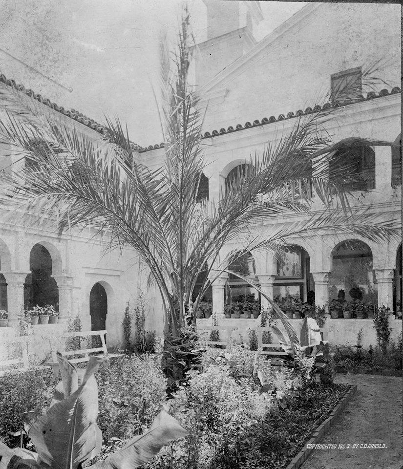
The Germans who settled in the Gretna area were primarily Catholics from southern Ger­many. At the time, there was no Catholic church in the county other than Sts. Peter and Paul in Naperville. Once a month, one of the priests from the church would gather his religious articles for the journey across the prairies to Gretna. By 1852 the bishop of Chicago had authorized the construction of a wooden Catholic Church and school with a churchyard cemetery. 
St Stephen's Catholic Church Cemetery.


St. Stephen's Catholic Church was dedicated the same year by Bishop James Oliver VandeVelde.

The vast farming area around Gretna and in Bloomingdale and Wayne townships con­tinued in use as rich agricultural land in the county until after World War II. The family names remained the same, it was merely the generations that changed. Included among these area farmers were the Kramers, Kuhns, Dieters, Nagels, Hahns, Klocks, Paulings, Starks, Neddermeyers, Barnes, Lies, and Kammes. Very few of the young men were called upon to serve in military service since they were already involved in a vital wartime industry - that of providing food for the armed forces abroad and for the people on the home front.

Following World War II, a few changes were made as the older farmers retired in order to give their offspring a chance at a place to live and work. The slow but steady migration of city dwellers into the suburban countryside was underway. However, for central DuPage County, it would be another few years before the cornfields would come alive with new homes almost overnight.

In the spring of 1953, the Illinois Department of Agriculture began a search for a farm and a farm family who would become the stars of a new television show on the National Broadcasting Company (NBC). One of the thirty-five farms on the itinerary was the Harbecke Farm on Gary Avenue, rural Cloverdale in Bloom­ingdale Township, operated by Harbecke's daughter and son-in-law, Bertha and Wilbert Landmeier. Tracing their roots to pioneer German farm families, the young couple had moved to the Harbecke Farm to operate a dairy farm. They had recently installed dairy equip­ment which carried the milk in refrigerated tubes from the milking machine to cooling tanks on the milk truck, which transported the commodity to an Addison dairy. The farm also had a hay drier which was another piece of modern machinery not found on every farm in 1953. These advantages, plus the fact that the location was considered one of the best be­tween Chicago and the Fox River for beaming the television waves, made the selection of the Harbecke-Landmeier Farm ideal for the show. Thus, "Out on the Farm" began the first of a two-year run from the Harbecke-Landmeier Farm in the summer of 1953.

During the second season, the first outdoor network colorcast originating from Chicago was the pickup from the Landmeier Farm. At the end of the 1954 season, the show was over, as Cloverdale and all of DuPage County were due for rapid change. The emphasis would shift within another year from the fine agricultural county of the past 124 years to a prestigious area of new homes for veterans of both World War II and the Korean War.

It was about this time that Jay Stream of Durable Construction Company, and a long­time Wheaton resident and businessman, be­gan looking for a place to create his own town, one in which industry and residence could exist side by side. Returning to his hometown after service in the armed forces during World War II, he turned to the home construction business. One of his business partners was Gordon Oury, whose family had an interest in the Imperial Service Company of Melrose Park. They began their new home venture by con­structing three homes along Geneva Road.

Durable continued its construction of new homes on scattered sites in Wheaton during the first years of its organization. Then Stream acquired two major tracts for conversion to new homes. These included the old Greene Valley Golf Course, south of Roosevelt Road between Main Street and Naperville Road, and the Hawthorne area, which lies east of Main Street and north of Hawthorne Avenue.

But there was one continuing problem for the families to whom Stream sold homes - high taxes. Many of the homeowners sought advice from the developer. The only answer Stream could offer was that the community had to obtain a broader base for the collection of real estate taxes, which escalated as the need for public services increased. He felt the simplest way to help defray the cost of public services in the City of Wheaton would be to have businesses or industries help share the tax burden. However, city officials did not want to rezone for the industry.

Thus, by the summer of 1956 Stream and his staff were looking in the Wheaton vicinity for land which could be used to develop a new community, one in which industry would be a built-in part. One of his requirements was that there should be sufficient land for his planned community to expand in years to come. After a number of air flights over the central DuPage area, Durable officials felt they had located the ideal spot for their future town. The land lay generally to the northwest of Geneva Road and Main Street in Wheaton. There was plenty of it, and the views from the air indicated that the sites were adequately drained.

In the summer of 1957, Stream and his crews were completing work on the Hawthorne Shopping Center on North Main Street. This would be a service center for his new community in its early years because it was less than two and a half miles away. Land acquisition began with three farms belonging to the Nagel and Mittmann families as well as the Giesers. This was raw land that had to be cleared, graded, and sectioned off into units. New streets were cut through and sewer and water lines were installed. Then a developer could begin to lay foundations for the new homes. Stream reasoned that the homes had to come first since industry would not be attracted to an area that did not offer a workforce.

While the basic engineering and work were underway in the new community, a personal tragedy struck the Stream family.

On Monday, August 26, 1957, Carol and three friends were returning from Racine, Wisconsin in a 1949 Studebaker. While attempting to cross U.S. Route 45 in central Kenosha County, the car was struck in the right rear corner, killing 15-year-old Richard Christie of Chicago, the passenger seated there. Carol was ejected through the windshield and into a utility pole. Neurosurgeons at Kenosha Memorial Hospital said the comatose girl might never awaken or, if she did, would likely be severely handicapped.

Meanwhile work on the new village continued. When the time came to file plats of sub­division with the county, the engineer asked Stream what name should be given to the small stream which ran through the southern section of the original units. He mumbled the name "Carol" and thus the name was penciled on the plat. However, when it was filed at the county offices, the name "Carol Stream" was applied not only to the small stream but to the entire new subdivision. In his next visit with his young daughter who was still in a coma after four months, Stream told her the new town had been named for her. As he recalled later, the motionless youngster opened her eyes for the first time since the accident months before.

Carol Stream is one of the few communities in America which took its name from the first and last names of a living person: Carol Stream, the daughter of its founder Jay Stream.


By November1, 1958, Roy and Jeanne Blum, with their infant son, Roy Jr., had moved into the first home to be occupied in the village. Within weeks there were more than 100 in­habitants residing in the new community. Under state law at the time, this was a suf­ficient number of residents to hold a referen­dum to incorporate the community as a village. Stream felt this was the only way to make certain that he would be able to carry out his dreams for a well-planned community. Six trustees, a village president, and a village clerk were elected in a special election held and the village of Carol Stream was incorporated in January of 1959.

Compiled by Dr. Neil Gale, Ph.D.