Showing posts with label Maps and Plats. Show all posts

Saturday, January 28, 2023

Lost Communities of Chicago - Aldine Square Neighborhood, 1874-1938.

Aldine Square was built on untouched prairie land on the South Side of Chicago.

Since the onset of the 20th century, Aldine Square has been one of the city's most fashionable neighborhoods for a few decades. Its big brick and limestone townhomes surrounded a wooded park with a lake and footbridge.

Built in 1874 between 37th Place and 38th Street, bounded by Vincennes Avenue (entrance) to the east and Eden Avenue (entrance) - no longer exists) to the west. 
Plot Plan of Aldine Square, Chicago.


Aldine Square Postcard.


Aldine Square was where judges, attorneys, and folk in society lived. In 1877, the Chicago Tribune called it "the most charming of all the beautiful places of residence in the city." It consisted of 42 houses built of brick and limestone that surrounded a park with a pond and was initially paved with Belgian Woodblock. Homes in the neighborhood carried an "Aldine Square" address.
Looking westward shows the Aldine Square main entrance on Vincennes, marked by two enormous stone pylons. Ragtime giant Jelly Roll Morton lived at 545 Aldine in 1918.


Towards the end-of-life of Aldine Square, near the Eden Street entrance, was a dumping ground over which a sign read, "No Dumping Here."

But by 1938, Aldine Square was gone, razed to build the now-demolished Ida B. Wells public housing project, and is all but forgotten. Fortunately, just before Aldine Square was demolished, the federal government sent photographers Joseph Hill and Robert Tufts to document the site. Their photographs, taken between 1934 and 1936, are among the few visual records of this spectacular Place that looked impressive even in its final days.
The original wood and iron footbridge.
So, what happened to Aldine Square? When black migrants from the South began settling in the Chicago area beginning in the 1920s, the white residents of Aldine Square and the surrounding neighborhoods moved away. 

The onset of the Great Depression in 1929 further exacerbated economic conditions, and the area quickly became slum housing.
Here you can tell the still-stately homes have seen better days. The simple wooden footbridge in the foreground replaced the more elaborate iron and wood original one.


The Chicago Tribune documented this in a 1929 story about a neighborhood reunion held by Aldine Square's original families. The article said the gathering was held at a downtown hotel by residents who "moved away from the path of the advancing Negro district."

That Negro district had some of the most substandard housing in the city, and the big, new, modern Ida B. Wells public housing project was supposed to fix those ills. Aldine Square, which occupied a small portion of the future public housing site, was in the path of progress.

Ironically, the Ida B. Wells homes have been demolished and replaced by upscale housing in the newly gentrified neighborhood.

Compiled by Dr. Neil Gale, Ph.D.

Monday, December 26, 2022

Clyde Tombaugh from Streator, Illinois, discovered that Pluto was a planet.

Clyde William Tombaugh was born in Streator, Illinois, on February 4, 1906. His family purchased a farm near Burdett, Kansas, while he was still young, where a hailstorm ruined his family's crops and put an end to his hopes to attend college at the time. 


Unimpressed with store-bought telescopes, Tombaugh constructed his first telescope at 20, grinding the mirrors himself. Throughout his life, he built more than 30 telescopes.

In 1928, he put together a 23-centimeter (9-inch) reflector telescope from the crankshaft of a 1910 Buick and parts salvaged from a cream separating machine. Using this telescope, young Clyde made detailed observations of Jupiter and Mars, which he sent to Lowell Observatory to garner feedback from professional astronomers.


Instead of receiving constructive criticism, Tombaugh was offered a position at the observatory. The staff had been searching for an amateur astronomer to operate their new photographic telescope in search of, among other things, the mysterious Planet X.


sidebar
Only a short time after its discovery in 1781, astronomer William Herschel declared it was initially either a comet or a star. The new planet, Uranus (no jokes, please), was found to have strange movements that could only be attributed to another celestial body. Neptune's discovery in 1846 somewhat accounted for the orbit, but there were still discrepancies that led scientists to conclude yet another planet existed. In 1894, businessman Percival Lowell built Lowell Observatory to study Mars. In 1905, he turned the telescope to search for the elusive Planet X, though he died before the new planet was found.

When Tombaugh was hired in 1929, he joined the search for the missing planet. The telescope at the observatory was equipped with a camera that would take two sky photographs on different days. A device known as a blink compactor rapidly flipped back and forth between the two photographs. Stars and galaxies remained unmoving in the images, but anything closer could be visually identified by its motion across the sky. Tombaugh spent approximately a week studying each pair of photographs, which contained over 150,000 stars and sometimes nearly a million.

On February 18, 1930, Tombaugh noticed movement across the field of a pair of images taken a month beforehand. After studying the object to confirm it, the staff of Lowell Observatory officially announced the discovery of a ninth planet on March 13, 1930.


With the discovery came the right to name the new body, so the staff opened a worldwide call for suggestions. Eleven-year-old Venetia Burney of England suggested the name Pluto because the dark, distant planet resembled the abode of the Greek god of the underworld.

In 1934, he married Patricia Edson, and they had two children, Annette and Alden. He earned his bachelor's and master's degree in astronomy from the University of Kansas, working at the observatory during the summers.

Tombaugh remained at Lowell Observatory until the advent of World War II when he was called into service teaching navigation to the U.S. Navy at Arizona State College. After the war concluded, he worked at the ballistics research laboratory at White Sands Missile Range in New Mexico. Tombaugh received the "Pioneers of White Sands Missile Range" medal. From 1955 until he retired in 1973, he taught at New Mexico State University.


Pluto endured as a planet for more than 70 years. As astronomical instruments became increasingly precise, other similar-sized objects were found beyond the orbit of Neptune. In 2006, almost a decade after Tombaugh's death, the International Astronomical Union reclassified Pluto as a dwarf planet.

The New Horizons mission to Pluto launched on January 19, 2006, and carries some of Tombaugh's ashes on board as it travels to Pluto. New Horizons performed a flyby of the Pluto system on July 14, 2015.

NASA's 'New Horizons' Mission to Pluto and a Puzzling Discovery.
[runtime: 19:38]

Although most famous for discovering the most controversial body in the solar system, Tombaugh also found a comet, hundreds of asteroids, and several galactic star clusters throughout his career. 

Tombaugh passed away at his home in Las Cruces, New Mexico, on January 17, 1997.

Compiled by Dr. Neil Gale, Ph.D.

Saturday, October 22, 2022

Boy & Girl Scout Camp Bemis in Bemis Woods South, Western Springs, Illinois. 1920s

The Boy and Girl scouts used the Camp Bemis Log Cabin in Bemis Woods in Western Springs, Illinois. Today Bemis Woods is in Westchester. The cabin and campgrounds were also rented by other groups. Camp Bemis was split into North and South by Salt Creek.

In 1920, the first Girl Scout troop in Western Springs was organized. Shortly afterward, an effort was made to have a Girl Scout campsite built in the Bemis Woods, directly north of the village. While the Forest Preserve District of Cook County had turned down eight similar requests from other groups, they agreed to allow a log cabin to be built in the Forest Preserve for the new troop.


According to news reports from that time period, the scouts found a spot in the Bemis Woods near Salt Creek, a half mile west of Wolf Road and north of Ogden Avenue, which they felt would be ideal for a campsite. The superintendent of the Cook County Forest Preserve District agreed, and soon, plans were underway for its construction. Best of all, the Forest Preserve District agreed to build the structure at no cost to the Girl Scouts.


The log cabin, used by the scouts for overnight campouts, had seven windows, two doors, and a fireplace constructed from stones gathered from the banks of the Salt Creek. The cabin was to be called “High Banks,” a reference to the banks of the nearby Salt Creek.

Newspaper reports described the cabin as being “… an exceedingly artistic structure, with a magnificent chimney and fireplace made of rough field stone.” The cabin also had an incinerator built of rough field stone for burning refuse, a log kitchen, a water well, and “… other necessary accommodations for both men and women.”


The Forest Preserve District even supplied an additional load of logs to construct a temporary dam near the cabin. This would raise the water level in Salt Creek by another three or four feet, thereby allowing the Girl Scouts to have better swimming and canoeing in the summer and ice skating in the winter. The Western Springs American Legion Post offered to construct the dam.

On October 15, 1921, the cabin was ready to be dedicated. And no fewer than five County Board Commissioners were in attendance, no doubt drawn by the promise of a fried chicken dinner served to them at noon in the new cabin.


At 2:15 pm, a train arrived in Western Springs carrying Girl Scouts from other western suburbs located along the Chicago, Burlington & Quincy Railroad, also known as the “Q.” After disembarking the train, they marched 1½ miles north to the new cabin.

At 3 pm, an American flag was raised, followed by a bugle call. The president of Western Springs, Henry Reeve, then spoke, welcoming everyone. After dedicating a bronze tablet, eight visiting Girl Scout troops sang a song, “Hail the Cabin,” which was written especially for the occasion:

On the high banks of Salt Creek, For the Girl Scouts of the “Q"
Stands a little red oak cabin, Built by foresters so true. 

To be shared by friends and neighbors, In our work and in our play,
So, to dedicate the cabin, We have gathered here today.

Hail the cabin, hail the cabin, To the Girl Scouts given free.
Hail the cabin, hail the cabin, Home of hospitality.

Grateful ever, may we never, Fail our duty to fulfill,
To make the spirit of the cabin, Be the spirit of Good Will.

Historical Society records indicate that the log cabin was used by Western Springs girls for several years thereafter. In addition, the cabin was often loaned to Girl Scout troops from other communities. It also served as a training center for Girl Scout leaders.


Unfortunately, because of what scout leaders termed “inadequate supervision for safe use of our girls,” ownership of the cabin was transferred back to the Forest Preserve District after a few years. However, the Girl Scouts continued to use the building for daytime outings until 1925 and for annual Christmas parties until 1926.

But what became of the cabin? Current aerial photographs of Bemis Woods show no trace of it, nor is there any mention of its eventual fate in Girl Scout records that were donated to the Historical Society.

THE LOCATION OF THE CABIN
Camp Bemis (north) 
West of Wolf Road, south of 31st Street and north of Salt Creek — three parking spaces — allowable picnic load, 5,000 (seven picnics) — two concrete dance platforms, one south of entrance drive and one west of upper parking space — two wells, third well one-half mile west of upper parking space on the trail — sanitary conveniences sixty-three table and bench combinations — open, level space for races and games — space available for Softball — fine woods, birds, wildflowers — bridge across Salt Creek — hiking and bridle trails — saddle stable west of Preserve — ideal for small group and family picnics.


Camp Bemis (south)
North side of Ogden Avenue, one-fourth mile west of Wolf Road, south of Salt Creek — three parking spaces, two cinders and one macadam [1] — allowable picnic load, 3,000 (two picnics only) — one type "A" picnic shelter with concrete floor and fireplace — two wells — sanitary conveniences — thirty table and bench combinations — open, level spaces for races and games — fine woods, birds, wildflowers — bridge across Salt Creek hiking and bridle trails.

The Boy & Girl Scout cabin is at the far north end.

Compiled by Dr. Neil Gale, Ph.D.
Contributor: The Western Springs Patch


[1] Macadam is a type of road construction pioneered by Scottish engineer John Loudon McAdam around 1820, in which crushed stone is placed in shallow, convex layers and compacted thoroughly.


Monday, October 17, 2022

Donley's Wild West Town (Amusement Park), Union, Illinois (1974-2021)

Donley's Wild West Town (Amusement Park), Union, Illinois (1974-2021)


Sixty miles northwest of Chicago.
Kids and adults could pan for gold pyrite at Sweet Phyllis Mine, shoot slingshots at Huck Finn's, or watch a wild west show.


The owner Larry Donley displays a handful of gold pyrite in the park's gold panning section. © David Kasnic, The New York Times.


Owner Mike Donley's parents, Larry and Helene, initially built a large storage facility to hold their growing collection of Museum-quality artifacts, antiques, collectibles, and memorabilia. 

The indoor Museum displays antique phonographs, Old West and Civil War artifacts, Carousel Horses, Outdoor Porcelain Signs and sports memorabilia. Around the back of the Museum was an outdoor replica town called "Wild West Town," complete with cowboy shows, a steam locomotive and a carousel.
Copyright © 2021 by Donley's Wild West Town


Copyright © 2021 by Donley's Wild West Town


Rides and Attractions included an Archery Range, Carousel, Hand Cars, Roping, Run Away, Shooting Gallery, Streets of Yesteryear, A silent movie house, Locomotive Ride, the Wild West Stunt Show, and others.
Run Away Mine Cars Roller Coaster


Run Away Mine Cars Roller Coaster, Copyright © 2021 by Donley's Wild West Town


"Please, keep your hands inside the car at all times ..."


Even young wranglers were pleased with the food and refreshment choices of an Ice Cream Parlor & Snack Shop, a Fudge Shop, and Clayton's Sarsaparilla Saloon.
The Lazy Canoe Float.


This is the cast and crew after what turned out to be the last-ever Wild West Show at Donley's Wild West Town on October 27, 2019. Copyright © 2019 Bob Brown ran the jail as“Marshal Bob.”


Onesti's Wild West Town (formerly Donley's Wild West Town) sold the amusement park to Ron Onesti in 2019.

Unfortunately, because of Illinois and McHenry County and local COVID-19 restrictions, they did not open the park for the entire 2021 season. It was announced in May 2022 that Ron Onesti's Wild West Town is permanently closed after the Wild West Town had a 47 46-year run.


Today, Donley Auctions sits in front of the Wild West [Ghost] Town. Monthly auctions attract buyers from around the world who enjoy the excitement of a live auction as much as trying to win a bargain.


VIDEO
Wild West Town Highlights - 2016

Compiled by Dr. Neil Gale, Ph.D. 


Saturday, October 8, 2022

The History of the 1925 Tri-State Tornado.

On March 18, 1925, a dark “smokey fog” touched down approximately three miles northwest of Ellington, Missouri, and it would become known as the Tri-State Tornado. By all accounts, the Tri-State Tornado was one for the record books.


The Tri-State Tornado is the U.S. record holder for the longest tornado track (219 miles), most deaths in a single tornado (695), and most injuries in a single tornado (2027). While it occurred before modern record keeping, it is considered by all accounts to be an F5/EF5 Tornado. It crossed the three states, thus its namesake “Tri-State,” tearing through thirteen counties of Missouri, Illinois, and Indiana. It crossed over and destroyed or significantly damaged nine towns and numerous smaller villages.

The resulting map perhaps shows why this tornado was so deadly. First off was the speed of the tornado. The average speed across its life span was an astonishing 62 miles per hour, with forward speeds, at times, reaching 73 mph. Also worth noting is that the tornado followed a slight topographical ridge with a series of mining towns perfectly aligned on the path.

Crossing the Mississippi river, the tornado struck the town of Gorham, Il. Gorham was a town of about 500 people; of those 500, 37 were killed and 250 injured. One notable effect in Gorham was the grass being torn from the ground in a gully on the east of town. The next town was Murphysboro. Eugene Porter reported the tornado to be “about a mile wide.” The town of Murphysboro suffered heavy losses, with 234 casualties reported along with 623 injuries. About 100 square blocks of the town were destroyed along, with another 70 by a fire after the tornado.

Perhaps the most spectacular show of power came from the next town in line, DeSoto, Il. Trees were snapped off at knee height, and stumps were ripped from the ground. No structure was left standing in the tornado’s path. Of the 69 people killed in DeSoto, 33 were killed in a school.
A child and puppy atop the wreckage of a home in Murphysboro, Ill., after the tri-state tornado ripped through town March 18, 1925.


Next up, West Frankfort was a mining town, and most men worked in the mines. The miners went to the surface to see the problem when the electricity went out. The miners came to the surface of a destroyed landscape. Most of the 148 deaths and 400 injuries in West Frankfort were women and children, given the men were in the mine.

A man in Parrish, Illinois, survived the tornado by clinging to a railroad track while the town was destroyed. 46 people died, and at least 100 were injured here. Between Gorham and Parrish, 541 lives were taken.

The tornado continued northeast, and most farms and an occasional schoolhouse or general store were destroyed over the next hour.

The total time on the ground of the Tri-State tornado was 3 hours and 30 minutes. During that time, it traveled 219 miles and killed 695 people, most of them in Illinois.

Compiled by Dr. Neil Gale, Ph.D

Sunday, September 25, 2022

Checkerboard Flying Field & U.S. Air Mail Field in Broadview, Illinois.

Before 1919, the tract of land located south of Roosevelt Road and west of First Avenue in today's Broadview, Illinois, was a cornfield.

During the spring of 1919, clothing merchants Decker & Cohen acquired this land and constructed an airfield. A metal hangar was erected on the northeast comer of this field, near the banks of the Des Plaines River. Meadows and pasture lands that were relatively level and free of holes made a suitable landing field for the airplanes of this era. Flying operations were possible in this field without having to prepare special runways.
I cleaned up this map to make it easier to read.


Chief mechanic Louis Meyer and ex-Signal Corps pilots David Behncke and Bert Hassell uncrated and assembled two planes the company had purchased. These airplanes, equipped with 90-HP Curtiss OX motors, were Curtiss JN-4 models, more commonly known as "Jennies." The Jennies carried a pilot and a passenger, fore and aft, in open cockpits and enough gasoline for about two hours of flying time at a speed of sixty miles an hour. They were first put into action on June 13, 1919, as Checkerboard Flying Field opened for business and began sending the Jennies on delivery runs, bringing "Society Brand Clothes" to local towns within a 120-mile radius.

When Checkerboard was operating, bright red and white Checkerboard designs were found on the Jennies (to aid in the eye-catching advertisement of Society Brand Clothes) and on the hangar's roof (to help pilots locate the airfield). Such bright patterns made it difficult to miss the airport when planes passed overhead!
Broadview Air Mail Field, previously U.S. Air Mail Field.


Obviously, the pilots did more than just deliver clothes in those Jennies. Off-hours were devoted to flying lessons, joy rides and pleasure hops. In addition, there was always stunt flying on weekends; such attractions brought people from miles around, creating a carnival atmosphere at the airfield.

In September 1921, the spectators were entertained by Ethel Dare dropping from the clouds, and in 1922 Bessie Coleman entertained crowds at Checkerboard. Such excitement induced the spectators to buy raffle tickets for the chance to ride in one of the planes."
U.S. Air Mail Field, aka Broadview Air Mail Field.
The first recorded instance of an Air Mail delivery was in January 1911 from Nassau Boulevard Flying Field in Garden City. New York to Mineola, New York. 

The first organized Air Mail route was started on May 15, 1918, by the Post Office Department and the Army Air Force, and utilized Army pilots and airplanes flying between Washington D.C. and New York City with Philadelphia as a halfway stop. Initially, Curtiss Jennies with 150-HP Hisso motors were used on this route.

At the end of World War I, the Army converted many DeHavilland Observation and Bombing Planes into mail planes for the proposed transcontinental Air Mail route.

In August of 1919. the Post Office Department took over the entire Air Mail operation, hired their own pilots, bought their own planes and started mail flights from New York City to Cleveland, Ohio, with Bellefonte, Pennsylvania as the halfway stop. On May 31, 1921, the route to Washington D.C. was discontinued. The Jennies were discontinued then, and the DH-4 became the official Air Mail plane.

The official Air Mail plane had problems; most significantly, the plane's engine endurance for the long transcontinental haul was troublesome Plus, the structural modifications amounted to some 600 changes in the fuselage. The forward cockpit was removed and moved further back, leaving space for the mailbag compartment, and the Liberty engine had to be overhauled.

These 400HP Liberty motors enabled the DH-4 to carry a cargo load of 400 pounds plus 100 gallons of gasoline at speeds up to 100 mph for as long as four hours.

Before the end of the summer of 1919, the route was extended from Cleveland to Chicago, with Bryan, Ohio, as a refueling stop. A strip of land in Grant Park, extending south along the lakefront from Randolph Street, was used as a landing field. A small hangar was erected at the north end of this field, about where the Amoco Building is today. Field size at Grant Park was limited, and prevailing lakefront winds made operations hazardous. Soon after, Checkerboard was proposed as a new site due to its superior year-round flying conditions. In 1920 it was officially designated as Chicago's Air Mail field.

Early in 1920, a hangar was built on the west side of the field along First Avenue, several hundred feet south of Roosevelt Road. A small garage-type office was also built at the north end of the hangar, and in January, the Air Mail operation officially moved to Checkerboard Field. Operations went well the rest of that winter until a heavy April 1 snowfall followed by an early thaw softened the ground so badly that several landing aircraft nosed over in the mud and were severely damaged. Air Mail operations immediately returned to Grant Park and remained as cinder runways were put in at Checkerboard.

On May 15, 1920, Checkerboard resumed operations with its new runways and regular flights to and from Omaha, Nebraska, began. By the end of the month, the Air Mail service was fully established at the increasingly well-known Checkerboard Airmail Field. Later in 1920, Decker & Cohen clothing deliveries were discontinued, making Checkerboard exclusively an Air Mail field. Additions and modifications to the field included the setting up of a repair hangar, brought in from Bustleton, Pennsylvania, just north of the original hangar that summer.

The first transcontinental flights were attempted on February 22,1921. Four different airplanes participated in the grueling trip, two leaving from San Francisco and two departing New York. The four simultaneous flights were intended to prove to Congress that day-night transcontinental flights were possible. Of the two New York-based flights, one was forced down shortly after takeoff, and the other landed at Checkerboard, only to be grounded by a snowstorm. The first pilot from San Francisco crashed and died in Nevada, but the second made it to North Plane, Nebraska, where a relay pilot named James H. ("Jack") Knight took over. Knight left North Plane at 7:50PM and arrived at Omaha, Nebraska, at 1:15AM, where he found that his relief pilot had been snowed in Chicago and had never made the flight to meet him at Omaha. Knight decided to continue on himself and fly the 435 miles to Chicago even though the Midwest was getting blasted by the fiercest snowstorm they'd seen in years. Since the Des Moines refueling stop was also shut down due to the weather. Knight was forced to an alternate site in Iowa City, which had also closed down once they had heard that the relay flight from Chicago had been canceled. Fortunately, the Iowa City night watchman could guide Knight to a safe landing just as the plane's fuel ran dry.

While his plane was being refueled. Knight ate a donut and drank some coffee. He wasted no time and took off into the driving snow as soon as his plane was ready; he arrived at Checkerboard at 8:40AM, proving once and for all that day-night coast-to-coast service was indeed feasible.
Checkerboard Flying Field
In June of 1921, a large hangar was obtained from a former Army airfield at Key West, Florida, and was assembled south of the original Checkerboard hangar. Though this new building was intended to be used as a separate repair hangar, it soon became the only one when the original hangar burned down on Christmas Day. This wasn't all bad, as the newer structures were more substantial and larger than the older ones. It was said that ."..the mechanics really appreciated doors that closed tightly to keep out the cold winter wind. Later, all major repair and overhaul operations were moved to Checkerboard Flying Field from New York, making it my maintenance center for the entire service. By this point, my Air Mail service had extended as far west as Omaha and Iowa City, with St. Louis and Minneapolis soon to follow.

Checkerboard operated from 1919 through 1923; after that, it was occupied by Yackey aircraft. Checkerboard, now no longer an Air Mail center, continued as a private and commercial airstrip until 1924 when David Behncke sold the field to Wilfred A. Yackey. Checkerboard served as an overhauling center, where French Brequet bombers were converted to five-place civilian transport planes. Later, Yackey built and planned to start production of a new aircraft of his own design; his progress on this endeavor ended on October 4,1927, when he crashed and died during a test flight of one of his new planes. The Government Civil Aviation Board declared Checkerboard unsafe for private and commercial use in 1927.

Let us backtrack a few years to 1918; the Government bought the land west of First Avenue, built Hines Hospital near 9th Avenue and turned the eastern portion of the land over to the Post Office Department, who in turn started making their own Air Mail field there and finished it in 1921. January 1923, the burning down of the Checkerboard repair hangar put pressure on the Post Office Department to complete their own field on the west side of First Avenue, from Roosevelt Road south to the Illinois Central Railroad tracks just north of Cermak Road (22nd Street). The brick and steel building, designated as the repair facility, was the closest one to First Avenue and the Railroad tracks and still has a facing stone on its north elevation that reads "U.S. Air Mail." Two additional hangars were built west of this prominent building along the tracks and used for service and operations.

A 200-foot-wide L-shaped cinder runway was constructed, with the long leg running the length of 5500 feet along First Avenue; the short leg extended west-northwest toward the Hines hospital building, which was the only building on the grounds at the time. Army fliers at that time said. ."..it was the best field in the country and large enough to handle all the types of aircraft of that era." This field, which opened in May 1922, was generally known as the Broadview Air Mail Field."

"U.S. Air Mail" airport is currently part of Loyola Hospital, and Checkerboard Field is now the Miller Meadow Forest Preserve.

Compiled by Dr. Neil Gale, Ph.D


For those who don't believe that Broadview was north of Roosevelt Road (22nd Street).


Saturday, September 24, 2022

A Former Southwest Chicago Suburban Airfield's Connection to Aviation History.

Cornelius R. Coffey made aviation history in the 1930s at Harlem Airport at 87th Street and Harlem Avenue in today's Bridgeview.
Cornelius R. Coffey
In the history of Negro aviation, Bessie Coleman, the first Negro woman to earn a pilot's license, is usually remembered as the one who opened the skies to Negro aviators. 

Less well known was Cornelius Coffey, who, with much the same vision and fighting the same obstructions, changed a cornfield in south Chicago into an airport that housed the nation's first large group of young, talented Negro aviators. 

In the years just before and after World War I, some 180,000 Negro Southerners immigrated to Chicago, settling on the city's rough south side. Bessie Coleman, a Texas transplant who wanted to fly, learned that aviation schools didn't accept Negro applicants, and she had to sail to France to earn a pilot's license. "Queen Bess" subsequently became the toast of the Chicago Defender newspaper, and when she died in a fall from her airplane in 1926, some 10,000 Chicago Negro mourners filed past her casket.

Coffey never met Coleman, and the Arkansas native quietly mapped his own route to the sky. Young Coffey possessed a great gift for mechanical work. He was the top graduate in a south Chicago auto engineering class in 1925, quickly earning the allegiance of Emil Mack, the white Chevrolet dealer who employed him. Coffey later found a spot at the dealership for a mechanic friend named John Robinson.

The two young men wanted to fly, but no one would teach them, so they taught themselves. Later, in 1929, they enrolled in an aviation mechanics program at Chicago's Curtiss-Wright School of Aviation. When they showed up for class, they were turned away because they were Negro, even though they had already paid their tuition. Mack threatened to sue on their behalf, and the school reluctantly admitted the pair. 


In 1931, the 28-year-old Coffey finished first in his graduating class and Robinson second. Two weeks later, Coffey took the exam to earn his mechanic's license from the U.S. government. The school must have been impressed because it changed its policy, inviting the men to return and teach all-Negro classes. They did. The aviation mechanic's degrees didn't open many doors, however. Coffey and Robinson were still unwelcome at airstrips except Akers Airport, near where they worked, so when Akers closed, they were grounded.

The men joined with several other local Negro aviation enthusiasts to form the Challenger Air Pilots Association (the name referred to the Curtiss Challenger engine). The new group looked for a place to fly from. In 1931, the group, joined by one or two white pilots from Akers, bought a half-mile-wide tract of land in Robbins, an all-Negro town southwest of Chicago. There they buried boulders, dropped trees, roughly leveled the terrain, and cobbled together a hangar from second-hand lumber. When they finished, their small fleet of disparate craft—a Church Mid-Wing, an International F-17, and a WACO 9—was parked at what historians consider the first Negro-owned airport in the United States.

The achievement is primarily a historical footnote: About a year later, a violent thunderstorm roared through Robbins, demolishing the hangar, flipping airplanes, and scattering hopes.

But a few miles north, at 87th Street and Harlem Avenue in Oak Lawn (today's Bridgeview) intersection, William Schumacher had purchased 140 acres of farmland with an airport in mind, and his brother Fred would manage it. Before Robbins' devastating storm, Fred Schumacher visited Robbins and, probably sensing a good tenant, invited the group to come to use his brother's airport.

After the storm, while Coffey was on a trip to Detroit, Robinson and two other Challenger members—pilot Dale Lawrence White and Curtiss-Wright school graduate Harold Hurd—approached Fred Schumacher to take him up on his offer. The facility was taking shape. Grass had sprouted where cornstalks had been plowed under, and a hangar and office sprang up along Harlem Avenue.

Schumacher readily agreed to rent the lower end of the airport to the Challenger group. Still, in an interview recorded for the Smithsonian Video History Program on Negro aviators, Hurd said that Schumacher initially insisted on segregation. He was already running an all-white school. "Look, fellas," he said, "I'm going to put you at the end of the field to save you from having any trouble with the other guys."

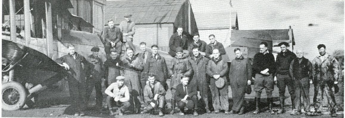
Negro and white pilots parked their airplanes in separate hangars, sharing Harlem's four sod runways, the longest of which was 2,000 feet. The rural area soon echoed with the thundering exhausts of Curtiss engines; the sky above the corn and wheat fields of Worth Township teemed with WACOs, Travel Airs, and Taylor Cubs. The leaders of the Challenger group were acknowledged to be Coffey and Robinson. 

At Harlem Airport, Schumacher asked Coffey to recertify the overhauled aircraft of his white customers, enabling Coffey to begin earning money as a mechanic. It started an amicable working relationship with the man Coffey called "Shoes." The Coffey Flying School operated on the airport's south end, and Schumacher's school was on the north. Coffey taught both white and Negro students together. "Every 10 students I took, I had one white student and one girl student in that unit," he said years later.

One of those "girl students" was Willa Brown, a former Curtiss-Wright student of Coffey's. In 1938, the pert 27-year-old traveled to Harlem to take flying lessons from her old teacher. Two years earlier, Brown, a former Gary, Indiana schoolteacher with a master's degree in business administration, had strutted into the Chicago Defender newsroom in jodhpurs and boots to promote an amateur airshow at Harlem. City editor Enoc Waters was so taken by her that he assigned himself to cover the event.


At Harlem, Brown became the first Negro woman to earn a pilot's license in the United States. She became indispensable to Coffey's operation and the Negro aviation movement. For a time, she also was Coffey's wife. In 1939, editor Waters proposed that the Challenger Air Pilots Association broaden its scope; within weeks, the new National Airman's Association was chartered, with Coffey as president, Dale White as vice president, Brown as secretary, and Waters as the group's unofficial promoter.

Smith remembers that Coffey and his instructors washed out few students, almost willing the young men and women to succeed. Smith himself struggled until Brown rescued him. She asked Smith to go for a ride one day. Smith was six-foot-two and weighed 210 pounds, and the five-foot-two Brown took off in a Cub. "She said, 'I've been watching you, Quentin, and I know you can learn to fly. Let me show you something,'" he remembers. "She pulled it up into a stall, and we spun seven or eight times—and you don't spin a Cub!—and then she pulled it out, and this little lady said to me, 'You can't be King Kong, Quentin. You've got to be gentle. You're going to learn to fly today.'" And he did. Smith completed training at Tuskegee and was assigned to a bomber group based in Seymour, Indiana.

In late 1939, civilian pilot training sites were announced; they included seven for Negro students (Tuskegee, which had finally begun flight instruction, was one). Harlem Airport was the only Negro training site that was not a college campus.

Coffey was to direct flight training and personally maintain the aircraft of his renamed Coffey School of Aeronautics. Willa Brown would run a ground school at Chicago's Wendell Phillips High School and coordinate the overall program.

"Shoes" sold Coffey a 50-horsepower Piper Cub needed for primary flight training, and another white friend helped Coffey buy a second one. For secondary training, Coffey and Brown cajoled the Curtiss-Wright school into lending two 220-horsepower WACO PT-14s.
The Coffey school also would teach cross-country and flight instruction; it and Tuskegee were the only Negro programs offering all four levels of instruction. Each trainee received 35 hours of flight time. By June 1941, the school's fleet—mostly Cubs—had increased to 10. When rain caused excessive puddling on Harlem's sod runways, the students practiced from paved airfields in Harvey or Joliet.

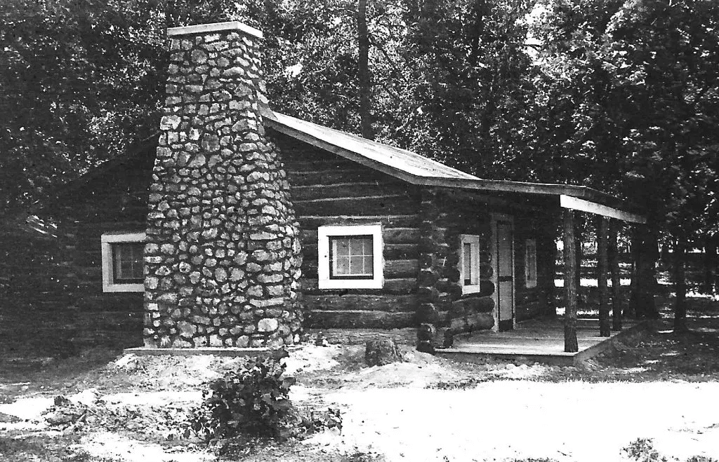
Everything about the civilian pilot training program at Harlem was modest. Coffey and Brown lived in a small cottage at the southern tip of the airport, a building that doubled as the Civil Air Patrol unit headquarters. Classroom work was conducted in a small one-room building crowded with student desks. 

The government wouldn't fund student housing at Harlem, so in 1942 supporters of the program erected a dormitory: a cot-lined room with adjacent latrines and showers. At one end, Brown supervised a dining area that served three meals daily to flight students and anyone else who wandered in.

"The atmosphere at Harlem was camaraderie," Quentin Smith recalls. He trained at the airport in 1942 at the invitation of Brown, whom he had known in Indiana. Smith says in his months at Harlem, all the student pilots had at least some college education and quickly bonded. "Every day, it wasn't raining, and we weren't flying. All we had to do was study," he recalls. "In the evenings, we'd get in the planes and get the feel of them. I probably wouldn't have made it without all the camaraderie. I mean, out there, we were so far from Negro people, we had to drive 20 miles just to see any."

Coffey and Brown procured olive green Civilian Conservation Corps uniforms to bolster the students' esprit de corps (a feeling of pride, fellowship, and common loyalty). They also quietly used some of their earnings to set up a pool of cash that the unpaid students could dip into for incidental needs.

Coffey remained committed to integration. When the Army Air Corps announced that the military unit from Tuskegee would be segregated from white servicemen, Coffey, speaking as NAA president, objected. "We'd rather be excluded than segregated," he declared. In the end, Army traditions prevailed. The Tuskegee Airmen would be a separate fighting unit known informally as the Red Tails; their most famous mission was flying escort for bombers in Europe.

Coffey offered to pay the Negro teen­ager, Bev Dunhill, 50 cents an hour to work at Harlem, plus give him 30 minutes of flying time each weekend. Dunhill instantly accepted though he didn't tell his airplane-fearing mother for six months. Each day Dunjill rode a streetcar to the end of the line at 63rd Street, where Coffey met him and drove him to the airport. The teen spent his days pushing airplanes from the hangar, washing fuselages and performing minor maintenance.

The number of pilots that the Harlem wartime program turned out is unknown, but it was in the hundreds. No airplane was ever wrecked. After the war, Coffey worked at Harlem but spent most of the next two decades teaching aviation mechanics in high schools and an area college.

Some of the aviators from Harlem's early years had distinguished careers. Coffey got a patent on a popular carburetor warming system, and the Federal Aviation Administration honored him with an aerial navigation waypoint ("Coffey Fix" in FAA spelling) to align aircraft landing at Chicago Midway Airport. Harold Hurd was inducted into the Illinois Aviation Hall of Fame. Dale White broke employment barriers for Negro mechanics. Willa Brown ran twice, unsuccessfully for Congress, the first Negro woman to try for a Congressional seat. Quentin Smith stayed active in aviation, becoming president of the Gary, Indiana Regional Airport Authority. And Bev Dunhill, who had entered the cadet program at Tuskegee as World War II ceased, re-enlisted in 1949 and became an F-86 jet combat instructor in Korea, along with a pilot named Gus Grissom.


Harlem Airport grew even busier in the post-war years, with six flying schools, a repair service, and half a dozen hangars. Forty acres were added, and 10 unpaved runways crisscrossed the field.


In September 1956, the airport lost its lease. A parcel of land that had once been a cornfield was transformed once more, this time into a residential sub­division and a shopping center named Southfield Plaza. 

Today, customers walk to Shop' N Save, Hobby Lobby, and Walgreens on the pavement where leather-helmeted pilots once revved engines to taxi and take off. Grassy airstrips scarred by ruts have disappeared under smooth streets lined with houses and trees. The acreage's only link to aviation is several hundred feet overhead, where airliners descend toward landings at Midway Airport.

For Harlem's 23-year existence, Fred Schumacher was manager, building his business on twin pillars: full service and a relatively enlightened sense of brotherhood. When the facility closed, he picked up and moved to Chicago-Hammond Airport. Probably the person in the best position to know, Schumacher told a newspaper reporter at Harlem's closing that some 350,000 hours of instructional flying had been logged at the rough field. This number represented a lot of realized dreams, regardless of their race.

Compiled by Dr. Neil Gale, Ph.D.