Showing posts with label Lost Towns of Illinois. Show all posts

Friday, September 16, 2022

Lost Towns of Illinois - Schoper, Illinois.

Located about eight miles from Carlinville, the town of Schoper (aka Standard City) was originally Thomas Schoper’s 500-acre family farm. 

After a coal shortage in 1917, Standard Oil Company wanted a reliable coal supply. In 1918, Standard Oil of Indiana bought the farm (literally) from Mr. Schoper.

After completing several geological surveys (commissioned by Standard Oil), it was discovered that there was a seven-foot tall seam of coal in the ground at Schoper. The property was conveniently situated near the Chicago and Alton railroad, which was centrally located between the refineries in Wood River (near St. Louis) and Whiting, Indiana (near Chicago). 

In 1918, Standard Oil placed a $1 million order (for 192 houses) with Sears Roebuck and Company for 192 Sears Honor-Bilt homes. The houses were purchased for employees in Carlinville, Wood River and Schoper, Illinois. One hundred and fifty-six of the houses were built in Carlinville (152 of the original 156 homes still stand in a nine-block neighborhood), 12 were built in Schoper and 24 went to Wood River.

Twelve Sears Modern houses were built at Schoper for mine supervisors. There were also boarding houses and dorms built at Schoper for the miners. Standard Oil purchased the farm from Mr. Schoper and sank two mines there, Berry and Schoper. The town of Schoper, aka Standard City, sprang up around the mines.

At its peak, Schoper was the largest coal mine in Illinois, employing 650 men and hoisting up to 4,000 tons of coal daily. About 450 men also worked at the Berry Mine, producing about 2,000 tons of coal per day. The times were good. In the early 1920s, Schoper miners worked about 298 days per year, while nationwide, most coal miners worked about 200 days yearly. 
Schoper circa 1919. At the foot of the sidewalk is a 12-bay garage shared by the occupants of the 12 Sears Houses. The Power House is shown in the background near Schoper Lake. The Whitehall, Gladstone and Warrenton models are shown in the foreground. Click here for Sears model plans and costs.


By the mid-1920s, the boom at Schoper had gone bust. The price of coal dropped after The Great War (1918), and Standard Oil could now buy their coal cheaper from mines in Kentucky (which did not have unions) than they could mine it in Macoupin County.

In July 1925, a small column on the bottom page of the Macoupin County Enquirer sadly announced that the mine was permanently closed.

Nine of the 12 little Sears Houses were painstakingly disassembled and left Schoper the same way they came in: on boxcars, headed off to unknown destinations.

Two of the Sears Homes were moved intact to sites just outside of Standard City. The last Sears House at Schoper (The Sears Gladstone) was home to John McMillan and his wife, a supervisor with the mine. After the mine closed, he became a caretaker charged with myriad tasks, such as making sure the powerful fans down in the mine kept the methane down to acceptable levels. McMillan’s little Gladstone eventually became rental property and burned down sometime in the mid-1990s. 

The last remnant at the site was the Schoper Powerhouse and Mine Offices, a massive concrete Federalist structure which was torn down in Summer 2003.

Today, Schoper is a ghost town.

Compiled by Dr. Neil Gale, Ph.D.

Lost Towns of Illinois - Sugarville, Illinois.

Sugarville was a community near Put Creek in Fulton County, Illinois, five miles west of Canton.  It once had several houses, a blacksmith shop, and a general store. It no longer exists today.


Compiled by Dr. Neil Gale, Ph.D.

Lost Towns of Illinois - Tankville, Illinois.

Tankville was an unincorporated community in Alexander County, Illinois, located along the Mississippi River west of Horseshoe Lake.


Compiled by Dr. Neil Gale, Ph.D.

Lost Towns of Illinois - Shasta, Illinois.

Shasta is a former settlement in Alexander County, Illinois. Shasta was located along the Mississippi River northwest of Tankville.


Compiled by Dr. Neil Gale, Ph.D.

Lost Towns of Illinois - Reeds Crossing, Illinois.

Reeds Crossing was a former settlement in Boone County, Illinois. It was three miles south-southeast of Belvidere.


Compiled by Dr. Neil Gale, Ph.D.

Tuesday, September 13, 2022

Lost Towns of Illinois - Piankashawtown, Illinois.

Piankashawtown was a former Indian village of significance in Edwards County, Illinois.


On the government's 1809 land survey, Piankashawtown was located on section 16, town one south, range ten east, four miles north-northwest of present-day Albion, Illinois. 

It was located immediately on the old Transcontinental Buffalo Trace (trail) that passes through and connects Vincennes, Kaskaskia and St. Louis, Missouri.

sidebar
The trace came up through Kentucky, crossed Indiana and passed through Illinois, to where East St. Louis ends at the Mississippi River. It is, after all, transcontinental, so the trace picks up somewhere on the west bank of the Mississippi. Herds of bison  numbered in the thousands at times.  Chicago as a Hunting Post.

We have the testimony of the earliest settlers that Piankashawtown was a village of considerable importance as late as 1815. At about this time, the Piankashaw Indians were removed thirty or forty miles to the north.

Farmers have plowed up many implements, guns and weapons. Even now (in 1880), one can trace for a considerable distance the old deep-cut trail where buffalo, Indian, explorers, priests, hunters, traders and soldiers tramped for successive generations. 

Compiled by Dr. Neil Gale, Ph.D. 

Lost Towns of Illinois - Parker City, Illinois.

Parker City, aka Parker, was a former settlement in Johnson County, Illinois. 


Parker City was west of New Burnside, south of Creal Springs, and founded at the crossings of the former Cleveland, Cincinnati, Chicago and St. Louis Railway and Marion to Brookport branch of the Illinois Central Railroad. 

The settlement was named after George Washington Parker, a former president of St. Louis, Alton & Terre Haute Railroad, the predecessor to the "Big Four."

sidebar
The Big Four wasn’t four railroad companies, but one — "The Cleveland, Cincinnati, Chicago and St. Louis Railway Company" [CCC&StL], (1889-1930).

At its peak, the village reached a population of nearly 300 but slowly began to decline in the 1920s. At one time, there were two hotels, two stores, a post office, dining rooms, and restaurants, and two barbershops that were always full of men. 

The Parker City Post Office opened on December 28, 1889, and closed on October 31, 1941. 

There were approximately 40 houses in Parker City during its pinnacle.

Compiled by Dr. Neil Gale, Ph.D.

Monday, September 12, 2022

Lost Towns of Illinois - Palmyra, Illinois.

Palmyra was a village two miles north of Mount Carmel in what today is Wabash County. 


First settled in 1814, Palmyra was originally the site of a ferry across the Wabash River. Soon after the town was founded, a road was built between the settlement and the county line of Gallatin County, Illinois. Palmyra was named the first county seat of Edwards County, with meetings being held at a resident's house.

The peak population of the village was claimed to be between 500 and 600, though it is more likely that number would be between 300 to 400. Epidemics of Malaria and Yellow Fever killed a large portion of Palmyra.

By 1821, it was clear that Edwards County's seat had to be moved to a stable community. On April 10, the Illinois General Assembly named Albion, Illinois the new county seat.

Compiled by Dr. Neil Gale, Ph.D.

Lost Towns of Illinois - Milton, Illinois.

Milton was a former settlement in Brown County, Illinois. 


Lewis Gay and William C. Ralls laid out the town on McKee creek, four miles from the Illinois River, near the site of the old Johnson mill, on August 26, 1836. In advertising the sale of town lots, the promoters referred to it as "located at the head of slack water navigation."

Compiled by Dr. Neil Gale, Ph.D.

Lost Towns of Illinois - Mills Prairie, Illinois.

Mills Prairie was a former settlement in Edwards County, Illinois, located 2 miles southeast of West Salem.


Mills Prairie was in the eastern part of Edwards County, Buck Prairie in the southeastern section, and Long Prairie in the western region. All were fertile areas and a center of considerable wealth.

Adam Hedrick, with his wife and five children, David, Joseph, Catharine, Matthias, and Elizabeth, his sister and stepdaughter, arrived in Illinois in 1829 and settled in, then called Mills Prairie. He was a prominent and valuable citizen, being a master of most of the mechanic trades. He held the office of township treasurer and was postmaster at the Mills Prairie post office.

Compiled by Dr. Neil Gale, Ph.D.

Lost Towns of Illinois - Midway, Illinois.

Midway is a ghost town in Fulton County, Illinois, about 2 miles southeast of London Mills.


Midway was a small settlement of about forty inhabitants. In 1835, it contains a general store, blacksmith shop and post office. 

The "Mount Pleasant Methodist Episcopal Church of Midway" was organized in 1836 with 12 members. 

Compiled by Dr. Neil Gale, Ph.D.

Sunday, September 11, 2022

Lost Towns of Illinois - Little Rock, Illinois.


Little Rock was a former settlement in La Salle County, Illinois. It was located on the south banks of the Illinois River, northeast of Oglesby and southeast of LaSalle.

Compiled by Dr. Neil Gale, Ph.D.
Thursday, September 8, 2022

Lost Towns of Illinois - Lexington, Illinois.


Lexington is a former settlement in Edwards County, Illinois, and was 2.5 miles southeast of Bone Gap.


Compiled by Dr. Neil Gale, Ph.D.

Lost Towns of Illinois - Kumler, Illinois.

Kumler is a ghost town on State Highway 54 in West Township, McLean County, Illinois, five miles northeast of Farmer City. 
Kumler townsite on State Highway 54.


Compiled by Dr. Neil Gale, Ph.D.

Lost Towns of Illinois - Jugtown, Illinois.

Jugtown was located in Grundy County, approximately 50 miles southwest of Chicago and one mile southwest of the confluence of the Kankakee and Des Plaines rivers, or six miles east of Morris, Illinois.

The original Goose Lake was drained in the early 1800s, and the surrounding area was rich in clay. Starting as early as the 1820s, the clay was excavated by the settlers. Some of them were trained potters who built a kiln, then fired clay pieces creating earthenware for trade on the frontier, for farm and household needs.

"Jugtown" was the colloquial name given to the unplatted hamlet that developed around William White and Charles Walker's middle nineteenth-century pottery and tile works. Variously known as "Goose Lake Stoneware Manufactory and Tile Works" and "White and Company's Pottery and Tile Works."


The pottery, which was established in 1856 in rural Grundy County near the western edge of what was once Goose Lake, was one of the earliest attempts at industrialized pottery and tile production in Illinois. Unfortunately for its financial backers, this pottery enterprise was unsuccessful and ceased production in 1866.

Today, the abandoned community of Jugtown is represented by two archaeological sites located along the north side of Pine Bluff Road within the "Goose Lake Prairie State Natural Area," including the "Pottery Works Site" and "Tile Works Site." 

Archaeological investigations were conducted at both sites to determine their potential for inclusion on the National Register of Historic Places. To be eligible for the National Register, the sites would have to contribute information relevant to our understanding of nineteenth-century pottery production methods, types of wares produced, and the pottery workers' and families' general living conditions. Based on this work, it was determined that both sites contributed significantly to the understanding of this middle nineteenth-century craft. Thus, both sites have been listed on the National Register of Historic Places for their archaeological significance.

Compiled by Dr. Neil Gale, Ph.D.

Lost Towns of Illinois - Gurney, Illinois.

Not to be confused with Gurnee in Lake County, Illinois. 

Gurney is a ghost town in Cass County, Illinois, and was located in Ashland Township, on Illinois Route 125 between Philadelphia and Ashland. 
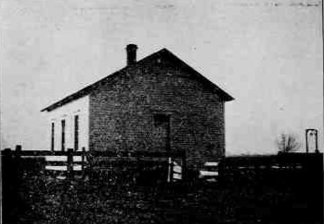
The Gurney School - Date Unknown.
The Gurney School was built in 1883 and had a large yard in which many trees should be planted. The school enrolled about fifteen students at the time of this picture.

Compiled by Dr. Neil Gale, Ph.D.

Lost Towns of Illinois - Griffin, Illinois.

Griffin was a former settlement in Wabash Township, Clark County, Illinois, and was located along a railroad line, starting at Marshall   Northeast to Dennison, Illinois; a seven-mile total trip. 


Compiled by Dr. Neil Gale, Ph.D.

Wednesday, September 7, 2022

Lost Towns of Illinois - Fremont, Illinois.

Fremont is a ghost town that was located in St. Rose Township, Clinton County, Illinois. It was eight miles north of Breese.


Compiled by Dr. Neil Gale, Ph.D.

Tuesday, September 6, 2022

Lost Towns of Illinois - Crawfordsville, Illinois.

Crawfordsville was situated on the line between Montgomery and Honey Creek Townships. 


The first record found of this place was when Edward Allison built a water mill in about 1830. Allison sold to a man named Kiger, who in turn sold to H. Martin, a son of John Martin, who came to the county in 1811. 

He built an ox mill and, later, a steam mill. H. Martin kept a blacksmith shop until about 1855. Elijah Nuttalls established a general store and several others had stores during different time periods. 

It was known as Martin's mill during this time, but when a post office was established, it was called Crawfordsville. Samson Taylor was the first postmaster. The post office was moved to Flat Rock when that town was laid out after the railroad came through. A woolen mill was connected with the steam mill about 1870 and operated until 1879 when it permanently closed.

Compiled by Dr. Neil Gale, Ph.D.

Lost Towns of Illinois - Clifford, Illinois.

Clifford was an unincorporated community in northwestern Williamson County, about one mile north of the village of Colp. It is an early 20th-century mining settlement that has disappeared since the closing of local mines in 1923.

A post office was established on January 26, 1905, and it remained in operation until May 1935. Clifford had a large school at its peak around the time of WWI (1914-1918). The population reached over two thousand at one time.

The population in 1958 was 300. The remaining residents moved their houses or sold the structures. Nature took over.

Compiled by Dr. Neil Gale, Ph.D.