Showing posts with label Environmental. Show all posts

Saturday, April 15, 2023

Illinois' Moniker: The Sucker State.

You probably recognize Illinois’ state nickname as "The Prairie State," which dates back to the 1840s. On the other hand, "Land of Lincoln" was made the official state slogan of Illinois in 1955. In fact, Illinois' exclusive use of the Land of Lincoln insignia was later authorized by a special U.S. copyright. 
The name and image of Illinois' most famous adopted son have become synonymous with the state and are on Illinois license plates and 'Welcome to Illinois' highway signs.
Most people don't realize that Illinois had a less noble sobriquet for much of the 19th century, "The Sucker State." And although there is no doubt that this nickname was associated with Illinois, the origin of the term is subject to debate. There are at least three interpretations.

One explanation involves a practice that was fairly common among travelers and inhabitants of the prairie. When water was needed, long, hollow reeds were thrust down into crawfish holes, and the water was literally sucked up, as through a straw. Such watering holes were called "suckers" in the local vernacular.

Another explanation derives from the fact that the central and southern portions of Illinois were originally settled by pioneers from Kentucky, Virginia and Tennessee, all tobacco-growing states. The sprouts around the main stem of a tobacco plant are commonly referred to as "suckers." These sprouts are cut off and discarded before they sap the vital circulating fluid of the plant, taking the nutrients away from tobacco plants 20 to 30 useable leaves. Most settlers of the area were poor and, in fact, had moved to Illinois in hopes of a better life. Society at that time, as throughout most of our nation's history, tended to look down on poor migrants as a burden. It was expected that these particular settlers would fail in their new venture and perish, like the tobacco sprouts that were cast off as undesirable. They were derisively called "suckers," and the term came to refer to the entire region of Southern Illinois, which at the time held most of the state's population.

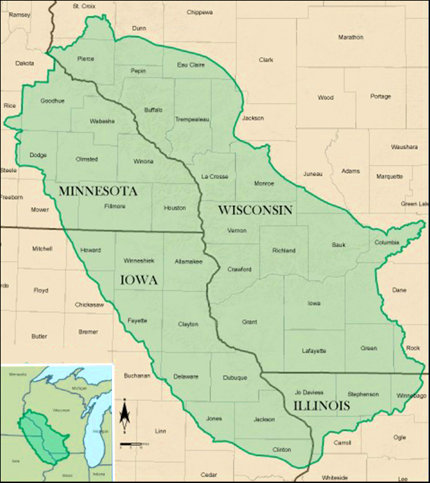
Probably the most popular explanation of how Illinois came to be known as the Sucker State involves the state's first lead mine, which was opened in 1824 near Galena. As word of the mine spread, thousands of men descended on Galena in search of work. Most came from Missouri and southern Illinois, traveling north on steamboats up the Mississippi River to Galena in the spring, where they would work until autumn and then return home. These travels corresponded to the migration pattern of a fish called a “sucker,” and the name was attributed to these workers by Missourians as a witticism. With six to seven thousand men coming to the Galena mines each year by 1827, the mass influx and exodus generated considerable strains and rivalries. In retaliation for the derisive term “suckers,” Illinoisans started calling Missourians “pukes,” a reference to the way in which Missouri had vomited forth to Galena the worst of her residents.

sidebar
The white sucker is a species of freshwater cypriniform fish inhabiting the upper Midwest and Northeast in North America. It's also found as far south as Georgia and as far west as New Mexico. The fish is commonly known as a "sucker" due to its fleshy, papillose lips that suck up organic matter and aufwuchs (plants and animals adhering to parts of rooted aquatic plants) from the bottom of rivers and streams. Other common names for the white sucker include bay fish, brook sucker, common sucker, and mullet. 
The White Sucker

Over Illinois’ 205-year history, the state’s residents have been called other names. The Land of Lincoln, as well as The Prairie State, are considerable improvements.

Compiled by Dr. Neil Gale, Ph.D.

Friday, March 3, 2023

Griggsville, Illinois, "The Purple Martin Capital of the Nation."

Due to the town's location between the Mississippi and Illinois Rivers in southern Illinois, Griggsville has a severe mosquito problem. 
A Male Purple Martin is dark and glossy blue. Females are brown in color.
In 1962, local businessman and nature enthusiast J.L. Wade encouraged the city to build birdhouses for purple martins, renowned for consuming more than 2,000 mosquitos daily, making them "America's Most Wanted Bird." 


Over the years, Griggsville built more than 5,000 birdhouses, which led to the town's nickname, "The Purple Martin Capital of the Nation."
The Purple Martin Highrise of Griggsville, Illinois.


Compiled by Dr. Neil Gale, Ph.D.

Tuesday, December 6, 2022

Nikola Tesla's "Egg of Columbus" at the 1893 Chicago World's Columbian Exposition.

Nikola Tesla (1856-1943) was a Serbian-American engineer and physicist who made dozens and dozens of breakthroughs in the production, transmission and application of electric power.

Tesla Electric Light and Manufacturing Company was in Rahway, New Jersey, that operated from December 1884 through 1886. Tesla is forced out of the Tesla Electric Light Company with nothing but worthless stock.
Nikola Tesla (1856-1943)


He endured a brutal winter of 1886/87 working as a ditch digger. He persevered, determined to develop his concept of generating electricity through rotating magnetic fields. However, Tesla knew that he must find a way to help investors and supporters understand the potential of his invention.

The rotating magnetic field is one of Tesla's most far-reaching and revolutionary discoveries. This is a new and wonderful manifestation of force — a magnetic cyclone — producing striking phenomena that amazed the world when he first showed them. It results from the joint action of two or more alternating currents definitely related to one another and creating magnetic fluxes, which, by their periodic rise and fall according to a mathematical law, cause a continuous shifting of the lines of force.

sidebar
Tesla invented the first alternating current (A/C) 'motor' and developed A/C electric  generation and transmission technology.

There is a vast difference between an ordinary electromagnet and the one invented by Tesla. In standard electromagnets, the lines are stationary, and in Tesla's invention, the lines are made to whirl around at a furious rate. The first attracts a piece of iron and holds it fast; the second causes it to spin in any direction and speed desired. 

Long ago, when Tesla was still a student, he conceived the idea of the rotating magnetic field. This remarkable principle is embodied in his famous induction motor and power transmission system, now universally used.
Tesla's exhibit at Chicago's 1893 World Columbian Exposition.


Tesla devises a machine to illustrate the concept: an electromagnetic motor that generates the force needed to spin a brass egg and stand it upright on its end.
Nikola Tesla's "Egg of Columbus" was exhibited
at Chicago's 1893 World Columbian Exposition.
Tesla named the device the "Egg of Columbus" after the famous story in which Christopher Columbus challenged the Spanish court and investors to stand an egg upright. When they failed, Columbus took an egg and crushed the bottom flat so it would remain upright. They accused him of playing a cheap trick. Still, Columbus overcame their objections by explaining that an idea can seem impossible until a clever solution is found, at which point it suddenly becomes easy.
How The "Egg of Columbus" Works.
Canadian Tesla Technical Museum.
Tesla Projects Laboratory Inc.
 
Tesla incorporates this logic in his Egg of Columbus to present his concept of alternating current A/C electricity to investors. It is a stroke of brilliance that results in funding from investors Alfred S. Brown, director of Western Union, and Charles F. Peck, a big-shot attorney from New York City. 

sidebar
Tesla’s first laboratory opened in April 1887 and was located at 89 Liberty Street in New York’s Lower Manhattan Financial District. This is where Tesla began planning and developing his designs for the A/C induction motor.

Tesla wrote in his autobiography of this time in his life when he went from ditch digger to laboratory owner, where he finally built the first models of his induction motor concept: "Then followed a period of struggle in the new medium for which I was not fitted, but the reward came in the end, and in April 1887, the Tesla Electric Company was organized, providing a laboratory and facilities. The motors I built there were exactly as I had imagined them. I made no attempt to improve the design but merely reproduced the pictures as they appeared to my vision, and the operation was always as I expected."
Nikola Tesla (year unknown).


sidebar
In 1893, three years prior to the earliest attempts in Hertz wave telegraphy, Tesla first described his wireless system and took out patents on a number of novel devices which were then but imperfectly understood. Even the electrical world at large laughed at these patents. But large wireless interests had to pay him tribute in the form of real money, because his "fool" patents were recognized to be fundamental. He actually antedated every important wireless invention.

Nikola Tesla lived a century behind his time. He had often been denounced as a dreamer even by well-informed men. He has been called crazy by others who ought to have known better. Tesla talked in a language that most of us still do not understand. But as the years roll on, Science appreciates his greatness, and Tesla receives more tributes.
"Today, Nikola Tesla is considered to be the greatest inventor of all time. Tesla has more original inventions to his credit than any other man in history. He is considered greater than Archimedes, Faraday, or Edison. His basic, as well as revolutionary, discoveries for sheer audacity, have no equal in the annals of the world. His master mind is easily one of the seven wonders of the intellectual world."                                                                                        ─ Hugo Gernsback
sidebar
There are a lot of assumptions made reguarding Tesla's private life. One of the few 
things that we know for sure is that Tesla never married. Tesla's seemingly indifference  in women {friends, like a sister}, made him the perfect target for whispers and gossip that he was homosexual, but, of course, there's no evidence. (Karl-Maria Kertbeny coined the term 'homosexual' in print 1868.) 

Tesla, unbeknownst to him, was the cynosure of all the lady's eyes. Despite being surrounded by beautiful, intelligent, women of substance, many who grew to love Nikola, yet nobody became Mrs. Nikola Telsa.

The issue wasn't the failure to meet his expectations. Instead, it turns out to be Tesla's 'no distractions' attitude allowing him to focus his energy on inventing (solutions to a problem), improvements, and , most importantly, the documentation.
 
"I don't think that you can name many great inventions that have been made by a married man." ─ Nikola Tesla.

Compiled by Dr. Neil Gale, Ph.D.

Saturday, October 8, 2022

The History of the 1925 Tri-State Tornado.

On March 18, 1925, a dark “smokey fog” touched down approximately three miles northwest of Ellington, Missouri, and it would become known as the Tri-State Tornado. By all accounts, the Tri-State Tornado was one for the record books.


The Tri-State Tornado is the U.S. record holder for the longest tornado track (219 miles), most deaths in a single tornado (695), and most injuries in a single tornado (2027). While it occurred before modern record keeping, it is considered by all accounts to be an F5/EF5 Tornado. It crossed the three states, thus its namesake “Tri-State,” tearing through thirteen counties of Missouri, Illinois, and Indiana. It crossed over and destroyed or significantly damaged nine towns and numerous smaller villages.

The resulting map perhaps shows why this tornado was so deadly. First off was the speed of the tornado. The average speed across its life span was an astonishing 62 miles per hour, with forward speeds, at times, reaching 73 mph. Also worth noting is that the tornado followed a slight topographical ridge with a series of mining towns perfectly aligned on the path.

Crossing the Mississippi river, the tornado struck the town of Gorham, Il. Gorham was a town of about 500 people; of those 500, 37 were killed and 250 injured. One notable effect in Gorham was the grass being torn from the ground in a gully on the east of town. The next town was Murphysboro. Eugene Porter reported the tornado to be “about a mile wide.” The town of Murphysboro suffered heavy losses, with 234 casualties reported along with 623 injuries. About 100 square blocks of the town were destroyed along, with another 70 by a fire after the tornado.

Perhaps the most spectacular show of power came from the next town in line, DeSoto, Il. Trees were snapped off at knee height, and stumps were ripped from the ground. No structure was left standing in the tornado’s path. Of the 69 people killed in DeSoto, 33 were killed in a school.
A child and puppy atop the wreckage of a home in Murphysboro, Ill., after the tri-state tornado ripped through town March 18, 1925.


Next up, West Frankfort was a mining town, and most men worked in the mines. The miners went to the surface to see the problem when the electricity went out. The miners came to the surface of a destroyed landscape. Most of the 148 deaths and 400 injuries in West Frankfort were women and children, given the men were in the mine.

A man in Parrish, Illinois, survived the tornado by clinging to a railroad track while the town was destroyed. 46 people died, and at least 100 were injured here. Between Gorham and Parrish, 541 lives were taken.

The tornado continued northeast, and most farms and an occasional schoolhouse or general store were destroyed over the next hour.

The total time on the ground of the Tri-State tornado was 3 hours and 30 minutes. During that time, it traveled 219 miles and killed 695 people, most of them in Illinois.

Compiled by Dr. Neil Gale, Ph.D

Tuesday, August 23, 2022

Rudimentary Road Construction History in Early Chicago and Eastern United States.

prelude
To the pioneers moving west from the east coast towards the Mississippi River, a road was any kind of a worn track or path leading to a designated point. Some paths were well defined by animal migration.  

Don't miss my in-depth study of pre-paved Chicago: Plank Road History in the Chicago Area.
A TRAIL THROUGH THE PRAIRIE

The Romans claimed to be the first to construct a cobblestone road which appeared on Rome's unparalleled network of about 75,000 miles worth of roads beginning in the Third Century (201-300AD).

Note: The curbs double as a pedestrian walkway. Spain.


The Roman roads were notable for their straightness, solid foundations, cambered surfaces (slightly arched to facilitate drainage), and the use of a form of concrete made from pozzolana (volcanic ash) and lime to set the stones.

The term "Cobblestone" (River Rock in North America) was derived from the ancient English word "cob," which had a wide range of meanings, one of which was "rounded lump" with overtones of a larger size. "Cobble," which appeared in the 15th Century, simply added the diminutive suffix "le" to "cob" and meant a small stone (usually ten inches or less) rounded by the natural flow of river water. 
We know Cobbles as River Rocks in North America.


Cobbles were set in sand or mortar, a method of paving streets common from the 15th into the 18th Century, when hamlets and villages wanted to improve dirt road travel. These routes made travel more reliable and less weather dependent, and they also do not get muddy or rutted by rain like dirt roads do.

sidebar
In 1846, the City of London in the United Kingdom decided to replace its wood paving blocks with granite. Upon removing the old wooden blocks people were allowed to take the wood, most using it for heating by fireplace.  In the 1850s practically all of the carriageways had been paved with granite setts from Scotland. However, the streets were often muddy in wet weather and full of dust in the summer. ‘Scavengers’ were employed to clean the streets and cart away the mud and manure.

How the City of Chicago dealt with 1,660 tons of daily horse manure.

Flat stones have a narrow edge on pitched road surfaces. A thousand years passed before setts bricks were produced and used to construct roads. Setts consist of granite mined locally from [Illinois] quarries and shaped into rectangular or square bricks called Belgian Blocks, aka Chicago Street Paver Bricks.

sidebar
People often confuse Belgian block with cobblestone or call both by the same name. Nobody seems to confuse them with antique brick streets that were popular at the same time. Cobbles are very different from Belgian Blocks, and the difference is plain to see if you know what to look for. Belgian Blocks are rectangular or square, whereas cobbles are roundish and typically have smooth edges.

In contrast, Belgian blocks were quarried (limestone) and carry the shape and tool markings that come with the stone cutting process. The rougher texture may have given them a rough and noisy ride on carriages and today’s automobiles. Still, that rough texture and angular shape were imperative to creating a good solid foundation for the horse-drawn carts of those days.

There is also "Belgian Woodblock" (aka Nicolson pavement), which Chicago started using by 1853. The Belgian woodblock paving method was preferred because it was so cheap, but was unsuitable unless pitched and sanded over.

In the alley behind the Archbishop of Chicago's Mansion (built 1885) at 1555 North State Parkway before the replacement pictured below. Estimated at over 100 years old. Note how tree trunks were cut at 3 foot in length, laid out and burried 2¾ feet deep before pouring the fill and packing it down.
You can find this recently replaced Belgian Wood Block alley behind the Archbishop of Chicago's Mansion. The alley runs east-west.
Public cobblestone roads are maintained in many historic towns and districts in the country's eastern half. They are also used for new public and private decorative construction purposes, such as Koi ponds and water features.
Wisconsin River Rock Veneer.


Compiled by Dr. Neil Gale, Ph.D.

Friday, July 22, 2022

Chicago's Urban Renewal into the 1960s.

Following World War II and continuing into the late 1960s, "urban renewal" referred primarily to public efforts to revitalize aging and decaying inner cities, although some suburban communities undertook such projects as well. Including massive demolition, slum clearance, and rehabilitation, urban renewal proceeded initially from local and state legislation, which in Illinois included the Neighborhood Redevelopment Corporation Act of 1941 (amended in 1953), the Blighted Areas Redevelopment Act of 1947 (which allowed for clearing land for non-residential uses, including highways), the Relocation Act of 1947, and the Urban Community Conservation Act of 1953. 

The earliest emphasis was placed on slum clearance or "redevelopment," followed by a focused effort to conserve 'threatened' but not yet deteriorated neighborhoods. Significant clearing of homes would occur with the 1955 Amendment to the Blighted Areas Redevelopment Act of 1947. It allowed for clearing land for non-residential uses, including highways.

The new legislation had three primary functions. First, it expanded the city's power of eminent domain and enabled it to seize property for the new "public purposes" of slum clearance or prevention. Second, it pioneered the "write-down" formula, which permitted the city to convey such property to private developers at its significantly reduced "use" value after the municipality subsidized its purchase and preparation. Last, the state provided assistance in relocating site residents—an absolute necessity in a time of severe housing shortages to enable the clearance of crowded, inner-city sites. The federal Housing Acts of 1949 and 1954, and their later amendments, mirrored the Illinois initiatives, providing a national framework and greater financial resources for the renewal effort. The clear intent was to offer public assistance to the private sector in the hope of heading off an urban crisis.

As early as 1943, a Chicago Plan Commission survey had found 242,000 substandard housing units within a 23-square-mile zone of "blight," with the most desperate conditions extending in a sweeping arc south and west of the Loop. Another 100,000 such units were scattered across Chicago in "non-blighted" areas. Such conditions, combined with the decentralizing pull of the burgeoning suburbs, threatened to ravage the city's tax base, deplete the stock of middle-class consumers, and raise the cost of basic city services such as police and firefighting. Worried about rising taxes, declining property values, and their traditional source of shoppers and workers, Loop interests such as Marshall Field & Co. and the Chicago Title and Trust Company moved swiftly to design plans to enhance downtown. Within weeks of his 1947 inauguration, Mayor Martin H. Kennelly received a housing program and legislative package that had gestated (develop over a long period) in Loop boardrooms.

Major institutional interests on the South Side, such as the Illinois Institute of Technology (IIT) and Michael Reese Hospital, also faced the daunting prospect of surviving within rapidly deteriorating neighborhoods. Even before World War II, they had recommitted themselves to the area, and, in 1946, they joined other local interests to create the South Side Planning Board (SSPB). Staking out a planning interest of seven square miles from Cermak Road south to 47th Street and from Michigan Avenue west to the Pennsylvania Railroad, their efforts—along with those of their Loop counterparts—enticed the New York Life Insurance Company to finance the Lake Meadows development. Michael Reese Hospital soon followed with its own Prairie Shores complex; IIT expanded its campus from 7 to 110 acres; Mercy Hospital decided to remain and grow in the area; and South Commons was developed as a middle-income housing enclave.
The population of Washington Park peaked at around 56,000 in 1950. There were significant overcrowding issues, but without other affordable housing options available because of racist policies and practices, many Negro residents on the South Side were forced into unsafe, egregiously overcrowded housing spaces.
The University of Chicago took the initiative in the urban renewal of Hyde Park, as it did with the conception and enactment of the Illinois Urban Community Conservation Act of 1953, a law precisely tailored to the institution's needs. Proceeding in stages throughout the 1950s under earlier redevelopment acts and through the South East Chicago Commission (SECC), the university responded forcefully to a racial transition accelerated by clearance projects to its north. The city approved a general renewal plan for Hyde Park– Kenwood in 1958 after the SECC had removed the worst pockets of "blight" and prevented precipitous "white flight." By 1970, the university and various public agencies had invested some $100 million in the area—an amount augmented by an additional $300 million in private funds.
The Urban Renewal program in Hyde Park displaces businesses and residents.


The largest renewal site north of the Loop provided space for Carl Sandburg Village between Division Street and North Avenue and, roughly, Clark and LaSalle. Most of the displaced residents were unmarried white renters without deep roots in the neighborhood. Demolition proceeded in 1960–61, with Arthur Rubloff & Co. beginning construction the next year. At its completion in 1969, the combination of high-rise towers and townhouses encompassed 3,166 units. At the same time, on the Near West Side, Mayor Richard J. Daley tried to protect the Loop, fight decentralization, and enhance Chicago's image by building a campus of the University of Illinois in the Harrison-Halsted area. Sparking considerable grassroots protest, the project displaced thousands of individuals and hundreds of businesses in an old, largely Italian community before it opened in 1965.

Concern with protecting and enhancing Chicago's core also generated a construction boom within the Loop itself. Beginning with the opening of the Prudential building in 1957, a 20-year burst of activity nearly doubled downtown office space; the federal government, Cook County, and the city of Chicago each added massive administrative centers.

The neighborhoods, however, experienced a different kind of transformation. While whites were among those uprooted in Hyde Park and on the North and West Sides, urban renewal in this context too often meant, as contemporaries noted, "Negro removal." Between 1948 and 1963 alone, some 50,000 families (averaging 3.3 members) and 18,000 individuals were displaced. Old neighborhoods disappeared, and new ones faced increasing racial pressures. Although some urban renewal sites were redeveloped for institutional expansion or middle-class housing, displaced African Americans received little benefit from the program. The city tried to contain the expansion of Blacks' living space, in part, by using densely packed, centrally located high-rise public housing. Segregation became public policy, as the courts acknowledged in deciding the 1966 suit brought by Chicago Housing Authority (CHA) resident Dorothy Gautreaux. In 1969, federal district court Judge Richard Austin found that 99 percent of the residents of CHA family housing were Black and that 99.5 percent of such units were confined to Black or racially changing areas. Rather than solve the urban crisis, urban renewal had set the stage for its next phase.

By Arnold R. Hirsch
Edited by Dr. Neil Gale, Ph.D.

Sunday, April 24, 2022

Melvin Price Locks and Dam & National Great Rivers Museum, Alton, Illinois.

The National Great Rivers Museum is located adjacent to the Melvin Price Locks and Dam on the Illinois side of the Mississippi River in Alton, Illinois.


MELVIN PRICE LOCKS AND DAM
Melvin Price Locks and Dam is a dam and two locks at river mile 200.78 on the Upper Mississippi River, about 17 miles north of Saint Louis, Missouri. The collocated National Great Rivers Museum, at 1 Lock and Dam Way in East Alton, Illinois, explains the structure and its engineering.


Melvin Price Locks and Dam replaced Lock and Dam 26, which opened in 1938, and was demolished in 1990. Almost from the beginning, Lock and Dam 26 was plagued with structural deficiencies. 
The Lock and Dam 26, 1938-1990


Scour holes developed below the dam. This was of particular concern because some of the holes were deeper than the wooden pilings supporting the dam. The scouring of the riverbed led to the disintegration of the concrete and a loss of foundation material, which eventually resulted in excessive deflections and settlement of the lock walls and dam piers.


The construction of the Melvin Price Locks and Dam constituted the first replacement of an original installation of the 9-Foot Channel Project. The new structure is located two miles downstream of the razed Lock and Dam 26, but the significance of the new installation is not limited to its colossal size. Throughout its design and construction, the Corps engaged in an extensive program of computer-assisted design, testing, and evaluation to create a structure that represents the state of the art in river navigation control works.

The Melvin Price Locks and Dam helps to control the flow of the Mississippi and is the means by which barges are able to navigate the river.


The main lock is 1,200 feet long and 110 feet wide; the auxiliary lock is 600 feet long and 110 feet wide. The main lock has a vertical lift gate and a miter gate while the auxiliary lock has two miter gates. The dam is 1,160 feet long with 9 tainter gates, each 110 feet wide by 42 feet high.

It is named after Illinois Congressman (Charles) Melvin Price (1905-1988) who served as:
  • Member of the St. Clair County, Illinois Board of Supervisors (1929–1931) at 24 years of age.
  • Member of the U.S. House of Representatives from Illinois's 22nd district (1945-1949).
  • Member of the U.S. House of Representatives from Illinois's 25th district (1949-1953).
  • — Chairman of the Ethics Committee (1967–76).
  • Member of the U.S. House of Representatives from Illinois's 24th district (1953-1973).
  • Member of the U.S. House of Representatives from Illinois's 23rd district (19731983).
  • — Chairman of the Joint Committee on Atomic Energy (1973–74).
  • — Chairman of the House Committee on Armed Services (1975-1985).
  • Member of the U.S. House of Representatives from Illinois's 21st district (1983-1988) totaling 59 years of service.
Congressman Price is probably most famous for his role in enacting the Price-Anderson Nuclear Industries Indemnity Act. He died in 1988 of pancreatic cancer. Price is the namesake of the Melvin Price Locks and Dam, in East Alton on the Upper Mississippi River, and the Melvin Price Federal Building and United States Courthouse in East St. Louis.

NATIONAL GREAT RIVERS MUSEUM
National Great Rivers Museum, Alton, Illinois. The large gift shop is in the background.


The National Great Rivers Museum, opened in October of 2003, is one of eleven planned regional visitor centers operated by the U. S. Army Corps of Engineers. Located adjacent to the Melvin Price Locks and Dam, this 12,000-square-foot facility is the result of a collaboration between the Corps and the nonprofit Meeting of the Great Rivers Foundation and tells the story of the Mississippi River. The Museum features state-of-the-art interactive displays and exhibits that help visitors understand the many aspects of the Mississippi River and how it affects our lives.

Compiled by Dr. Neil Gale, Ph.D.

Saturday, April 23, 2022

An Extensive History of Jerseyville, Illinois.

In 1827, James Faulkner, a Pennsylvania native, and his family built a small-framed structure named the "Little Red House" in the area now Jerseyville. The Little Red House served as the first stagecoach stop, first tavern, first school, and first bank in the immediate area. 

The Hickory Grove settlement was near a timbered point on the Macoupin prairie, Greene County, twelve miles south of Carrollton and on the road to Alton, Illinois. Situated upon a broad, rolling prairie, rich in everything that tends to make a country desirable, it certainly merits the highest encomiums (praises someone or something highly) that can be lavished upon it. The townsite is such that drainage is easily obtained – by no means a small desideratum (something that is needed or wanted) – and is well protected by timber from the cold winds which usually sweep across the face of our prairies. About four miles to the west, there was an abundance of timber, chiefly oak, also oaks to the north and northeast.

By 1834, the small settlement that grew up around Faulkner's house in Hickory Grove was surveyed and platted by two immigrants from New Jersey, John Lott and Edward M. Daly. 

Lott and Daly's involvement marked the beginning of a proportionally large number of merchants, businessmen, and settlers from New Jersey. That same year, a meeting was called at the Little Red House to vote for a town name, so a post office could be established. The name of Jerseyville was chosen to honor the native state of many of its inhabitants.

In 1839, Jersey County was formed out of Greene County, and Jerseyville was named its county seat. After the Civil War (1861-1865) ended and the Alton & Chicago Railroad construction was completed, Jerseyville saw a period of commercial, industrial and urban growth.
Downtown Jerseyville, Ill. 1910
East Side State Street, Looking North, Jerseyville, Ill.


The Streets are broad and pleasant for the most part. Upon either side of the street are magnificent shade trees, which, during the summer season, gave the city almost the appearance of another Arcadia, Illinois. Many of the residences' yards are filled with choice and beautiful flowers, which added to the verdure (the fresh green color of vegetation) of the trees and shrubs, form a tout ensemble extremely gratifying to the eyes of the beholder.
The Jersey Theater
Jacoby Bros., Jerseyville, Ill., Circa 1910.


The business portion of town, and, in fact, the entire town proper, is situated one half a mile from the railway – just far enough away to be freed from the smoke and noise of passing trains and yet near enough to meet all the requirements of businesses. Instead of being clustered around the courthouse, the business houses are chiefly upon two streets, one running north and south, the other east and west. This arrangement allows more extended space for the growth of business interests than when clustered upon the four sides of a square. Already the spirit of improvement is manifesting itself in various ways and, in a few short years, will make a most radical change in this respect.
Villinger Building, Jerseyville, Ill., Circa 1900s.


Jerseyville Business Directory, Jersey County Democrat, February 1, 1865.
A. Hollenback, butcher.
A. Jett and Son, grocery (saloon/tavern/pub).
A. Jett, auctioneer.
A. K. Van Horne, physician and surgeon.
A. P. Ferguson, boot and shoe store.
A. Recappe, harness and saddlery.
Andrew Jackson, county clerk.
Barnes, physician, and surgeon.
Benjamin Wedding, government collector.
Black & Wood, dealer in stoves, kitchen furniture, etc.
Buffington & Bro., druggists, dealers in stationery, etc.
C. H. Bowman, sheriff.
C. M. Hamilton, groceries, produce, pork, etc.
C. M. Knapp, merchant.
C. R. Hardin, boot and shoe maker.
Casey & Coe, physicians, and surgeons.
Charles Shroeder, harness maker.
Chas. Lipscomb, gunsmith.
Cross & Swallow, bankers.
Daniel McFain, dealer in groceries, produce, pork, etc.
David T. Bonnell, banker and merchant.
Derbys & Houston, dealers hardware, agricultural implements.
E. C. Calm, merchant.
F. Bertman, merchant.
F. Osburn, wool carding machine.
F. S. Hanghawout, editor "Jerseyville Register."
Farley, physician, and surgeon.
Fields, H D R K, freight agent.
Flamm & Hund, restaurant.
Ford & Bro., house and sign painters.
George Bickelhaupt, baker and confectioner.
George Burris, barber and hairdresser.
George Eglehoff, carriage & wagon maker.
George H. Hodgkens, Merchant's Union Express Co. agent.
George H. Jackson, notary public and real estate agent.
George I. Foster, county surveyor.
George Parent, painter.
George S. Miles, dentist.
George W. Ware, druggist, stationery, bookstore, notions, etc.
Goodrich, Nevius & Co., millers, and flour merchants.
H. A. Whiting & Co., dealers in produce.
H. Calkins, dentist
H. N. Wyckoff & Co., merchants.
Harvy Yeaman, dealer in furnishing goods.
Henry A. Brandt, dealer in tobacco and cigars.
Henry F. Bayer, barber and hairdresser.
Henry Schefler(?), boot and shoemaker.
Herdman & Bro., merchants.
Hewitt & Drotsch, house and sign painters.
J. C. Strong, photographer and artist.
J. E. Sanford(?), butcher and dealer in pork(?).
J. E. Van Pelt, grain dealer and commission merchant.
J. Geo Swartz, livery stable.
J. H. Ames, dealer in tinware and hardware.
J. H. Buffington, postmaster.
J. Halstead & Co., dealers in tobacco, cigars, and fancy notions.
J. K. & J. N. Beardslee, stationers, dealers in notions, etc.
J. L. White, physician and surgeon.
J. O. Hamilton, physician, surgeon, dealer in drugs, stationery.
J. P. Bell, carriage maker.
J. S. Daniels, deputy sheriff, and town collector.
Jacob Gammindinger, wagon maker.
James McClure, blacksmith.
James McGannon, blacksmith.
James McKinney, deputy sheriff.
James Nelson, boot and shoemaker.
James O'Halloran, groceries, produce, pork, etc.
Jefferson King, blacksmith.
John C. Darby, dealer in groceries, produce, pork, etc.
John C. Tack, dealer in ready-made clothing.
John F. Smith, county assessor.
John Flamm, a notary public.
John Laufketter, tobacconist.
John McFain, U.S. Express Co. agent.
King & Pinero, attorneys at law.
Krumpanitzky & Son, dealers in groceries, produce, pork, etc.
L. H. Robbins, physician and surgeon.
L. Johnson, coroner.
L. Johnson, livery stable.
L. Thurston, harness and saddlery.
L. Williams, milkman.
Larkin Bethell, R.R. baggage master.
Lewis Grosjean, boot and shoemaker.
Lewis Turner, miller and grain dealer.
Luther Chaffee, telegraph operator.
Lyon & DuHadway, physicians and surgeons.
M. B. Miner, government assessor and attorney at law.
M. E. Bagley, circuit clerk, master in chancery.
M. S. Parker, "Jersey House" landlord.
M. Walker, produce dealer.
Mrs. Ford, a dressmaker.
Mrs. Frost, boarding house.
Mrs. Jennings, millinery.
Mrs. McGill & Co., milliners.
Mrs. S. Van Pelt, milliner.
N. Grosjean, barber and hair dresser.
Newton Cory, manufacturers of agricultural implements.
O. A. Tiff, blacksmith.
P. Conway, dealer in groceries, produce, pork, etc.
P. H. Ryan, dealer in fancy notions, tobacco, and cigars.
P. L. Hargiss, harness maker.
P. S. Nevius, wagon maker.
Pat Dunphrey, dealer in groceries, produce, pork, etc.
Paul Lareashe, jeweler.
Pierce & Wilson, restaurant.
R. M. Knapp, attorney at law.
R. M. McClure, blacksmith.
R. P. Elliot & Co., dress furnishing house.
S. M. Shayer (Shaver?), artist.
S. M. Titus, auctioneer.
S. W. Davis & O. M. Paris, grain.
Shephard & Co., bankers.
Steiner & Cockrell, grain merchants.
Swan & Rockwell, dealers in furniture, house furnishing goods.
T. J. Selby, editor "Jersey County Democrat."
Thomas Ford, boarding house.
Thomas J. Houston, auctioneer.
Three Entries are Unreadable: a butcher, a grocer, and notions.
Tomas May, blacksmith.
V. Villinger, watchmaker and jeweler.
Vandervort & Beardslee, merchants.
W. H. Anderson, dealer in lumber near the depot.
W. H. Fields, barber and hairdresser.
W. W. Bollinger, watchmaker and jeweler.
Waldron & Williams, marble works.
Wallace Leigh, baker and confectioner.
Warren & Pogue, attorneys at law.
Wiley & Ten Eick, hardware, queens ware, house furnishing.
William E. Pitt, news dealer, stationery, books, etc.
William Hesser, physician and surgeon.
William Pilger, harness maker.
William Shroeder, merchant.
Wm. Embly, architect and builder.
Wm. Keith, cabinet maker and dealer in furniture.
Wm. Shephard, merchant.
Wm. Taylor Dapper, [no information given]
The first significant period of growth in the city occurred from 1880 to 1916, and from that time to the present, Jerseyville's development has been steady and substantial. Most commercial structures in the Downtown Historic District and Courthouse Square were built during the late 19th and early 20th centuries. 

It was also during this time that the present Jersey County Courthouse was built. The two-story, 124-foot-tall Romanesque Revival building was completed in 1893 and is considered one of the most aesthetic courthouses in the area. Other nearby Victorian-style buildings in the city include Queen Anne, Edwardian, and Italianate architectural features, with several recently renovated buildings.

From 1912 to 1918, Jerseyville was the terminus of an interurban electric passenger railroad from Alton that was a project by the Alton, Jacksonville, and Peoria Railway for a line to Peoria.
Col. William H. Fulkerson Farmstead, Jerseyville, Ill.
In recent decades, Jerseyville has been a testing ground in agricultural biotechnology. Bayer (formerly Monsanto) owns and operates a facility located just south of the city. In 1987, was the site of the world's first biotechnology field trial – first with tomatoes and later that year with soybeans. The facility was also home to the first triple-stacked corn trial in 1998, which later became a part of one of Monsanto's top-selling products. The facility was further expanded in 2008 and now consists of sixteen greenhouses and almost 300 acres of land for field testing.

The Downtown Historic District is home to some antique stores, gift shops, clothing and shoe stores, a pharmacy, a public library, a post office, and several local restaurants and banks. Most of the growth that has occurred since the early 1990s has been in the southern and southwestern portions of the city, where new residential subdivisions and retail shopping centers have been built, and numerous land annexations have been made by the city.
The Cheney Mansion in 1900.


Cheney Mansion is located in Jerseyville, IL. Dating back to 1827, the Cheney mansion, a 12-room house, has plenty of history. The center part of the Mansion was the first structure built in Jerseyville and was called the "Little Red House," it was a stagecoach stop that ran through this part of the country. The basement had a false cistern (an underground reservoir for rainwater) where Slaves were hidden. It served as a "station" for the Underground Railroad.
In 1839, Dr. Edward D'Arcy converted the Little Red House into a private house. He later gave the place to his daughter, Prentiss Dana Cheney, and her husband. They were the first of three generations of Cheneys to live here. Over the years, the family expanded and improved the house, which became the Cheney Mansion.


In 1998 the Cheney Mansion and grounds were donated to the Jersey County Historical Society, and it became our permanent location. Since then, the Society has added a museum, genealogy lab, and other buildings donated to the Society consisting of a one-room country school and an old country church. We also have three log cabins replicating the three cabins that made up Hickory Grove.

Compiled by Dr. Neil Gale, Ph.D.

Tuesday, March 8, 2022

Illinois' Driftless Region Explained.

The driftless region or zone consists of the extreme northwestern corner of Illinois, southwestern Wisconsin, southeastern Minnesota, and northeastern Iowa. Illinois' driftless region borders are not well defined. Generally, they contain all of Jo Daviess and Stephenson Counties and the western portions of Carroll County near the Mississippi River.
The Upper Mississippi Region, about 15,000 square miles, was miraculously left untouched by glacial erosion and sediments during the last ice age.


Galena, Illinois, is a perfect example of a driftless region. "Driftless" refers to the geological history of the area; its ground hasn't been eroded by glaciers in the Pleistocene (last) Ice Age, nor does it have rocks or sediments (termed drift) transported by the moving glaciers. 


The driftless region is characterized by steep hills, forested ridges, deeply carved river valleys, Karst[1] geology with spring-fed waterfalls, and cold-water trout streams.
The Illinois Counties in the Driftless region.


As in Wisconsin, the Illinois portion of the driftless area became a significant center for Lead and Zinc Mining in the 1800s. The city of Galena was named after the lead sulfide mineral Galena.

In Soldiers Grove, Wisconsin, the Driftless Brewing Company took advantage of the fresh, naturally filtered water. The great-tasting spring water is crucial to brewing their beer brands, and they chose to pay homage to the driftless area they occupy.

Compiled by Dr. Neil Gale, Ph.D.


[1] Karst
is an area of land made up of limestone. 

Limestone, aka chalk or calcium carbonate, is a soft rock that dissolves in water. As rainwater seeps into the rock, it slowly erodes. 
Driftless area in southwest Wisconsin.


Karst landscapes can be worn away from the top or dissolved from a weak point inside the rock. Karst vistas feature caves, underground streams, and sinkholes on the surface. Where erosion has worn away the land above ground, steep rocky cliffs are visible.

                   ██  Karst Landscapes in Illinois.