Showing posts with label Forts - Posts - Camps. Show all posts

Saturday, October 31, 2020

Fort Lincoln near Fulton, Kansas. (1861-1865)

The original Fort Lincoln was established by Kansas Senator and Militia General, James H. Lane was named for President Abraham Lincoln. It was used primarily to house Confederate prisoners. Fort Lincoln was located at the confluence of Fish Creek and Little Osage rivers on the north side of the Little Osage River just a mile east of the present-day town of Fulton, Kansas. 
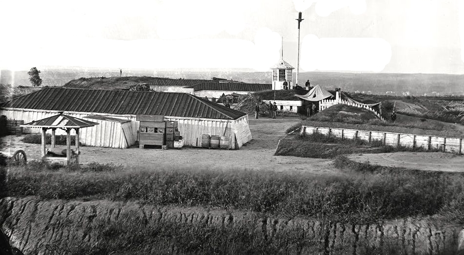
Fort Lincoln, Kansas.
The fort consisted of a number of buildings surrounded by a 5-foot-high earthwork embankment. It was primarily used to house Confederate prisoners, it also served as part of a border defense system of Fort Scott during the Civil War, protecting Kansas residents against attacks from Confederate forces. 

Lane was criticized for choosing such a low spot to build Fort Lincoln because it was difficult to see enemy troops coming and the area was prone to flooding during periods of heavy rains.

After the Battle of Dry Wood Creek (aka the Battle of the Mules) was fought on September 2, 1861, in Vernon County, Missouri, Lane believed that the Confederates would attack Fort Scott the next day. He ordered the town of Fulton evacuated and the citizens and troops to take refuge at Fort Lincoln. However, the attack never happened and the citizens soon returned to their homes. The town of Fort Lincoln was established by Lane outside Fort Lincoln in 1861.
Fort Scott was established in 1842 as a part of a group of frontier forts charged with keeping the peace between American Indians and white settlers. Since Fort Scott lies close to the border between Kansas and Missouri it remained a combat zone through the Civil War. Soldiers were repeatedly sent to Fort Scott to help restore order, but the violence escalated after the soldiers left. Fort Scott became a major supply depot and housed a general hospital during the Civil War, which made it a target for Confederate troops. Confederate General Sterling Price tried to take Fort Scott twice but failed on both attempts. The military made its last appearance at Fort Scott during the building of the railways in Kansas. Some opposed the building of the railroad, and soldiers were often dispatched to prevent any disruptions.
Once the threat to Fort Scott disappeared in September 1861, Lane took most of his troops from Fort Lincoln, leaving about 300 infantry and cavalry troops. In 1862, Lane's force was disbanded and the post was occupied by black Union soldiers, who guarded the post as a prisoner of war camp. Many Confederates were incarcerated there. In April 1863 the black troops were replaced by white troops. Between May and August 1863 the military abandoned the use of Fort Lincoln.

After its abandonment, George Walrod moved his family inside the fort. Walrod garrisoned the post as a one-man operation. Walrod died in October 1863 and in the winter a militia was formed in the area. 

Sometime in 1864 a large log blockhouse was removed from Fort Lincoln and was relocated to the town of Fort Scott. This blockhouse was placed at the intersection of Lowman and First streets. Probably a stockade, possibly also removed from Fort Lincoln, was erected around the blockhouse. This structure was moved to help guard the town and military post of Fort Scott and was under its jurisdiction. Fort Scott helped guard the area, along with Forts Blair, Henning, and Insley when Major General Sterling Price's forces skirted town in October 1864 during the Confederate retreat during Price's Missouri Raid. The militia probably made use of Fort Lincoln until its destruction by retreating Confederates under Price on October 25, 1864.

The Fort Lincoln blockhouse was torn down after Fort Scott's post was deactivated in 1865, as it was no longer needed when the threat of war had passed. It was never rebuilt and the town of Fort Lincoln eventually disappeared.


Compiled by Neil Gale, Ph.D.

Friday, October 30, 2020

Lincoln Forced to Walk Home from Wisconsin when his Horse was Stolen.

Lincoln's brief, but memorable, relationship with Wisconsin began in the summer of 1832, in a company of Army regulars and Illinois militiamen commanded by Gen. Henry Atkinson. The troops had been sent in early spring to reduce the threat of an India n war in the Illinois and Michigan Territories (Wisconsin then was a part of the Michigan Territory), and were pursuing the rebellious Chief Black Hawk—then in his early 60s—and his courageous band of Sauk and Fox. The federal government had moved the Sauk and Fox from Illinois to Iowa, but in the spring of 1832, Black Hawk led his band back across the Mississippi River to attempt to regain their croplands near Rock Island, Ill. His people were hungry, and he claimed the chiefs had been given mind-numbing firewater before agreeing to turn over to the U.S. all of their lands east of the Mississippi.

At the time, the lanky Lincoln was just 23 years old. Back home he had tested his luck as a shopkeeper's assistant, but the store failed. And he was waging a losing race for the Illinois legislature. Perhaps that was why the promise of $125 ($3,250 today) and 165 acres of land for a short tour of duty with the militia seemed appealing.

Here, he was part of a throng of soldiers, about four times the number of Black Hawk's 1,000 Indians, 500 of the warriors, relentlessly on their trail. The defeat of these Native Americans would signal the opening of this wilderness area to white settlement.

Lincoln saw no combat, but he and his fellow soldiers soon became weary as they struggled through the heat, rain, mosquitoes, and never-ending discomfort of what was then the wilds of what would be northern Illinois and southern Wisconsin—always seeing the outnumbered Indians slip away as troops closed in.
Lincoln's speech; Comment about being in the Black Hawk War.
The friends of General Lewis Cass, when that gentleman was a candidate for the presidency, (In the 1848 presidential campaign, Lewis Cass was the Democratic nominee but was defeated by the Whig candidate, Zachary Taylor.) endeavored to endow Lincoln with a military reputation. 
Mr. Lincoln, at that time a representative in Congress (1847-1849), delivered a speech before the House, which, in its allusions to General Cass, was exquisitely sarcastic and irresistibly humorous:

"By the way, Mr. Speaker," said Mr. Lincoln, "do you know I am a military hero? Yes, sir, in the days of the Black Hawk War, I fought, bled, and came away. Speaking of General Cass's career reminds me of my own. I was not at Stillman's Defeat, but I was about as near it as Cass to Hull's surrender, and like him, I saw the place very soon afterward. It is quite certain I did not break my sword, for I had none to break; but I bent my musket pretty badly on one occasion. If General Cass went in advance of me in picking whortleberries, I guess I surpassed him in charges upon the wild onions. If he saw any live, fighting Indians, it was more than I did, but I had a good many bloody struggles with the mosquitoes; and although I never fainted from loss of blood, I can truly say I was often very hungry."

Mr. Lincoln concluded by saying if he ever turned democrat and should run for the Presidency, he hoped they would not make fun of him by attempting to make him a military hero! 
As his stint of several months came to an end, he received his discharge. Official word came July 10, 1832, while he was camped with 3,000 soldiers in a place now called Burnt Village Park, near Cold Spring, midway between Jefferson and Whitewater.
Captain Abraham Lincoln
As many as 1,000 men got their orders at the same time. That's why it was no surprise that Lincoln's horse was stolen that night. But the iron-willed young man was not deterred and would walk and canoe his way back to his home in little New Salem, Illinois, where the next year he would become its postmaster.

The trek would be a long one—250 miles.

Two and a half decades later, in 1859, Lincoln would pass this way again, on a speaking tour that reached Beloit and Janesville. Remarkably, the next year he would be elected to the White House, the 16th president of the United States.

NEWSPAPER ARTICLE
February 12, 1934: Horse Stolen, Lincoln Forced to Walk Home from Wisconsin.

At Baraboo lives Franklin Johnson, one of very few living Wisconsin citizens who ever saw and heard Abraham Lincoln.

Around this time of year, many Lincoln stories pop up. In many cases, the folks who tell about having seen Lincoln probably are mistaken, as reliable sources seem agreed that the great emancipator visitor [visited] Wisconsin only three times, one of these being his participation in the Black Hawk War which brought him into the Madison area.

He was mustered out on the shores of Lake Koshkonong, and before he could start back for his home in [New Salem] Illinois, his horse was stolen and he had to walk back.

He visited Beloit and Janesville once, stayed overnight in Janesville, it is said. At another time, the year before he was elected president, he was the speaker at Wisconsin's state fair in Milwaukee.

In July of 1832, 23-year old Abe Lincoln's horse was stolen in Wisconsin so he walked and canoed 250 miles back to New Salem, Illinois. The historical marker is located at Cold Spring Creamery Park, Fort Atkinson, Wisconsin.
Compiled by Dr.  Neil Gale, Ph.D.

Tuesday, October 27, 2020

The History of Fort Abraham Lincoln near Mandan, North Dakota (1872-1891).

Constructed in June 1872 by Companies B and C of the 6th U.S. Infantry to protect the construction of the Northern Pacific Railroad. The initial post was located on a high bluff overlooking the confluence of the Missouri River and the Heart River and was known as Fort McKeen. Fort McKeen, named for Colonel H. Boyd McKeen, who was a Pennsylvanian officer and brigade commander killed at the Battle of Cold Harbor during the Civil War, was built as an infantry post with three blockhouses and a partial palisade, unsuited for cavalry operations. It was soon realized that the mission required mounted cavalry and that the new post was unsuited for those troops. 
A second post, Fort Abraham Lincoln, was constructed just south of Fort McKeen. The new post was begun in late 1872 as a six-company cavalry post and on March 3, 1873, Fort Abraham Lincoln was authorized by act of Congress. The newly created fort encompassed both the infantry post and the cavalry post.

Fort Abraham Lincoln was built to protect the Northern Pacific Railroad[1] and to contain the local Indian tribes, including the Sioux. A post office also operated at the fort.
Fort Abraham Lincoln Cavalry Post Blockhouse.
The first commander of the combined post was Lieutenant Colonel (brevetted Major General[2]) George Armstrong Custer. Custer had fought in the Civil War in the 1860s and had been given the temporary rank of “General” at that time. The commander’s house at Fort Abraham Lincoln was very large and fancy. It had a bathroom, expensive carpets, drapes, and fine furniture.
Fort Abraham Lincoln Cavalry Post Custer House.
Fort Abraham Lincoln Cavalry Post Custer House Interior.
By 1874 the fort housed nine companies with about 650 men, three companies of the 6th Infantry, and 17th Infantry, and six companies of the 7th Cavalry. The fort was among the largest and most important on the Northern Plains.
Hunting camp party of Custer (standing in center) and guests at Fort Abraham Lincoln on the Heart River, Dakota. Territory, 1875. Note Custer's fringed leather coat.
The Lakota were made up of several bands that were related to the Dakota nation. In 1876, Lakota leaders Sitting Bull, Crazy Horse, Rain-in-the-Face, and Gall led a large band of Lakota to Montana to hunt bison and celebrate a summer feast. The U.S. government ordered the Indians to return to their reservations, but they ignored this order. The Lakota were angry about treaties being broken and their lands being taken over by settlers and gold seekers. The Indians were forced to live on reservations. Provisions promised to them were often not available.
Fort Abraham Lincoln, Dakota Territory, 7th Cavalry Band.
The Army ordered troops to Montana to move the Lakota back to their reservations. On May 17, 1876, Custer and his troops prepared to leave Fort Lincoln. Giovanni Martino (John Martin), Custer’s Bugler, details the brigade’s make-up and disposition. "The troops for this expedition consisted of twelve troops of the Seventh Cavalry, four companies of infantry, ten of fifteen Indian scouts, and twenty-five or thirty civilians. We took the field at 6:30 AM 'Boots and Saddles' was sounded, and at 7 AM, stand, horse, and mount was called. Then we passed in review and bade farewell to our friends and though the band was playing "The Girl I Left Behind Me," it seemed like a funeral procession.
American Marching Song:
"The Girl I Left Behind Me."

Then they started off for Montana. Libby Custer and other officers’ wives rode with the troops part of the first day. Then they stopped to say their goodbyes. Later they played Custer’s favorite tune, “Garyowen” [Garry Owen].” 

"Garyowen" - Song of the 7th Cavalry

Martin continues, “After leaving the post, the march was taken up in columns of fours, route step, General Terry and staff in the front, followed by General Custer and staff (Mrs. Custer rode on the left of the General). That day we made Little Heart River and camped for the night. After pitching camp assembly was sounded (I was a bugler) and we fell in for payment. It was a pretty sober crowd, everybody felt the position we were in. Some made deposits for their money, and I, for one, put $50 with the Paymaster. The next morning general call was sounded at 6:30, boots and saddles at 7, and we took up the march again. The paymaster went back to Fort Abraham Lincoln.”
Group portrait of officers in uniform, from the 7th Cavalry and 6th Infantry, and ladies, standing and seated in front of building at Fort Abraham Lincoln, North Dakota, circa 1874. Lt. Colonel Custer is the third person from the left.

Identified persons by number are: 1) Lt. Bronson, 6th Infantry; 2) Lt. George D. Wallace, 7th Cavalry; 3) General George Armstrong Custer, 7th Cavalry; 4) Lt. Benjamin H. Hodgson, 7th Cavalry; 5) Mrs. Elizabeth B. Custer (wife of General Custer); 6) Mrs. Thomas McDougall, 7th Cavalry; 7) Capt. Thomas; McDougall, 7th Cavalry;  8) Capt. Badger, 6th Infantry; 9) Mrs. George W. Yates; 10) Capt. George W. Yates, 7th Cavalry; 11) Charles Thompson (civilian clothing); 12) Mrs. James Calhoun, wife of Lt. Calhoun (and sister of General Custer); 13) Miss  Annie Bates; 14) Col. Poland, 6th Infantry; 15) Lt. Charles A. Varnum, 7th  Cavalry; 16) General Carlin, 6th Infantry; 17) Mrs. Myles Moylan; 18) Capt. Thomas W. Custer, 7th Cavalry; 19) Col. William Thompson; 20) Lt. James.
The Indian tribes had come together at the Little Bighorn River at the behest of Chief Sitting Bull to discuss what to do about the white man.

Scouts who were sent ahead came back and reported to Custer that there were huge numbers of Indians camped beside the Little Bighorn River (the Lakotas called this river the Greasy Grass). Custer did not believe that there could be so many. He decided to go ahead and attack without waiting for the two other units.
Custer's command came upon this large encampment, he split his forces into three battalions and attacked. A series of missteps and an underestimation of Indian strength caused the initial attack by Major Marcus Reno to falter then fail. Thousands of Indians then attacked the remaining men who were forced to ground by the overwhelming force. Custer and all his men were killed in the final stand. Other units also failed to defeat the Lakotas and their Cheyenne Indian allies.

Wounded soldiers from the other units were quickly taken to the Yellowstone River where the steamboat "Far West" was waiting with supplies. The boat’s pilot, Captain Grant Marsh, steamed as fast as he could back to Bismarck. Ten days after the battle, the Far West reached Bismarck, and word quickly spread that over 250 men had lost their lives.

Though the Lakota had defeated the U.S. Army in battle, they knew more soldiers would come after them. They left the Greasy Grass River. Several bands traveled all the way to Canada where they were safe from the U.S. Army.

It seemed like everybody criticized Custer for being reckless and leading his troops to death. Libby Custer wanted people to believe that her husband was a brave hero. She spent the next 57 years, until her death at age 91, writing books, articles, and letters defending her husband’s memory.

Fort Abraham Lincoln remained the headquarters of the 7th Cavalry until June of 1882 when the 7th and its headquarters were transferred to Fort Meade in South Dakota. After the railroad to Montana was complete the fort gradually declined in importance and was finally abandoned in 1891.

After the fort was abandoned, settlers took apart the buildings and used the lumber to build houses and farm buildings. They also made good use of other items they found, like the fancy bathtubs in the officers’ quarters made good feeding troughs for the farmers’ pigs.

At its height, Fort Abraham Lincoln had 78 separate buildings. Many of those original buildings were dismantled by settlers and used in the construction of homes and farms. 

Today, several of the buildings at Fort Abraham Lincoln, including Custer’s house, have been reconstructed. The site is located in Fort Abraham Lincoln State Park near Mandan, North Dakota.


Compiled by Neil Gale, Ph.D. 


[1] The Northern Pacific Railway, founded in 1864, was a transcontinental railroad that operated across the northern tier of the western United States, from Minnesota to the Pacific Northwest.

[2] A brevet was a warrant giving a commissioned officer a higher rank title as a reward for gallantry or meritorious conduct but may not confer the authority, precedence, or pay of real rank. An officer so promoted was referred to as being brevetted.

Fort Lincoln in NE Washington DC and its Ring of Civil War Union Forts. (1861-1865)

Fort Lincoln was established to protect the B&O Railroad and the Baltimore Turnpike on the eastern edge of the District of Columbia in Colmar Manor, Maryland. Fort Lincoln was situated between Fort Thayer and Battery Jameson in the defensive ring around Washington D.C.[1]. 
Fort Lincoln Interior
A Union Civil War earthworks fort was established in 1861 in Northeast Washington D.C. and named after President Abraham Lincoln.

By 1865 the Defenses of Washington DC were said to include some 68 named fortifications, 93 detached batteries, 20 miles of rifle pits, blockhouses at three key points, and 32 miles of military roads. At the beginning of the civil war, there was only a single fort, Fort Washington, protecting the city.
Fort Lincoln Gun Emplacements 5 & 6. A 100-pounder Parrott Gun is on the right.
Fort Lincoln was a bastioned fort with four faces that mounted one 100 pounder Parrott and four 20 pounder Parrott guns as well as a number of other major pieces of artillery. 
Battery Jameson earthworks, Fort Lincoln.
Fort Lincoln HQ and Officers Quarters.
A May 17, 1864 report from the Union Inspector of Artillery noted the following:
"Fort Lincoln and Battery Jameson, Captain A.W. Bradbury commanding. Garrison, withdrawn; works guarded by First Maine Battery from Camp Barry, 1 ordnance-sergeant. Armament, eight 6-pounder field guns (bronze), four 12-pounder field guns, five 24-pounder barbettes, one 24-pounder siege, six 32-pounder sea-coast howitzers, two 24-pounder howitzers, two 8-inch howitzers, two Coehorn mortars, one 10-inch mortar, four 30-pounder Parrotts, one 100-pounder Parrott. Two magazines, dry and in good order, one magazine has never had a lock. Ammunition, full supply, and serviceable. Implements, complete, and serviceable."
Fort Lincoln was abandoned in 1865 at the end of the Civil War.

A brief summary of Washington D.C. during the Civil War.
When the Civil War began, newly elected President Abraham Lincoln was only 40 days into his term as President. After the Confederate firing on Fort Sumter and Lincoln’s call for 75,000 volunteers to quell the growing rebellion, Virginia seceded from the Union. Lincoln took great measures to ensure that Maryland, a slave state, did not secede from the Union lest Washington be surrounded by Confederate states. Lincoln imprisoned secessionists in Maryland to prevent Maryland’s secession, and Lincoln’s bold strategy worked.

Throughout the war, Washington saw an exponential increase in population, like its Confederate counterpart, Richmond, Virginia. At the start of the war, 75,080 people lived in Washington, but that number boomed to 200,000 at its peak. By 1862, Lincoln began enacting policies to increase the power of the Federal government in Washington such as military police, prohibition laws, and anti-vagrancy laws. With an expanding population, however, public health often took a back seat to dedicate resources to wounded Union soldiers arriving from the frontlines. The Federal capital saw waves of smallpox run through the city. Generals trained their armies and crafted strategy in and around Washington. Lincoln would often check in on the military to personally oversee the war effort.
Company E, 4th U.S. Colored Infantry, at Fort Lincoln, Washington DC. Nov. 1865
The well-defended city did not experience much combat. When General George B. McClellan took command of the principal Union Army of the Potomac, he built fortifications that stretched 33 miles. By the time McClellan was finished with constructing fortifications, Washington was one of the most fortified cities in the world. The city defenses were nearly impenetrable. Confederate forces did not want to attack Washington directly due to the mountainous defenses. The Confederates made false advances towards Washington to spook Lincoln the high command. One advance was Thomas J. “Stonewall” Jackson’s campaign in the Shenandoah Valley in Spring of 1862, forcing the Union to dedicate forces away from Richmond and towards the Shenandoah Valley. The Union was focused on keeping the war in the South, and the capital in Union hands. Confederates hardly ventured north of the Mason-Dixon Line. Among the few times that the South did venture north, was at Antietam, which was fought before mid-term elections in the Union, and Gettysburg, which was fought one year before Presidential elections.  In July of 1864, Lt. Gen. Jubal Early assaulted Fort Stevens, on the north side of Washington. During the battle, Lincoln came under enemy fire and was nearly shot. Jubal Early’s intent with this raid was not to capture and hold Washington, but to divert Union forces from Petersburg to relieve the Confederates from the siege at Petersburg.

While Washington was not much of a military battleground, it was a political battleground. Throughout the war, there was a massive debate about whether to free the enslaved population and perpetually grant enslaved people freedoms. So-called “radical” Republicans and Democrats faced off in the House and Senate chambers debating the soon to be freed people’s rightful freedoms. Lincoln’s original stated war aim was to preserve the Union. Lincoln explained to newspaper editor Horace Greely in August of 1862 that he wanted reunification no matter the cost and wanted to take caution in emancipating slaves in the country. His position on slavery dramatically changed, however, after the Battle of Antietam. Lincoln issued the preliminary Emancipation Proclamation just after the battle which would on January 1, 1863, effectively free all slaves in areas that were in rebellion, but not in the border states of Maryland, Delaware, and Kentucky. Congress passed the 13th Amendment to the Constitution, abolishing slavery in all states present and future in January of 1865, ending the institution of slavery that plagued the United States since its inception.

Towards the end of the war, the city’s water supply ran low due to massive overpopulation. The Army Corps of Engineers constructed an aqueduct to accommodate the city’s need for water. Washington’s police and fire departments were revitalized to provide efficient service to the newly settled residents in Washington. Washington was in the throes of becoming the modern city that L’Enfant and the Founding Fathers had hoped it would become.

At the end of the war, Washington was a sprawling city that became a major city on the eastern coast of the United States. With the 13th, 14th, and 15th Amendments passed and inscribed in the Constitution, formerly enslaved people were now free under the law.  Washington became a new hub for many of these formerly enslaved individuals, including Frederick Douglass. On April 14th, 1865, just mere days after the surrender of Robert E. Lee’s forces at Appomattox Court House, Virginia, 

Abraham Lincoln was shot in Ford’s Theater by the assassin John Wilkes Booth, a Confederate sympathizer. Lincoln died in the Peterson Boarding House in Washington the next morning. After Lincoln’s death. Andrew Johnson, a southern Democrat, assumed the Presidency. On May 23rd to 25th, 1865, Johnson organized a military precession throughout Washington called the Grand Review of the Armies. This celebration was the precursor to Memorial Day. In 1865, however, the Grand Review of the Armies signaled the end of the Civil War that had ravaged the country.


Compiled by Neil Gale, Ph.D.


[1] In the District of Columbia, the Union Army built the following forts in areas which had remained relatively rural on the limits of the city. Most of the land was privately owned and taken over by the military at the beginning of the Civil War. Most of these owners lost possession of their land for the duration of the war and were unable to receive income from it. Only a few received compensation or rent from the land during the war.
A ring of Union Civil War Forts scattered around the capital city's perimeter was erected early in the war to protect Washington, D.C. from the threat of Confederate assault. This ring included fortifications in Virginia and Maryland as well as Washington DC. By 1865 the Defenses of Washington DC were said to include some 68 named forts, 93 detached batteries, 20 miles of rifle pits, blockhouses at three key points, and 32 miles of military roads. At the beginning of the Civil War, there was only a single fort, Fort Washington, protecting the city.

These numbers are difficult to reconcile because of name changes, consolidations, and upgrading of batteries to named forts. There is also confusion about what fortifications are included especially the permanent fortifications and the outlying fortifications at Baileys Crossroads and Seven Corners. What can be said is that the city was ringed with connected fortifications and that the Virginia side defenses were especially dense with many fortifications within close range of each other. The 37-mile circle of fortifications had platforms for some 1,500 field and siege guns with some 807 guns and 98 mortars in place.

The forts in the District of Columbia were temporary structures. They were in most part built of earthen embankments, timber with limited masonry, and were surrounded by trenches and flanked with abatis. They were not designed to serve beyond the Civil War as the land was intended to be returned to their owner at that time.
Fort Lincoln and Associated Batteries including Battery Jameson.
The list below attempts to include all of the named fortifications that surrounded Washington DC during the U.S. Civil War. It does not include camps, barracks, unnamed batteries, and other administrative facilities. I've compiled a list of 93 fortifications and batteries.

Click the Latitude (North/South) and Longitude (East/West) coordinates to see the exact location on digital maps.

Northwest Quadrant
Battery Alexander (MD)
Battery Bailey (MD)  38.95261, -77.11028
Battery Benson (MD)
Battery Cameron (aka Battery Georgetown)  38°54′56.3″N 77°05′19.7″W 
Battery Gaines  38.93917, -77.08889
Battery Jameson (MD)  38.92796, -76.95219
Battery Kingsbury  38.96333, -77.04417
Battery Rossell  38.95457, -77.06956
Battery Sill  38.96111, -77.03833 
Battery Simmons  38.95182, -77.09927
Battery Smead  38.96139, -77.06056
Battery Terrill  38.95694, -77.06111
Fort Cross (MD)
Fort Davis (MD)  38.86639, -76.95056
Fort Gaines  38.93611, -77.0875
Fort Kearny  38.94833, -77.05833
Fort Kirby (MD)
Fort Mansfield (MD)  38.95297, -77.10164
Fort Reno (aka Fort Pennsylvania)   38°57′10.2″N 77°04′41.9″W
Fort Simmons (MD)  38.95209, -77.09834
Fort Stevens (aka Fort Massachusetts)  38°57′50.2″N 77°01′46″W
Fort Sumner (MD)  38.95669, -77.12247

Northeast Quadrant
Battery Mahan  N 38.89500 W 76.94444
Battery Morris  38.92889, -76.97694
Battery Totten  38.95070, -77.00552
Fort Lincoln  38° 55.687′ N 76° 57.151′ W - Fort Lincoln Cemetery
Fort Scaggs (Not Armed aka Fort Craven & Fort of Circular Form)  38.89112, -76.94855

Eastern Branch
Battery Carroll  38.83709, -77.00403
Fort Baker  38.86222, -76.96417
Fort Meigs  38.87351, -76.92941
Fort Ricketts (aka Battery Ricketts)  38°51′24.5″N 76°58′32.8″W
Fort Sedgwick (aka Kennedy's Hill Fort)  38.88417, -76.93639
Fort Snyder  38.84694, -76.9825
Fort Wagner (aka Fort Good Hope)  38.86, -76.96972

Potomac Approaches
Fort Washington, MD  38°42′39″N 77°01′59″W

Arlington Line – Virginia
Battery Bayard  38.84919, -77.09195
Battery Garesche  38.83843, -77.09698
Fort Albany  38.86509, -77.06569
Fort Barnard  38.84919, -77.09195
Fort Bennett  38.90025, -77.07863
Fort Berry  38.85559, -77.09161
Fort Buffalo  38.87201, -77.15587
Fort C.F. Smith  38.90083, -77.09056
Fort Cass  (later within Fort Myer)  38.88519, -77.08203
Fort Corcoran  38.89626, -77.07592
Fort Craig  38.87041, -77.08165
Fort Ellsworth  38.806, -77.06867
Fort Ethan Allen  38.92444, -77.12361
Fort Farnsworth  38.78861, -77.07361
Fort Haggerty  38.89611, -77.06863
Fort Jackson  38.87129, -77.04141
Fort Lyon  38.79389, -77.07778
Fort Mc Pherson  38.87273, -77.07381
Fort Morton  38.89192, -77.0871
Fort Munson  38.86026, -77.14507
Fort O'Rourke  38.78704, -77.07319
Fort Ramsay (aka Fort Upton)  38.87284, -77.14623
Fort Reynolds  38.83824, -77.09436
Fort Richardson  38.85773, -77.07783
Fort Runyon  38.86985, -77.04508
Fort Scott  38.8475, -77.05898
Fort Strong (formerly Fort DeKalb)  38.89694, -77.08806
Fort Taylor  38.87476, -77.15898
Fort Tillinghast  38.8785, -77.08383
Fort Ward  38.83026, -77.10264
Fort Weed  38.78929, -77.07832
Fort Whipple (later within Fort Myer)  38.88424, -77.07835
Fort Willard  38.78274, -77.06617
Fort Williams  38.8118, -77.09
Fort Woodbury  38.88966, -77.08281
Fort Worth  38.81472, -77.09889 

Fort Lincoln Historical Marker is in Fort Lincoln Cemetery in Colmar Manor, Maryland.
Inscription. These earthworks are a portion of the original fortifications which made up Fort Lincoln. This fort was built during the summer of 1861 to serve as an outer defense of the city of Washington. It was named in honor of President Lincoln by General Order No. 18, A.G.O., Sept. 30, 1861. The brigade of Major General Joseph Hooker was the first to occupy this area. In immediate command of the fort was Captain T.S. Paddock. The Civil War cannons have been placed here through the courtesy of the Department of Defense to commemorate this auspicious occasion.

Sunday, December 15, 2019

The Search for Fort Sturdivant.

In 1998, Ron Nelson and Gary DeNeal local historians in Hardin County, Illinois researched the former location of Sturdivant's Fort using surviving early 19th-century land ownership records. The former site of the Sturdivant Gang fort (aka Sturdivant's Castle) is now on private property where it is located in the undeveloped backyard lot of a residential house, just north of the present-day water tower in Rosiclare. Nelson and DeNeal got permission from the owner to investigate. 

To locate Sturdivant's Fort, we started with what was known. As late as 1876, the ruins of Sturdivant's Fort could still be seen. Dr. Daniel Lawrence of Golconda, Illinois a visitor to the historic site noted that all that existed of the once imposing fortress was a dilapidated blockhouse but what remained revealed it had formerly been a substantial log structure. Dr. Lawrence also discovered numerous bullet holes in the old logs. Eventually, the fort ruins were torn down. 

Early authors mentioned that it was somewhere on a high bluff overlooking the Ohio River near the present town of Rosiclare, Ill. One of the first sites we checked was Jack's Point, just south of the mouth of Big Creek. The name "Jack's Point" brought to mind the stories we had heard of "Bloody Jack" Sturdivant. Could this point be named for him? This site was rejected after abstracting deed records for the north shore of the Ohio River revealed Roswell Sturdivant's land. It was in Section 33, which placed it just north of Rosiclare. Jack's Point was in Section 27. The contract for deed states that this property, containing 95 acres on the bank of the Ohio River, was sold by Amos Chipps to Roswell Sturdivant for $2,000 on November 17, 1820.

The legal description was "beginning at the mouth of the spring branch on the Ohio River, then up the branch with a line run by Lemuel Harrison between William Jackson & John Morris to a hickory ash and hackberry marked T, thence south 55 west until it strikes the old section line, thence with the said line to the southwest corner of said fraction, thence east with the surveying line to the Ohio River, thence up the river with its meandering to the mouth of said spring branch, it being Range 8, Township 12 and Fractional Sections 33 and 34, containing the aforesaid 95 acres more or less."

The Sturdivant Fort was attacked three times (once in 1822 and twice in 1823) by officers of the law in an effort to clean out this nest of criminals.

After the attacks on Sturdivant's Fort, a deed was brought into the county courthouse on Sept. 13, 1824. One Samuel Omelvany claimed he had purchased this property from Roswell Sturdivant on Oct. 7, 1820, for $1,000. The deed was signed by Roswell Sturdevant and attested to by Merrick Sturdevant and James Steel. It seems from the dates on the deeds that Roswell Sturdivant sold this property to Samuel Omelvany before he ever owned it.

With the deed, we located the exact property of Roswell Sturdivant. Amos Chipps had sublet the contract for deed to Edmund Searcy on January 26, 1821, who paid Chipps $1,700 and was to collect the balance from Sturdivant when due. When the payment came due, Sturdivant refused to pay Searcy, claiming that Searcy could not produce the deed. Then Amos Chipps told Searcy that James Ford was holding a mortgage on the property and the deed. Ford was brought into court and forced to sign his interest over to Searcy for five shillings (about $7), Ford claiming he did not know the boundaries of Chipps' part of the property. Searcy won the case and Sturdivant evidently paid what he owed.

The abstracting of the property with the above deeds proves Sturdivant's property lies along the high bluff in Section 33 just north of the present Rosiclare water tower. This property is today owned by Mr. and Mrs. Wayne Fowler. The fort site encompasses their entire yard. Fortunately, when their home was built, it was built far enough away from the bluff that it did not destroy the fort site.

We visited the Rosiclare bluff several times during the month of March in 1998. We also studied old maps, aerial photographs, soil and water conservation maps, Ohio River U.S. Corps of Engineers maps, etc. On April 6th, we again visited the Rosiclare bluff. This time we went house to house, interviewing each homeowner. We finally came to the Fowler property. We were already convinced from the abstract that the fort had been on their property. Now we wanted to look for ourselves. What would be left after nearly 200 years?

The Fowlers graciously allowed us permission to view their property. The east side of the house, facing the river, immediately revealed irregular elevations in the soil, easily detected as the foundation of a large house. Around the house-site were long elevated mounds similar to what is found on Civil War battlefields. We walked around the yard, and with my dowsing rods, we were able to mark with red flags the perimeters and the layout of the fort. 

What was found was that the loghouse in the stockade of the fort was approximately 60 x 60 feet. In comparison, the Old Slave House in Gallatin County, Illinois, is 50 x 50 feet. There were six rooms, three on each side, separated by a 4-foot wide hallway running east and west. The front two rooms, facing the river, measured 20½ x 28 feet. The back four rooms were of equal size and measured 17 x 28 feet. There was an extension on the northwest corner of the house, 18 x18 feet. Extending from the corners of the log house were four corridors approximately leading to the corner blockhouses. There was a palisade surrounding the perimeter of the house. There was also an outer perimeter palisade encompassing the entire property. From documents, we know that the house was 1½ to 2 stories high."
We were standing on the very site of the counterfeiters' den. It was here that men lost their lives pursuing a life of crime. It was here that William Rondeau was almost killed. It was here that men of principle came head to head with the unscrupulous. Who really won?

The time period counterfeit laws:
During the territorial days and early statehood of Illinois, counterfeiters became a severe problem. It affected everyone from the settlers to merchants and bankers. It was theft by deception. Along with the hopeful settlers, there also came villains who used their God-given talents of engraving to make fraudulent or counterfeit money. The counterfeiters may have descended from old-world European families. Some of these master craftsmen produced works of art, engraving upon gold or silver, ornate knives, firearms, watches, silverware, etc. Engravers were highly sought after and very much in demand in the printing business. Almost every picture appearing in the old newspapers was the result of a master engraver's work. These plates were engraved in brass or copper, as photographs were unknown at this time. The engraver was paid a small sum for each piece. To some engravers, the temptation to duplicate banknotes or coin molds became too great, and they soon found themselves manufacturing bogus currency, which was sometimes better than the originals. In so doing, these artisans moved into the realm of the criminal
This is an early 19th-century horse-powered ferry boat on the Ohio River typically used by counterfeiters and river pirates.
One such artistic group of counterfeiters was the Sturdivant family, who were operating in Pope Co., Illinois, and who also had ties in St. Clair County along the Kaskaskia River. Some of this family had evidently served in the Revolutionary War, helping to establish our country's independence. Many of the Sturdivant family came from the northeast, Connecticut and Massachusetts. One group came from Virginia and settled in Tennessee. Roswell S. Sturdivant and his brother, Merrick Sturdivant, claimed they came from "Robinson" [Robertson] County, Tennessee, though no records could be found of their presence in this county. Roswell is listed on the census of St. Clair County, Illinois, in 1820. Other documents proving that both Roswell and Merrick were in Illinois by 1818, and were probably here a few years earlier. One source also lists a Stephen Sturdivant in connection with the counterfeiters.

It seems the Sturdivants were involved in counterfeiting long before they came to Illinois, however, this is not to say that all of the Ohio Sturdevant's were considered outlaws, for it was said of James B. Sturdevant that he was "a hard-working and honest man," who had cleared and worked his own farm, as did his brother, Chauncey H. Sturdevant.

There were at least two operations in the counterfeiting scam. The first was the actual engraving and printing of the notes, the second the "passing off" these notes, or as it was called "passing the queer." The counterfeiter would sometimes sell these bogus notes at a discount. Some sources stated that Sturdivant sold $100 counterfeit for $16 legal currency.

There were two groups of people living side by side along the Ohio River, one who had a work ethic and respect for morals, and the other who spent their time habitually living outside the law. Legislators soon realized the problem counterfeiting was causing and passed laws to try to discourage the practice and punish the violators. On January 11, 1816, the law in the Illinois Territory set the penalty for counterfeiting at "death by hanging, without the benefit of clergy." Other penalties listed in this law ranged from death to paying "a fine of fourfold the amount of such note or bill" or beating with "not less than thirty-nine lashes well laid to the bareback" for such things as manufacturing or bringing paper into the Illinois territory to be used for counterfeiting, making or concealing plates used for counterfeiting, and passing or assisting others in passing counterfeit notes.

In 1818, Illinois received statehood. At its first General Assembly held at Kaskaskia, on February 27, 1819, the penalty for counterfeiting was lessened to a $500 fine and 75 lashes. In addition, the convicted felon would "be deemed infamous, and beheld incapable of holding any office, or giving testimony in any case whatever." 

This same penalty went for anyone found manufacturing or bringing paper into the state for counterfeiting purposes and making the counterfeiting plates. However, for passing or assisting in the passing of bogus notes or concealing money molds carried a penalty of a $500 fine plus "thirty-nine lashes to the bareback." If this fine was not paid, the person was to be committed to jail until the next term of court. If the fine was still not paid, the Sheriff was to sell the offender to the highest bidder for a term of servitude of seven years. Should the person sold try to run away from his master, his term of servitude would be increased. In 1821, this law was strengthened to include counterfeiting gold or silver coins with the same punishment as above.

New settlers were arriving who were willing to enforce these new laws and would not ignore the crimes of the counterfeiters. One such man was young Shawneetown attorney, John McLean, who evidently was one of the first to go after the Sturdivant gang. 

There is no evidence that anyone paid the price for the crimes of the Sturdivant Gang.

Compiled by Neil Gale, Ph.D.


[1] The Sturdivant Gang was a three-generation family gang of counterfeiters, whose criminal activities took place over a fifty-year period, from the 1780s, in Connecticut and Massachusetts, with one branch of the family going to Tennessee via Virginia and a second family branch going to Ohio and finally settled on the Illinois frontier, between the 1810s to 1830s