
In historical writing and analysis, PRESENTISM introduces present-day ideas and perspectives into depictions or interpretations of the past. Presentism is a form of cultural bias that creates a distorted understanding of the subject matter. Reading modern notions of morality into the past is committing the error of presentism. Historical accounts are written by people and can be slanted, so I try my hardest to present fact-based and well-researched articles.
Facts don't require one's approval or acceptance.
I present [PG-13] articles without regard to race, color, political party, or religious beliefs, including Atheism, national origin, citizenship status, gender, LGBTQ+ status, disability, military status, or educational level. What I present are facts — NOT Alternative Facts — about the subject. You won't find articles or readers' comments that spread rumors, lies, hateful statements, and people instigating arguments or fights.
FOR HISTORICAL CLARITY
The State of Illinois derives its name from a historical group of Indians who called themselves "Illiniwek," a term that the French quickly changed into "Illinois." "When one speaks the word 'Illinois," the Jacques Marquette Journal reports, "it is as if one said in their language, 'the men,' As if the other savages were looked upon by them merely as animals." This idea of superiority over other tribal groups was a common belief among many Indian nations.
When I write about the INDIGENOUS PEOPLE, I follow this historical terminology:
- The use of old commonly used terms, disrespectful today, i.e., REDMAN or REDMEN, SAVAGES, and HALF-BREED are explained in this article.
Writing about AFRICAN-AMERICAN history, I follow these race terms:
- "NEGRO" was the term used until the mid-1960s.
- "BLACK" started being used in the mid-1960s.
- "AFRICAN-AMERICAN" [Afro-American] began usage in the late 1980s.
— PLEASE PRACTICE HISTORICISM —
THE INTERPRETATION OF THE PAST IN ITS OWN CONTEXT.
sidebar
The Illinois (aka Illiniwek or Illini) is pronounced as plural: (The Illinois') were a Confederacy of Indian tribes consisting of the Kaskaskia, Cahokia, Peoria, Tamarais (Tamaroa, Tamarois), Moingwena, Mitchagamie (Michigamea), Chepoussa, Chinkoa, Coiracoentanon, Espeminkia, Maroa, and Tapouara tribes that were of the Algonquin family. They spoke Iroquoian languages. The Illinois called themselves "Ireniouaki" (the French word was Ilinwe).
 |
| The Illinois "Illiniwek" Confederacy. |
René-Robert Cavelier, Sieur de La Salle (Sieur de La Salle is a title only: translating to "Lord of the manor."), an early explorer in the Illinois County, also mentions the Korakoenitanon, Chinko, Tapouro, Omouahoas, Chepoussa, and others as being Illini," but these latter groups have long been extinct, and little is known about them.
In 1721, Pierre Francois Xavier de Charlevoix, a French Jesuit and historian, learned from several sources that, according to tradition, the Illini had originally come from the "banks of a very distant sea to the westward." Other tribes, such as The Delaware, have legends about coming into their homelands from the west, but it is difficult to evaluate these traditions." There is, however, one mention of a group of Indians in the Delaware legend, which some scholars identify as possibly being the Illini in late prehistoric times. Nevertheless, the lands of the Illini in early historical times were bounded by the Wisconsin, Ohio, Wabash, and Mississippi Rivers. At times, they also lived in the present states of Iowa and Missouri.
sidebar
The word "Mississippi" comes from the Ojibwe Indian Tribe (Algonquian language family) word "Messipi" or "misi-ziibi," which means "Great River" or "Gathering of Waters." French explorers, hearing the Ojibwe word for the river, recorded it in their own language with a similar pronunciation. The Potawatomi (Algonquian language family) pronounced "Mississippi" as the French said it, "Sinnissippi," which was given the meaning "Rocky Waters."
 |
| Chief Chicagou |
There was a Michigamea chief named Chicagou, (aka Agapit Chicagou) in 1725, and in the 1680s, The Illinois River was called the Chicago. However, it is impossible to prove conclusively that the Michigamea once lived in the northern regions of Illinois.
In about the year 1639, the Winnebago betrayed and killed a group of Illini visitors. For revenge, the Illini delivered a telling coup against this tribe, which was certainly living in the Green Bay area. Reports of 1640 and 1642 place the Illini south of Lake Michigan and near the Sioux, with whom they had continual wars. Evidently, the main villages and hunting grounds of the Illini extended to or beyond the Mississippi River at this time.
 |
| Nicolas Perrot, Explorer, Fur Trader. |
At first, the defenders were able to defeat the Iroquois and drive them out of the Illinois County, but the stubborn Iroquois continued their attacks.
Although the Five Nations of the Iroquois seemed to have only about 2,000 warriors, they had conquered most of their eastern neighbors by 1656 and were looking for new enemies to fight. They then concentrated their efforts against The Illinois and other Western groups.
Jesuits were told again in 1657 or 1658 that The Illinois numbered 20,000 men and lived in sixty villages, a report which was certainly exaggerated, but at this time, they, no doubt, were a numerous nation although the French called several different groups "Ilinois." However, the Iroquois continued their raids against them and other groups near Lake Michigan; it was reported in 1659 or 1660 that Lake Superior was lined with Algonquin tribes who had fled there to escape from the Iroquois. Likewise, The Illinois retreated westward, probably across the Mississippi, where they seem to have lived for a number of years. The Huron of the Tobacco Nation, who had also run away from the Iroquois, were kindly received by The Illinois at this time. Perhaps The Illinois ventured east of the Mississippi River at certain times because the Iroquois, searching for the Meskwaki (Fox) about 1661, discovered the Illinois party and "killed a considerable number of them." This unfortunate group of The Illinois was certainly east of the Mississippi, but it seems that shortly after this date, they were forced to abandon their ancestral lands to the Iroquois beaver hunters. As The Illinois moved further into the territory of the Sioux, they made peace with them so that they might pass through their country and trade at Point Chagaouamigong or Saint-Esprit, near the western end of Lake Superior. As traders, The Illinois was quite well known, exchanging their Indian slaves with the Ottawa for muskets, powder, kettles, hatchets, and knives.
Jesuits were told again in 1657 or 1658 that The Illinois numbered 20,000 men and lived in sixty villages, a report which was certainly exaggerated, but at this time, they, no doubt, were a numerous nation although the French called several different groups "Ilinois." However, the Iroquois continued their raids against them and other groups near Lake Michigan; it was reported in 1659 or 1660 that Lake Superior was lined with Algonquin tribes who had fled there to escape from the Iroquois. Likewise, The Illinois retreated westward, probably across the Mississippi, where they seem to have lived for a number of years. The Huron of the Tobacco Nation, who had also run away from the Iroquois, were kindly received by The Illinois at this time. Perhaps The Illinois ventured east of the Mississippi River at certain times because the Iroquois, searching for the Meskwaki (Fox) about 1661, discovered the Illinois party and "killed a considerable number of them." This unfortunate group of The Illinois was certainly east of the Mississippi, but it seems that shortly after this date, they were forced to abandon their ancestral lands to the Iroquois beaver hunters. As The Illinois moved further into the territory of the Sioux, they made peace with them so that they might pass through their country and trade at Point Chagaouamigong or Saint-Esprit, near the western end of Lake Superior. As traders, The Illinois was quite well known, exchanging their Indian slaves with the Ottawa for muskets, powder, kettles, hatchets, and knives.
After The Illinois withdrew across the Mississippi, the Iroquois sought other nations to fight, and gradually The Illinois returned to their former country. Fifteen cabins went to the Green Bay region about the year 1666, established a village near the Fox, and cleared some land for their gardens. This particular group of The Illinois had probably lived west of the Mississippi in previous years. The Jesuits learned that The Illinois were greatly reduced in numbers from former times when they had had ten large villages; constant wars had "almost exterminated them." During the years 1669-1670, The Illinois also frequented Saint-Esprit, and the Jesuits learned that they had five large villages, "of which one has a stretch of three leagues, the cabins being placed length-wise." (The French league was equal to about two and one-half miles.) Their population was said to be nearly 2,000 men, women, and children, but their exact location during these years is unknown.
Marquette remarked that The Illinois were a thirty-day journey by land from Saint-Esprit in 1669-1670 and were gathered in two villages that contained 8,000 or 9,000 people. Since the missionaries had not contacted The Illinois in their own country, these early reports seldom agreed as to location, number of villages or population. At one time after the first Iroquois attacks, it was said that The Illinois were living at a spot seven days' journey west of the Mississippi, but by 1670, part of The Illinois were reported to be near the Mississippi, probably in Iowa. Another report (1670) placed The Illinois in eight villages which were located 100 leagues south of Saint-Esprit, and a Jesuit map was drawn at about the same time, evidently from information supplied by French traders, indicating that the center of The Illinois was at a Kaskaskia village near Starved Rock on The Illinois River.
 |
| Starved Rock, Utica, LaSalle County, Illinois. |
Our first long account of The Illinois is contained in what has come to be called the Marquette Journal of 1673. This document relates how Louis Jolliet, a French explorer and trader, and Father Jacques Marquette, a Jesuit missionary, embarked "with five men" on May 17 from the mission of St. Ignace at Michiljmackinac (Mackinac) in two bark canoes to explore the Mississippi River. They paddled from the Straits of Mackinac down to the head of Green Bay, proceeded up the Fox River to Lake Winnebago and from there entered the lower Fox River. Their route continued along this river to the portage that connects it with the Wisconsin River. On June 17, just one month after leaving Mackinac, the explorers entered the Mississippi and glided south with its gentle current. Nothing important seems to have happened until June 25, when they discovered an Indian path leading down to the shore. After following the tracks for about two leagues (6.9 miles), they came upon the Village of Peoria, which was located on the bank of a river, either the Des Moines or the Iowa River. Two other villages, one of which was occupied by Moingwena, were situated on a hill about half a league from The Peoria.

One anthropologist has recently declared that the Peoria were "on the west bank of the Mississippi near the mouth of the Missouri River" when Jolliet and Marquette discovered them in 1673. The basis for this revolutionary thesis is an interpretation of one sentence in the so-called Marquette journal, which seems to be vague. Since this question has been raised, it is necessary to delve into the origin of the Marquette Journal of 1673. No copy of the journal in Marquette's handwriting has ever been found, and Jolliefs original journal was lost in a canoe accident. Who then wrote the account of the expedition as we have it today? The late Dr. Jean Delanglez, who served in the Institute of Jesuit History at Loyola University, was perhaps the most learned scholar ever to study this problem. Delanglez declares that Father Claude Dablon (1619-1697), superior of the Jesuit missions in New France and editor of the Jesuit Relations, assembled a journal of the expedition from various sources at hand: interviews with members of the exploring party, Jolliefs map and his dedicatory letter to Louis Frontenac, and Marquette's map and notes. "There is no essential fact concerning the voyage of 1673 in the Receipts," Delanglez asserts, "that cannot be traced to these written or oral sources." Dablon had previous accounts of various Indian nations at his disposal, but he certainly found it very difficult to reconstruct the voyage of Jolliet and Marquette since he had never made this trip himself. This fact certainly accounts for the numerous errors and vague statements in the Marquette journal that we have today. Dablon, Delanglez points out, was "undoubtedly distracted" when he wrote the tangled paragraph concerning the Missouri River.
A study of the Marquette journal reveals that it is not a day-by-day account but rather a narrative of the voyage written after the event took place. At the beginning of the journal, there is a statement about Marquette's mission among The Illinois, but this mission was founded during Marquette's second expedition. The date of the departure from The Peoria is given in one place as June 26th and in another place as "at the end of June." The statements in the journal following the initial visit with the Peoria are very confused: first, the explorers are in the current of the Missouri River, then the account jumps back up the Mississippi River to the spot near Alton, Illinois, where the Piasa Bird was found.
 |
| Piasa Bird, Alton, Illinois - © Neil Gale |
 |
| Piasa Bird, Alton, Illinois - © Neil Gale |
Those who believe that the Peoria village was near the mouth of the Missouri River ignore the one contemporary source that is beyond question: Marquette's autograph map of the expedition's route. This document shows The Peoria and Moingwena to be located in a Des Moines river. The Missouri River is clearly marked and placed a great distance below this site, and there is no mention of any of the Illinois groups living there. Another Jesuit map describing explorations made in 1672 and 1673 also shows 300 Peoria cabins and a Moingwena village on either the Des Moines or Iowa rivers. Since the Peoria houses were constructed of mats, it is possible that this group of The Illinois was on a summer hunt in Iowa, a common practice among these Indians. This thesis seems to be corroborated by the fact that The Peoria is reputed to have fed Jolliet and Marquette fatty buffalo meat, signifying that it was not cured by sun, heat, or smoke. Rarely did any Indians hunt buffalo near their permanent villages, and if this had been a permanent village, the buffalo meat would certainly have been obtained on a distant hunt and thus have been cured meat. The permanent village of The Peoria at this time was probably on Lake Peoria in the Illinois County, where later explorers found them.
There is no mention in the Marquette journal of the explorers having seen either the Cahokia or Tamaroa along the banks of the Mississippi. Perhaps these groups were still on the west side of the Mississippi or away on their summer hunt. It was not until the expedition reached what is thought to be the St. Francis River in Arkansas that a Michigamea village was discovered. This tribe prepared to attack the explorers, but upon seeing the Calumet, it is said that they ceased their menacing threats and allowed Marquette and Jolliet to come ashore. Although the Michigamea did not speak the same language as the Peoria, "an old man" was found in the village "who could speak a little Illinois." According to the journal, The Arkansas informed the explorers that The Illinois village was just four days west of them. Perhaps this was a group of Cahokia or Tamaroa who had not as yet returned to the Illinois County after the Iroquois wars, which had thrown The Illinois into disorder and demoralized them.
 |
| Southern Illinois Kaskaskia Indian. |
Marquette's journal relates that after staying with The Arkansas for a while, the explorers decided to return instead of seeking the mouth of the Mississippi. July 17 is the date given for the start of the return trip, but there are some questions about the exactness of the dates in this journal. Although the account of the Jolliet-Marquette expedition down the Mississippi is vague and confusing, it can be followed much better than the brief report of their return. It seems that when they reached the mouth of The Illinois, Jolliet and Marquette turned into this river "which greatly shortens our road, and takes us with but little effort to the lake of The Illinois (Lake Michigan)." While paddling up THe Illinois River, presumably at a point between the present towns of Utica and Ottawa, they found a Kaskaskia village of seventy-four cabins. This certainly was the Great Village of the Kaskaskia or La Vantum, as the French called it in later years. Then, as an afterthought, the journal reports that the explorers "passed through Ilinois of Peouara on the return voyage," where they remained for three days. No exact location for this Peoria village is given; it could well have been on Lake Peoria, the home of this tribe in later years. Perhaps they were the same group of Peoria discovered by Jolliet and Marquette while descending the Mississippi. The time element would be approximately correct since The Illinois usually returned to their permanent villages from the summer hunt in time to harvest their corn in August or September. But Dablon's editing of the material is confusing, and locating those villages encountered on the return trip is impossible. If Dablon saw the Jesuit map, which depicts the explorations of the Jesuits in the years 1672 and 1673, and used it as part of his source material, it is perhaps possible to explain why he mentioned their second visit with the Peoria as a vague afterthought. This map indicates that Jolliet's expedition retraced its previous course on the Mississippi River until the explorers reached the Peoria village on the Des Moines or Iowa. From this point, the route suddenly moves overland across the prairie to the Kaskaskia village on The Illinois River. Dablon, it would seem, was confused about many points of this famous expedition.
The Illinois were probably returning to their Illinois County before the French made contact with them, but the presence of these Europeans seems to have given them the courage to face the Iroquois. In 1673-1674, the Jesuits related that their mission at Green Bay (St. Francis Xavier) had encouraged some groups of the Illini who were still living west of the Mississippi to return to their "former country, near the lake that bears their name."
After resting at Green Bay, Marquette set out again to visit The Illinois on October 25, 1674 and was accompanied by a party of Potawatomi and The Illinois, but in November, he was forced to make winter camp on the Chicago River, where he witnessed The Illinois going to trade their beaver skins at "Nawaskingwe" which has not been identified. The facts and details of this second expedition by Marquette are found in a journal that was undoubtedly written by Marquette himself. He explains that there were encampments of The Illinois, evidently winter hunting parties, six leagues from his hut, but the severe weather kept them from hunting, and they were starving. Here, Marquette met an Illinois Indian named Chachagwessiou, who was held in much esteem by his tribe because he was a great fur trader. Marquette also learned that The Illinois wished to obtain powder but refused to give them any since he feared they might start a war with the nearby Miami. As spring returned to the Illinois County, Marquette regained his strength and, on March 30, continued his journey to The Illinois' great village, which was on The Illinois River and probably near Starved Rock. He estimated that the Kaskaskia there numbered approximately 1,500 warriors, and from other French reports, it can be estimated that their strength was about 4,500 persons or 500 to 600 families. After establishing a mission called the Immaculate Conception among the Kaskaskia, Marquette left their village after Easter for the return trek to Mackinac, but he died along the eastern shore of Lake Michigan on May 19th.
Soon after the Illini returned to their lands in Illinois, they renewed their war with the Fox living near Green Bay. During the winter of 1675-76, they raided the Fox, killing some and carrying others off into slavery. Not until Father Claude Jean Allouez replaced Marquette at the mission among the Kaskaskia was there another reliable account of The Illinois. In October 1676, he left Green Bay and proceeded south along the western shore of Lake Michigan. When he reached the southern tip of this lake, he found eighty Illinois Indians encamped there, and the chief escorted Allouez to the great Kaskaskia village. On April 27, 1677, he reached his destination and discovered that the village contained 351 cabins, a great increase from the seventy-four cabins found there by Marquette in 1673. Then it had been occupied only by the Kaskaskia, but now it was the home of eight bands or groups of The Illinois who had formerly lived along the Mississippi but had been summoned to La Vantum by the Kaskaskia.
It seems probable that the Kaskaskia had asked the other Illinois groups to join them in order to withstand the threatened Iroquois attacks. In 1677, the Iroquois announced that they intended to make war upon The Illinois, and the following year, they sent war parties into the Illinois County but were beaten by The Illinois. The Iroquois, who had begun trapping in the Illinois County since the defeat of The Illinois, suddenly found that the previous occupants had returned and were killing their beaver hunters. Nearly forty Iroquois had been slain, and their deaths were used as an excuse for renewing the war against The Illinois. The English encouraged the Iroquois attacks, which they thought would force The Illinois to trade with them." Although their first attempts failed, the Iroquois continued to send war parties to harass The Illinois.
 |
| René-Robert Cavelier, Sieur de La Salle |
Since the party needed food, they took thirty minots (slightly more than one bushel) of the corn and continued their voyage down the Illinois River.
 |
| Henri de Tonti |
He warned the little garrison that the Iroquois would probably attack The Illinois during the winter and that the latter might flee at the first encounter. Evidently, La Salle realized that The Illinois were disorganized and demoralized as a result of the previous Iroquois raids.
On La Salle's trip back up the Illinois River, he passed the deserted village of the Kaskaskia but later saw two Illinois Indians and the principal chief, Chassagoac. The chief promised La Salle that he would send corn to the French at Fort Crevecoeur.
Before La Salle left Fort Crevecoeur, he had sent Hennepin, Michel Accault and "the Picard" to explore the Illinois River south of the Peoria village. They left on February 29 and met a returning party of The Illinois hunters who invited them to turn about, but the explorers paddled on toward the mouth of the river. Hennepin's party found a village of Tamaroa consisting of 200 families at a distance of two leagues from the mouth. They informed Hennepin that their main village, however, was west of the Mississippi and six or seven leagues below the mouth of the Illinois River." It would seem that the Tamaroa was just starting to reoccupy the Illinois County when Hennepin made contact with them. The Tamaroa was hiding not only from the Iroquois but also from the Sioux. After reaching the mouth of The Illinois River, the Hennepin party turned north and paddled up the Mississippi. On April 11, they met a war party of 120 Sioux who were traveling south in thirty-three bark canoes and searching for the Tamaroa and Miami. Thus, The Illinois was caught between two powerful enemies: the Iroquois and the Sioux. With two such resolute foes, the days of The Illinois were numbered.
While La Salle was returning up The Illinois River, he noted the natural fort that has come to be known as Starved Rock and informed Tonti, by messenger, that he should occupy this site in case of an attack. Tonti did move from Fort Crevecoeur to Starved Rock in April of 1680, but no fortifications were made there. The Illinois, La Salle said, had about 1,800 warriors and should have been able to defend themselves against the Iroquois, but their organization was growing weaker. The French themselves were one cause of this weakness, for they did not wish to see The Illinois become independent or establish peace with the Iroquois. La Salle remarked that if peace were established, The Illinois might make war against the Ottawa and interrupt the fur trade enjoyed by the French. For these reasons, the French were slow to furnish The Illinois with weapons and military support, although they furnished arms and ammunition to the Iroquois. The Miami had about 1,500 warriors who should have joined The Illinois in their fight against the Iroquois, but fear and jealousy separated the Illini and Miami. The subtle Iroquois, therefore, made peace with the Miami and marched to strike The Illinois in 1680. Only 500 or 600 Iroquois warriors and 100 Shawnee are said to have taken part in this raid, but The Illinois would not face the Iroquois in battle, although Tonti did his best to organize them for a defense of their village near Starved Rock. In September, the Iroquois arrived at the great village where about 7,000 or 8,000 Illinois Indians had been living, but the women and children had been sent six leagues farther down the Illinois River as soon as scouts reported that the Iroquois were coming. Tonti related that he had only 500 Illinois warriors with him when the Iroquois arrived.
Tonti approached the Iroquois party only to be stabbed and severely injured before he could make his peace proposals. Negotiations were carried on for several days, and meanwhile, The Illinois hurriedly constructed some fortifications, but on September 19, Tonti learned that the Iroquois were bent on destroying The Illinois. When they heard this, The Illinois fled south along The Illinois River to join their women, and Tonti moved north toward Green Bay. Upon learning that The Illinois had departed, the Iroquois gave vent to their rage by burning the village and desecrating the cemetery. Graves were dug up, the bones were strewed about, and the bodies, which The Illinois had placed on scaffolds in the trees, were pulled down. Even the fields of corn were destroyed.
After several days of pillage, the Iroquois broke camp and followed The Illinois down the river, not daring to attack because The Illinois had mustered all their forces as they retreated. However, although the Illinois Confederation was once again functioning, it lacked leadership and determination. On the retreat from Starved Rock toward Peoria, The Illinois made six encampments, and the Iroquois camped opposite these spots each time. These maneuvers continued until both parties reached the mouth of the Illinois River, where the Iroquois announced that they were now content, having driven The Illinois from their country once again, and promised to return home if The Illinois would disband and offer no more resistance. The Illinois were deceived by the wily Iroquois and separated, the Kaskaskia and Cahokia going up the Mississippi, the Peoria crossing the Mississippi, the Moingwena traveling down the Mississippi, and the credulous Tamaroa remaining to hunt in Illinois. Immediately the Iroquois fell upon the Tamaroa and slaughtered about 700 women and children, the fleet-footed warriors escaping with few losses. In this battle, the Tamaroa suffered a loss of about 1,200 persons killed or captured, while the Iroquois lost only thirty warriors. Many of the captive women and children were subjected to the most terrible tortures before being killed. Never again would The Illinois completely dominate the Illinois County. Some of The Illinois even fled north and lived with the Fox temporarily.
Most of The Illinois (whom Zenobe Membre - a recollect missionary - said consisted of seventeen villages) fled across the Mississippi and established themselves among the Osage who lived 200 leagues from the Illinois County. The Iroquois, after slaughtering the Tamaroa, decided to return home by way of the Ohio River and were already on their way when Paessa, chief of the Kaskaskia who had been away hunting, returned with 100 warriors to the site of the Tamaroa camp. Upon discovering the carnage, Paessa immediately followed the trail of the retreating Iroquois and, in February of 1681, came upon them in winter quarters somewhere in the Miami country, probably in southern Indiana. Although greatly outnumbered, the Kaskaskia charged the Iroquois camp three times but were beaten off each time. Paessa was killed, and the remaining Kaskaskia then proceeded toward Lake Erie to take revenge against some winter hunting parties of Iroquois whom they knew would be in that region.
When the Iroquois of Onondaga returned home, they had 700 Illinois captives with them; over 600 of these were burned at the stake, and their roasted flesh was eaten.
In the spring of 1681, La Salle learned that the Miami intended to cooperate with the Iroquois in a continuation of the war against The Illinois, but when he made a personal appearance in the Miami villages, the Iroquois quickly left, and the Miami agreed to make peace with The Illinois. Now, the French were convinced that the Iroquois had attacked The Illinois, the Ottawa, and the Huron to disrupt trade, but the Iroquois may have had other reasons for their raids; in any case, their organization was geared for war. And in 1682, the Iroquois wished to continue the war against The Illinois, although most still lived west of the Mississippi.
 |
| A Tamaroa Warrior. |
When La Salle and Tonti, with their party of twenty-three Frenchmen and eighteen Mohegan Indians, journeyed through the Illinois County in January of 1682, they found that the big village at Starved Rock was deserted, as was the Peoria village. Kaskaskia and Peoria were still hiding from the Iroquois beyond the Mississippi, but when the explorers reached the Tamaroa village, six or seven leagues below the mouth of the Missouri River on the east bank of the Mississippi, they found evidence that the Tamaroa had returned and were occupying their former location. Although the Tamaroa was away hunting, Tonti counted 180 lodges that had been constructed since the Iroquois raid of 1680. La Salle and Tonti continued down the Mississippi and found an Illinois slave among the Arkansas, but before they reached the mouth of the Mississippi, they turned back. In June of 1682, about four days after having left the mouth of the Ohio River, Tonti discovered a war party that he thought consisted of thirty Tamaroa. They remembered him, and upon closer inspection, Tonti found that the party contained not only Tamaroa but also Missouri and The Illinois. Tonti probably meant Kaskaskia since the early explorers maintained that the Kaskaskia was the true Illinois. The Tamaroa had undoubtedly allied themselves with The Missouri for protection against the Iroquois. From the Tamaroa, Tonti learned that their village was only a day and a half distant, and he arrived there on June 18 to find that the Tamaroa had returned from their winter hunt along the Ohio River and that the village had increased to 200 cabins.
Tonti proceeded back up the Illinois River, but there was no sign of either the Peoria or Kaskaskia. It was June 27 when Tonti passed the Kaskaskia site, and they should have been there long before this time if they intended to plant corn. He explained that fear of the Iroquois kept The Illinois away from their country, and when Nicolas de La Salle, a commissary employee in the Louisiana Country from 1701-1709, arrived at Peoria in July, there still were no indications that the Peoria or Kaskaskia had returned. Desolation reigned alone at both Peoria and Starved Rock. Most of The Illinois still remained west of the Mississippi, but the five Iroquois nations continued to search for them and informed Frontenac at Montreal on September 11, 1682, that they were about to march against The Illinois again. These attacks continued, although the Iroquois assured Frontenac that they wished to maintain peace with the French.
Since La Salle wished to build a bulwark against the Iroquois and establish an empire in the Illinois County for the fur trade, he joined Tonti in December of 1682, and they began the construction of a fort on top of Starved Rock, which they named Fort Saint Louis du Rocher (Fort St. Louis). The deserted village of the Kaskaskia was, according to La Salle, about six leagues above the new fort, and he intended to induce The Illinois to return and form an alliance with their neighbors for defense against the Iroquois. When the fort was finished, probably in the spring of 1683, the Miami from St. Joseph's River and the headwaters of the Kankakee joined La Salle. In February of 1681, La Salle met a Miami called Nanangoucy, who told him that if a fort were built in the Illinois County, The Miami would settle there. With the Miami came a group of Shawnees who had been living with them at the mouth of St. Joseph's River since the fall of 1681. While La Salle had been traveling in the Illinois County in 1681, a Shawnee chief sent word to La Salle from his village on a southern tributary of the Ohio River, probably the Cumberland, that he wished to bring his 150 warriors and join La Salle. Runner La Salle informed this Shawnee leader that he would be protected from the Iroquois if he came. The actual number of Shawnees who left the Ohio River Country to settle near La Salle's fort was perhaps 200 cabins. Father Membre stated that there were 200 cabins of new Indians who were going to help "repeople" the Illinois County.
 |
| Longhouses were built by farming tribes who lived in permanent villages like some of The Illinois tribes. They were built similarly to wigwams, with pole frames and elm bark covering. Longhouses could be 200 feet long, 20 feet wide, and 20 feet high. Raised platforms created a second story inside the longhouse, which was used for sleeping space. Mats and wood screens divided the longhouse into separate rooms. Each longhouse housed as many as 60 people. Indian hunting parties built wigwams that could be completed and torn down within an hour. Women might live in the same longhouse their whole lives. |
Fort St. Louis gave security to the Indians, although they themselves built four other forts for protection. The Miami certainly remembered that in 1682 the Iroquois had attacked their villages and caused them to flee. Only upon the return of La Salle did the Miami venture back to their old villages and then relocated to the fort. However, the Iroquois continued to raid the Illinois County during the first part of 1683, and although they could not capture the fort, they discouraged The Missouri from joining La Salle's colony. His Illinois Indian, La Salle learned, was very capricious and undependable; he found it difficult to raise scouting parties to reconnoiter {make a military observation of a region} the Iroquois forces.
In August of 1683, La Salle left the fort and returned to Canada in order to straighten out affairs with the new governor, who disliked him. Tonti was left in charge of the "colony," but the governor, La Barre, sent the Chevalier de Baugis to relieve him of his command. De Baugis found his task difficult, and on March 21, 1684, the Iroquois attacked Fort St. Louis with 200 warriors. For six days, they besieged the defenders and then retreated after some losses. Small parties of The Illinois and their allies pursued and killed a few of the attackers, and when the Iroquois began to pillage French canoes and capture many valuable furs, Governor La Barre secured a peace settlement with the Iroquois in September of 1684, but he did not send enough aid to The Illinois. The Iroquois boasted that they would not leave one Illinois Indian alive, and the war continued.
Tonti, having been restored to his command by La Barre, set off for the fort in the fall of 1684, but the ice kept him in Canada until spring. When The Illinois learned of the war that the French were waging against the Iroquois in the East, they offered assistance. But La Barre's half-hearted support of The Illinois caused Louis XIV to remove him in March of 1685 and appoint Jacques Rene de Brisay, Marquis de Denonville. Tonti arrived at Fort St. Louis in June of 1685 and discovered that The Miami had renewed their old feud with The Illinois and had defeated them. But with many presents, Tonti was able to reconcile the two nations and keep the confederacy together. The governor of Canada planned to use The Illinois against the Iroquois in the East, but the distance was great, and many of The Illinois were not eager for a battle with their powerful enemy. When Tonti left the Illinois County in April of 1687, he had with him only fifty Shawnee, four Delaware and seven Miami, for a campaign against the Iroquois. Three hundred Illinois Indians, however, joined him while en-route east, but all of them except 149 soon deserted; Tonti and his Indian allies nevertheless proceeded toward Detroit. During the summer, the French raided many of the Iroquois villages, and at the conclusion of this campaign, Tonti returned to Fort St. Louis with a little band of forty men on October 27, 1687.
The Michigamea seem to have remained along the Mississippi during the years that La Salle maintained Fort St. Louis at Starved Rock. While Henri Joutel, a French officer, was paddling up the Mississippi in August of 1687, he found the Michigamea living several days' journey below the mouth of the Ohio River. He later discovered, on September 11, that part of the Kaskaskia was living near Lake Peoria, and when he arrived at Fort St. Louis, he found Kaskaskia, Peoria, and Shawnee living there. No mention is made of the several groups of Miami who had previously been part of La Salle's confederacy, although Sieur Deliette relates that the Miami were at the fort in 1687 but left the following year, part of them going to the upper Mississippi, part to the St. Joseph River, and some to Racine, Wisconsin. These three groups were the Wea, Miami, and Piankashaw. There were still 100 families of Shawnee at the fort in 1687, according to Sieur Deliette, but they left about 1689.
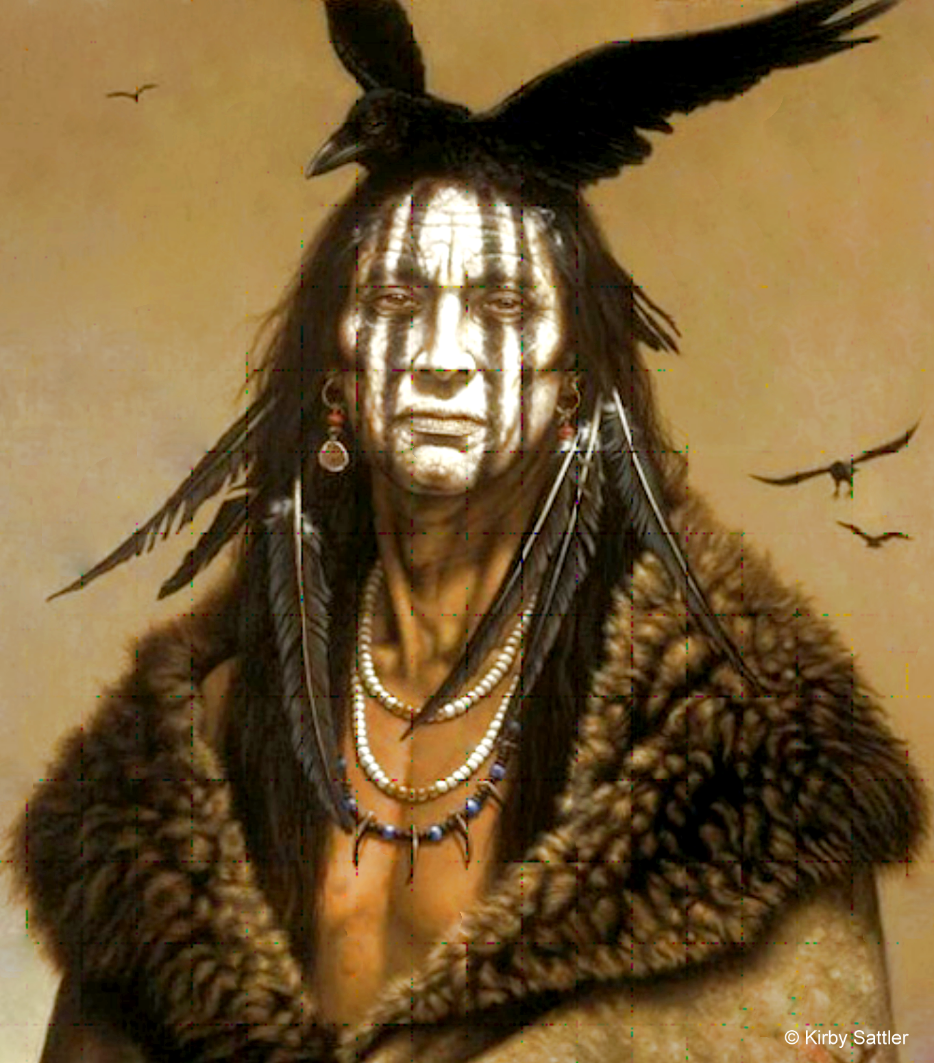 |
| "I Am Crow" by Kirby Sutton. Tribe Unknown |
On October 17, 1689, Tonti arrived at the mouth of the Illinois River and discovered a village of The Illinois there. Their warriors had just returned from a war with the Osage, losing thirteen men while capturing 130 prisoners. The Illinois also lived around Fort St. Louis in 1691, but the Iroquois attacks continued. During the summer of that year, the women discovered that the Iroquois were cutting their corn, and Sieur Pierre Deliette, a nephew of Henri Tonti who had been left in charge of the fort in Tonti's absence, sent out eighty warriors to reconnoiter. These scouts captured two Iroquois and discovered that 300 more were in the vicinity, waiting for the corn to ripen before attacking. The Iroquois were beaten off, but upon the return of The Illinois war parties, which had gone out in the spring, a council was held, and it was decided that Starved Rock could not be defended. Although the position of the fort atop the rock was nearly impregnable, firewood and water were difficult to procure during an attack. Deliette assembled v in September and asked them where they wished to go; they replied that they would move to Lake Peoria, called Lake Pimitoui, or "Fat Lake," so named because there was an abundance of the game there.
Although The Illinois were retreating from the Iroquois, the French were determined to send them and the Ottawa into war against the Iroquois, who maintained connections with the British in Boston. When the king of France granted Fort St. Louis to Tonti and Francois Dauphin de la Forest, one of the conditions of the grant was that The Illinois would direct war parties against the Iroquois. Although The Illinois was no longer at Fort St. Louis, the king expected the war to be continued.
In the spring of 1692, Sebastien Rasles, a Jesuit, arrived at Lake Peoria to serve as a missionary to the 300 cabins of The Illinois living there. From these people, he learned that The Illinois was, at that time, composed of eleven villages, but these were not all at Peoria. The following year it was reported that the other villages were along the Mississippi, near the mouth of the Missouri, where the Tamaroa and Cahokia lived, and the only tribes mentioned as being at Peoria were the Kaskaskia and the Peoria. Although these last two groups were closely united, a considerable number of Kaskaskia remained at Lake Peoria. They did not accompany the Peoria on their winter hunt, which began on September 26, 1693. Other groups of The Illinois who had previously lived on Lake Peoria seem to have moved before 1693, for the missionary report of 1693-1694 states that there were only four villages on Lake Peoria, and all of these were occupied by Peoria and Kaskaskia. Perhaps fear of the Iroquois or disagreement with other members of The Illinois had again driven some of the smaller groups beyond the Mississippi.
In May of 1693, the chiefs of the Peoria and Kaskaskia journeyed westward to seek an alliance with the Missouri and Osage Indians. It would seem that the Iroquois, a relentless foe, were still making inroads into the Illinois County. However, from 1687 until 1701, they were largely occupied in defending themselves from the attacks of the French and their Indian allies.
Little is known of The Illinois from 1694 until 1696; in the latter year, a missionary, who was stationed at Peoria, reported that he had baptized 2,000 of The Illinois, but he does not report the size of the village, and many of these conversion accounts appear to have been greatly exaggerated for the eyes of the Jesuit authorities in Canada. The Tamaroa in 1697 had two villages close to the site of Fort de Chartres, west of the present town of Prairie du Rocher. In this same year, the Michigamea were settled on what is probably known today as Apple Creek on the west bank of the Mississippi. Although the Iroquois do not seem to have raided these Illinois groups living on the Mississippi, the Sioux constantly threatened their depleted ranks.
Jean Francois Buisson de St. Cosme, who belonged to the Seminary of Foreign Missions, reached the site of Fort St. Louis on November 15, 1698, but found that it was abandoned, The Illinois having settled at Lake Peoria. Four days later, St. Cosme reached Peoria, where those villagers not on the winter hunt were encamped. After remaining here for a while, St. Cosme continued his journey down the Illinois River, and during the first day's paddling, he found the cabin of Rouensa, the principal chief of The Illinois. Another important chief among The Illinois was named Peoria, evidently taking his name from the tribe so named or the village site. (Father Francis Pinet converted him sometime before January of 1699.) All along the route, St. Cosme found cabins of Wini who were evidently hunting. Among those encountered were chiefs called the Bear and Tivet; some of the encampments contained as many as twenty cabins. On December 6, St. Cosme came to the village of the Cahokia - probably at the present Cahokia site. They had suffered a disastrous raid that had been carried out by a group of Shawnee and Chickasaw. Ten Cahokia warriors had been killed, and nearly 100 had been marched away into slavery. The following day St. Cosme's party reached a village of the Tamaroa, located on the east side of the Mississippi about eight leagues below the mouth of the Illinois River. However, the main Tamaroa village was situated on an island farther down the Mississippi, where they evidently had fled for protection from the Shawnee and Chickasaw. St. Cosme related that although most of the Tamaroa were away hunting, their village showed a large population. Thaumur de la Source said that the Tamaroa had 300 cabins. St. Cosme was told that the Michigamea were quite numerous and lived farther down the Mississippi, but at this season, they were all hunting some distance away from the permanent village. F. J. Montigny reported that the Michigamea village was on the Arkansas River at this time.


When the French decided to establish a colony at the mouth of the Mississippi in 1698, this proposed settlement had considerable influence upon the Indians of the Illinois County. Although the Kaskaskia had withdrawn from Starved Rock and joined the Peoria in 1681, the Kaskaskia wished to leave them and settle in the new Louisiana Country down the Mississippi. The Jesuit missionary Jacques Gravier left Chicago on September 8, 1700. When he arrived at Lake Peoria, he discovered that the Kaskaskia was determined to leave the other Illinois groups and move farther south. The Peoria and Moingwena opposed the Kaskaskia's moving and were about to insult them before they left. Father Gravier was able to heal the breach, but he could not stop the migration of the Kaskaskia. He, therefore, went with them and, on the journey, persuaded them to settle on the north bank of the Des Peres River where St. Louis now stands. By October 9, the Kaskaskia had reached their new village site. Gravier found that the Tamaroa and Cahokia village was on the east bank of the Mississippi, five leagues north of the Meramec River mouth. The Tamaroa, however, were in winter quarters two leagues below the village, where they awaited the Michigamea, who were going to winter with them. According to the Tamaroa, the Michigamea lived sixty leagues to the south, probably on the Arkansas River, as previously reported. The Cahokia had moved four leagues north of the Tamaroa-Cahokia village and established a winter camp; this spot was nine leagues north of the Meramec River mouth on the Mississippi.

After remaining at their Des Peres location for about two and one-half years, the Kaskaskia moved further down the Mississippi River. On April 25, 1703, they established a new village, often called Rouensa after their chief, near the mouth of what is known today as the Kaskaskia River, but it was then called the Michigamea or the Tamaroa. The Sioux had continued their war with The Illinois, and the move from Des Peres was to avoid contact with these ancient foes. At first, both the French and the Kaskaskia lived together in the same settlement. Penicaut gives the first accurate location of the new Kaskaskia village by remarking in 1711 that it was two leagues upstream from the Mississippi, on the west side of the Kaskaskia River.
With the removal of the Kaskaskia from the Illinois River, the power of The Illinois was greatly weakened. However, in historic times, this loose confederation was never able to maintain the solid unity necessary for survival against such groups as the Iroquois and the Sioux. Auguste Chouteau insisted that the Sioux contributed the most toward the downfall of The Illinois and drove them from their northern lands. By 1702, the Mascouten and Kickapoo, who numbered about 450 warriors, drifted down from Wisconsin and hunted beaver on the various northern tributaries of the Illinois River. These intruders did not establish large permanent villages in the Illinois County; instead, they were content to trap the beaver and carry the valuable pelts to Green Bay for sale. The French themselves attempted to move The Illinois to the mouth of the Ohio River in 1702, but this plan failed. Some of The Illinois even turned against the French and pillaged their canoes on the Mississippi.
Although there was a mission among the Peoria, these Illinois were hostile toward the priests and clung tenaciously to their old beliefs. Their village, on Lake Peoria, was the largest Illinois settlement and consisted of Peoria, Moingwena, Korakoenitanon, Maroa, and Tapouro. If these groups had cooperated with their southern kinsmen - the Kaskaskia, Tamaroa, and Cahokia - The Illinois could have mustered about 1,500 warriors at this time. An estimate in 1702 of the Peoria and Cahokia villages is placed at 800 families, but this did not include the Kaskaskia. Few of the population reports given at the beginning of the Eighteenth Century agree on the number of The Illinois; the priest at Peoria insisted that the Peoria numbered 3,000 in 1706, but another report estimates them at between 800 and 900. The Tamaroa village at Cahokia in 1706 is said to have consisted of 2,200 inhabitants. Although the Michigamea frequently wintered with the Tamaroa, they remained living with the Quapaw and, in 1704, helped to destroy the Koroa who lived on the Arkansas and Yazoo rivers.
A Peoria group of The Illinois on Lake Peoria drove the Jesuit missionary Jacques Gravier out of their village in 1706. One of the most powerful of the Peoria Chiefs, Mantouchensa (Bear's Head) shot Gravier with five arrows because he resented the Jesuit's influence among his tribe. Although The Peoria had never widely accepted Christianity, the missionaries made grandiose claims of success. But this overt action by Mantouchensa seems to have divided his people, and some of the Christian Peoria moved down to live with the Kaskaskia. This division again weakened The Illinois even though Hendrick de Leth's map of circa 1710 shows The Illinois to be in control of the country from Rock River south to the Ohio River. Perhaps this map was drawn from old reports. At this time, the British estimated that the strength of The Illinois was approximately 3,000 men. Father Gabriel Marest found no Illinois near Lake Michigan in this area had been lost by The Illinois because they could no longer defend it. Potawatomi had moved into the St. Joseph River area at the southeastern tip of Lake Michigan by 1711, but they were on good terms with The Illinois. It was the Sioux who continually harassed them, coming down the Mississippi or paddling up the Illinois River to strike The Illinois.

Although the Iroquois had made peace with Illinois in 1701, they executed a raid into the Mississippi Valley during 1714-1715, and in return, they passed near Kaskaskia, where they killed one Illinois, wounded another, and carried off eight women. This seems to have marked the last Iroquois attack upon Illinois, and in 1717, they felt remorse for their deed and returned two of the women. Their trouble with the Iroquois came to an end, but, The Illinois still distrusted The Miami. La Salle had managed to keep the peace between them until his Illinois empire collapsed; after this, the Miami had withdrawn toward the Wabash River, where they still nursed their hatred for The Illinois. Trouble frequently broke out between The Illinois and the Wea, but Deliette and de Vincennes attempted to reestablish peace even though others thwarted their efforts for selfish reasons. In 1714, The Miami and Illinois could have mustered 1,500 warriors to repulse the inroads being made by the Fox if they had been able to unite and forget their past differences.
Soon, the French king saw the necessity of establishing an amicable settlement between the Wea and The Illinois, and peace was consummated in 1715, with Vaudreuil sending many presents to both tribes.
Those Peoria at Starved Rock in 1715 numbered at least 450 warriors, and - since peace had been established between The Illinois and the Wea - The Illinois joined the Huron and Potawatomi to fight the Kickapoo and Mascouten who were moving into the northern part of Illinois. On November 20, 1715, a battle ensued, probably on the Fox River, but The Illinois and their allies from the Detroit region were able to defeat the seventy cabins of Kickapoo and Mascouten. In addition to capturing forty-seven prisoners, The Illinois and their allies killed about 100 warriors, but as they withdrew, 400 Fox pursued them, and a battle took place on December 1, in which The Illinois repelled the Fox in a hard struggle lasting from dawn until three o'clock. Afterward, the Fox retreated to their village in the Wisconsin Country, but the French forces followed them and laid siege to their camp. Instead of annihilating the defenders, the French allowed them to surrender on the promise of many beaver skins. This was an error because the Fox were determined warriors and had designs in the northern parts of Illinois.
In southern Illinois, the Kaskaskia were also having trouble, for in 1716, the Cherokee made war upon both the French and the Kaskaskia. The downfall of The Illinois came about largely because of their inability to cooperate, and when they became further divided in 1700, their doom was assured. In separate groups, they could not withstand their enemies. The Peoria village at Starved Rock in 1718 contained about 400 warriors, the rest of this tribe being on Lake Peoria, but they were constantly at war with the Kickapoo and Mascouten or the allies of these two tribes-the Fox. In the spring of 1719, the Fox sent a war party against The Illinois living at Starved Rock, and raids continued until 1721. The Illinois could boast of only 800 or 900 people. Those Illinois at Starved Rock were forced to make their village on an island at the foot of the rock in order to defend themselves, and here Pierre de Charlevoix found them in September of 1721. On October 3, he came upon the second Illinois village at the southern tip of Lake Peoria on the right bank. Both of the villages were being attacked by the Fox, who, in small war parties, was lurking about the neighborhood in order to kill any Illinois that might go out hunting.

Charlevoix found the remainder of the Kaskaskia Indians two leagues up the Kaskaskia River from the French settlement of the same name. They had been frightened by many French who had settled among them and moved up the river in the summer of 1721 before the arrival of Charlevoix on October 19. These Kaskaskia, Charlevoix observed, were very few in number, and many of the Indians living with them were either Tamaroa or Michigamea. The Osage were friendly with the Kaskaskia and frequently sent delegations to perform the calumet dance as a token of their loyalty.
For mutual protection against the marauding Fox, the Peoria of the lake settled with the other group at Starved Rock in 1722. On June 9, Legardeur Delisle reached Lake Peoria and found the village abandoned, but when he arrived at Starved Rock on June 12, he saw the Peoria encamped there with their kinsmen. Many of the inhabitants were absent from the village hunting, but Delisle discovered that the two groups were not in agreement, so he divided his presents between the two. Even in the face of a Fox invasion, The Peoria could not cooperate. Delisle left the Rock on June 18, and sometime later in the year, the Fox surrounded The Illinois village and forced them to surrender eighty women and children. As a result, The Illinois immediately left Starved Rock and settled with the other members of The Illinois at Cahokia, Michigamea, and Kaskaskia. Mantouchensa, the powerful Peoria chief who had wounded Father Gravier at Lake Peoria in 1706, took his band to Kaskaskia and joined forces with the Kaskaskia bands led by Kiraoueria and Michael, the latter being a Christian, as indicated by his name.
Now The Illinois were almost evenly divided among the three villages, with approximately 200 warriors each at Kaskaskia, Michigamea, and Cahokia. In all, D'Artaguiette estimated that The Illinois in 1723 consisted of about 700 warriors, and on April 30, a war party of 200 passed Fort de Chartres on their way to strike the Fox, who were attempting to establish a village at Starved Rock. However, the Fox drove The Illinois back and killed eleven of their warriors. These invaders made raids as far south as Fort de Chartres, and it was necessary to keep a garrison there in order to protect Michigamea, which was one-half league north of the fort.
In 1725, French officials in Louisiana decided to take a group of Illinois chiefs to France. At this time, the Peoria chief Mantouchensa, who was living at Kaskaskia, was considered the principal leader of The Illinois. Six chiefs were chosen for the journey, but Mantouchensa refused to go; instead, he sent a message to the king. Chicago, a Michigamea chief who claimed to be the headman at Kaskaskia, arrived in Paris on November 28 and met the French officials. Although The Illinois was weak, the French were forced to rely upon this confederation to control the northern Louisiana Country. The Peoria had 200 valiant warriors in 1728, and they sometimes ventured up the Illinois River to fight the Kickapoo. A report made the following year gave the strength of The Illinois as 600 warriors, but the French declared that The Illinois were nevertheless masters of the Mississippi River and must be kept from joining the English.
Among the problems which the French encountered in controlling the Illinois County were the incursions of the Fox. In 1728, the French had failed to defeat them, but the following year, the Kickapoo and Mascouten, allies of the Fox, made peace with The Illinois as well as the French at Fort de Chartres. This action withdrew 150 warriors from the Fox alliance, and now the French determined to conquer the weakened Fox. When the Fox learned of this, they fled and united with the Iroquois. In order to reach the Iroquois, they had to pass around the southern tip of Lake Michigan. Quickly, the French marshaled their forces to trap them. Both the officials of Canada and Louisiana sent troops for the expected battle since the Fox had left their village on the Fox River of Wisconsin about June 1, 1730, and were traveling southeast with their women and children. But when they reached the trails at the foot of Lake Michigan, they found them barred by Kickapoo, Mascouten, and Potawatomi and were forced to proceed farther south into the lands of The Illinois.
Early in July, a party of 350 Fox warriors and their families (making a total of about 1,000) reached the Illinois River near Starved Rock, where they forded the river only to discover that the Indian allies of the French had them surrounded. Those Peoria living near Starved Rock sent word of this movement to their kinsmen at Kaskaskia, where the great chief Mantouchensa still remained with his band of Peoria. These warriors and the Cahokia marched to the aid of The Illinois of Starved Rock. In the face of this united opposition, the Fox retreated back along the Vermilion River and established a fort about 63 miles south of Starved Rock. Lieutenant de Villiers hastened there with his forces from Fort St. Joseph, and Lieutenant St. Ange from Fort de Chartres marched to close the trap with 400 Illinois. On August 17th, St. Ange reached the besieged Fox and entrenched his forces; now, the Fox asked for terms, but the siege continued even though on September 7, between 200 and 300 of The Illinois from Cahokia deserted. Wea and Piankashaw had joined the French and raised the number of besiegers to 1,200, but the Sauk pleaded for the lives of the trapped Fox. However, the Illinois and the French were determined to wipe out this tribe, which caused them so much trouble.
During the night of September 8th, the hungry Fox stole from their fort and tried to escape toward the east, but their children's crying revealed the movement, and the French allies followed them. After the Fox had traveled about twenty-four miles, The Illinois stopped their escape and massacred them; it is said that 1,000 or 1,200 Fox were killed, and their nation was nearly annihilated. Credit for the victory was sought by both the commandants of Canada and Louisiana; each submitted different reports claiming that the victory was obtained in their territory. This caused many difficulties in locating the Fox Fort and the battlefield.
With the defeat of the Fox, the Peoria chief Mantouchensa requested in May of 1731 that he be allowed to return to Peoria with a small detachment of French troops. Sieur Perier gave permission for their removal from Kaskaskia to Lake Peoria but refused to allow French troops to accompany the band until Louis XV approved such an order. French officials in the Illinois County stated that The Illinois respected the French more when they lived at some distance from each other. However, it is not certain that any of the Peoria returned to Lake Peoria in 1731. Our first record of their being back at their old village comes in 1733; neither French soldiers nor priests were with them then. In the previous year, most of the Peoria had still been settled at Cahokia, and these two groups numbered between 300 and 400 warriors. At this same time, the Kaskaskia had about 200 men and the Michigamea 100. One of the principal chiefs of The Illinois was Ouabichagana, who had made an alliance with the Kickapoo and Mascouten.
Although The Illinois favored the French above the English, they became quite insolent after the defeat of the Fox. Part of the Peoria returned to Starved Rock in 1733, and in the spring of that year, they sent a war party as far north as the Wisconsin River, where they killed some Chippewa, Menominee, and Sauk, but the French complained that The Illinois was not eager to go on the warpath. However, the French forced those Illinois living between Fort de Chartres and Kaskaskia to take up the hatchet against the English-supported Chickasaw in September 1732. These attacks resulted in the Chicakasaw's sending war parties against both the French and Illinois villages, but The Illinois, aided by the Indians from Wabash River, took eighty-five scalps from the Chickasaw during the winter of 1733-34, and the Chickasaw asked for peace. With deaf ears, The Illinois continued their raids, capturing at one time twenty women and children and, at another, seventeen men. The three villages of The Illinois contemplated another raid against their southern enemies in the fall of 1735.
In 1736, the Michigamea were living at their village just north of Fort de Chartres and although the mission was closed sometime during this year, there were still 250 warriors there. The Kaskaskia had 100 warriors; the combined Cahokia and Tamaroa consisted of 200 braves living with their families at Cahokia; and the Peoria, who were reported as living at Starved Rock in 1736, had 50 warriors. At this time, the main villages of The Peoria were either at Starved Rock or Lake Peoria. By 1736 The Illinois could no longer adequately protect itself, and little bands were leaving the main villages. This year, there were eight Kaskaskia living with the Potawatomi on the St. Joseph River, southeast of Lake Michigan. Within this same village were ten Miami, formerly an enemy to The Illinois.
When the French began their war with the Chickasaw, they called The Illinois into the struggle and on October 25, 1739, a war party arrived at the present site of Memphis. With these Illinois were some Potawatomi, Piankashaw, and Shawnee, but The Illinois were not enthusiastic about the war and had little success. They renewed their fight with the Chickasaw in 1737 but had less success than in their earlier wars from 1732 to 1735. The theater of operation was in the Carolina Country, far from Illinois. The Illini probably took little interest in the French-English struggle, which raged in North America and Europe from 1701 until 1763.
Trouble was made for the lliniwek in 1737 when a French officer caused an attack upon the Sioux who were living along the west bank of the Mississippi near its source. These Sioux retaliated -- not against the French but against The Illinois ─ and killed two women. One of the raiders was captured and burned by The Illinois, but this brutality caused the Sioux to attack The Illinois in the spring of 1740. Then, the year the Peoria countered by making an attack upon the Sioux, probably under the direction of the Peoria Chief La Babiche. However, the Sioux were not the only enemy of The Illinois; others were pressing down upon The Illinois at the same time. In 1741, the Cahokia sought to punish the Sauk and Fox by raiding their villages, probably near the Wisconsin River or Fox River. The Cahokia captured some of the Sauk, but in return, they passed Lake Peoria, where the Peoria attempted to secure the Sauk prisoners for themselves. When the Cahokia refused to give them up, the Peoria took them by force. Such bickerings reveal the state to which The Illinois had degenerated. Their disunity had originally led to their defeat at the hands of the Iroquois, and it continued to plague the dwindling Illinois. Even the Cherokee were seen hunting near the mouth of the Ohio River in 1741, a region formerly controlled by The Illinois.
Since their support of the French had caused them so much trouble, The Illinois were inclined to be neutral in 1747. However, the English sent runners to Kaskaskia, informing them they would be killed if they did not unite with the English. Regardless of their connections with either the French or British, The Illinois were still subjected to the raids of the relentless Sioux. In 1750, the attacks continued, and the numbers in Illinois decreased. There were four Illinois villages in 1750, and the principal chief of The Illinois was Rouensa. The total population of these villages was about 2,000, but the Jesuits remembered that when they first entered the Illinois County The Illinois numbered 5,000 souls. In 1750, however, the three villages in the vicinity of Kaskaskia contained only 800 persons, of whom about 600 lived at Kaskaskia, and the remainder of The Illinois was at Lake Peoria. Some of the Kaskaskia even lived at Fort de Chartres in 1751, and during the winter of 1751-1752, the Michigamea were once more living at their old village above this fort. These Michigamea seem to have traveled between the Arkansas River and their village near Fort de Chartres. Other groups of The Illinois were also moving away from the regular village sites. In 1751, there were four cabins of The Illinois living at Starved Rock, and along the White River of Indiana, there were a few who had combined with other renegades to form a little republic that was friendly toward the English and the Iroquois.
Attacks against The Illinois continued in 1751 when the Potawatomi, Mascouten, Menominee, and Chippewa sent war parties against the Peoria in the spring, but the Peoria defeated the raiders, captured some prisoners, and sent them home to tell their tribes that it was futile to fight the Peoria. However, the other Illinois villages were not so fortunate, and by April of 1752, they had suffered serious losses. That same year, The Cahokia brought down the wrath of the northern tribes by capturing and burning six Fox hunters in a time of peace. One of the Fox, while tied to the stake, escaped and carried the news to his tribe, who called upon their allies, the Sioux, Sauk, and Kickapoo, for war against The Illinois. It was estimated that 1,000 warriors descended the Mississippi River in 180 canoes for a stroke against the Michigamea, who were living just north of Fort de Chartres because they had given shelter to the Cahokia. On June 6, 1752, the northern tribes surrounded the Michigamea and, in a surprise attack, killed seventy or eighty persons and destroyed the village. Many of The Illinois contemplated moving to the renegade settlement on the White River. One traveler said in 1753 that one reason for the hatred of The Illinois by the northern Indians was that The Illinois, in previous years, had hunted beaver in the Wisconsin Country and had killed both males and females, which was considered a crime by the northern tribes. This was perhaps an excuse to hide their expansion into the Illinois County.
After defeating the Michigamea, a group of Sioux, Potawatomi, Kickapoo, and Mascouten sent war parties against the Peoria, who had previously been able to defeat them; the northern tribes were bent on destroying the Peoria also. Although The Peoria was under attack, the commander of Fort de Chartres was able to collect 300 Illinois from his area for action against the English in the East. On June 26, 1754, Captain De Villiers arrived at Fort Duquesne and proceeded against Fort Necessity, where they forced George Washington to surrender. In the summer of 175, another group of The Illinois, probably The Peoria, discovered some Kickapoo and Miami on the Iroquois River and drove them away after killing a few. Although in a weakened condition, The Peoria still considered this region of Illinois as its territory.
At the outbreak of the French and Indian War in 1756, The Illinois were allied to the French, and those living in the area of Fort de Chartres often joined expeditions against the English. On April 1, 1756, the great chief of The Illinois, Papape-changouhias, led his warriors against the English settlers in Virginia. Papape-changouhias had become chief in 1754 after the death of Chicago, a Tamaroa Indian and a visitor to France in 1725. (Chicago's predecessor had also been a chief by the name of Chicago.) Papape-changouhias' war party was successful in capturing a little fort and taking forty prisoners. During 1756, The Illinois, Delaware, and Shawnee burned the grain of the English as far east as Pennsylvania, raided settlers in Georgia, and attacked English forces in the Carolina Country. French leaders supplemented The Illinois war parties in all of these instances. The Peoria, however, had troubles of their own and apparently did not join in the raids against the English. This village at Lake Peoria was fortified with posts by 1756 to withstand the repeated raids of the Fox.
With the advent of 1757, Illinois war parties again moved against the English settlements along the frontiers, and an exaggerated account of their numbers was given by one writer who claimed that the Cahokia and Michigamea numbered 400 warriors, the Kaskaskia 400, and the Peoria 700. A more realistic enumeration in 1759 of The Illinois by M. Aubry, the last acting governor of Louisiana, places the Kaskaskia at 100 warriors, the Michigamea and Cahokia at 40 and 60, respectively. Aubry does not mention the strength of The Peoria, but they were much stronger than the rest of The Illinois combined.
Just when the majority of The Peoria was driven from Lake Peoria is not certain. In 1763, there was a Peoria village within half a mile of Fort de Chartres, and nearby, another group of Illinois had reoccupied the Michigamea village, which had previously been destroyed. Together, these villages contained approximately 300 warriors. Captain Thomas Hutchins estimated that The Peoria had 800 warriors the following year, but their location is not given. Some of the Peoria were still settled along the Illinois River, and a few established themselves with a band of Iowa who lived along the Mississippi. Frequently, these Peoria would return to Lake Peoria and steal horses from the French living there. Likewise, the Peoria and Cahokia near Fort de Chartres constantly stole horses from the whites and caused the French officials much consternation. Many of the Peoria had never received Christianity and were more warlike than other members of The Illinois; as a result, they found it difficult to live like the white man. The Kaskaskia, however, became quite docile under the rule of the French and, in 1764, numbered about 600 persons, including about 100 warriors, but liquor, war, and the diseases of the whites had already defeated them. After 1764, the northern part of Illinois was controlled by the invading Sauk, Fox, and other tribes.
Although the Illinois County was annexed to the British Empire by the peace treaty of 1763, the English troops did not take immediate possession of it. In May of 1763, Pontiac led an uprising against the forts on the frontiers, and the Illinois County was cut off. Pontiac's confederacy was defeated the following year, but this brave chief continued to organize the Indians for war against the whites. On July 1, 1764, Pontiac left Fort de Chartres with the promise of The Illinois that they would cooperate with him. However, in October of 1765, the British took possession of the Illinois County, and the Indians were under their surveillance. A British officer was sent to Fort de Chartres, now renamed Fort Cavendish, and he learned that the Kaskaskia were living half a league north of French Kaskaskia and had about 150 warriors. Peoria and Michigamea were established within a mile of Fort Cavendish, the former numbering 250 warriors and the latter 40. But the Cahokia could count no more than 40 warriors and had their village at Cahokia.
Although the British tried to gain the friendship of The Illinois, their loyalty remained with the French, who had moved across the Mississippi River into Spanish territory. When the British met the Kaskaskia in council, the Indians informed them that they were also moving across the river. Some of The Illinois, probably the Michigamea, paddled down the Mississippi to join The Arkansas and the remainder left the Illinois County in December of 1765. However, the Chickasaw threatened The Illinois, and some of them returned to their former villages but were slow to accept the offered presents of the British. Prior to the arrival of the British, the French had attempted to have The Illinois make peace with the new masters of the Illinois County, but the Kaskaskia chiefs Tomera (or Tamarois) and Chacoretony, a war chief, together with another Illinois chief, Levacher, informed St. Ange that they intended to continue the war with the British. But when The Illinois discovered that the British could make peace with their enemies, the confederacy became better disposed toward the new occupants of the Illinois County. The British arranged peace between their own allies - the Chickasaw and Cherokee - and The Illinois on the condition that the latter would trade with British merchants and support their policies. During 1765, however, many of The Illinois remained west of the Mississippi, along the Missouri River, although a few lived at the Illinois River's mouth.
By 1766 most of the Kaskaskia had returned to their old village where they occupied fifteen cabins and numbered about 150 men, but Black Dog, chief of the Peoria, could not keep his tribe together on the east bank of the Mississippi. Captain Harry Gordon found twenty cabins of Peoria at Cahokia in August of 1766, but the remainder of the Peoria, about 200 warriors, had moved to a new village two miles south of St. Louis. And even those Illinois who remained on the British side of the Mississippi carried their furs to St. Louis, where they traded with the Spanish, although on August 24, 1766, George Croghan held a conference with The Illinois (Kaskaskia, Peoria, Michigamea, and Cahokia) at Fort de Chartres and received permission to occupy forts in the Illinois County and a promise of allegiance to the king of Great Britain. But The Illinois had lived with the French for so long that it was not easy to change their "Great White Father." A liberal estimate of The Illinois in 1766 placed their number at 650 men, but they were so frequently drunk that the British realized little benefit from their new charges. In the summer of 1767, however, the Kaskaskia chose an additional chief who was friendly to the British and not a victim of whiskey: Jean-Baptiste Ducoign. Although Tomera was still the principal Kaskaskia chief, Ducoign exercised much influence.
Many of the Peoria lived at St. Louis in 1768, but Black Dog and his band maintained their village at Cahokia, where they were on cordial terms with the British at Fort de Chartres. While out hunting during the late spring of 1768, The Peoria discovered a war party of sixty Potawatomi who were on their way to attack the British. When the commander at Fort de Chartres was informed of the matter, he immediately collected Illinois warriors to bolster his small garrison. A war party of Michigamea, from their village three-quarters of a mile from the fort, joined the whites on May 5th and pursued the raiding Potawatomi. Likewise, the Kaskaskia set out under their chief Tomera to follow the Potawatomi, whose raid had been beaten off. But pressure from northern Indian groups continued, and fuel was added to the flames of war sometime within the first week after Easter (March 26) in 1769 when Pontiac, an Ottawa chief and recognized leader of the Indians in the Midwest, was stabbed to death at Cahokia, while drunk, by a Peoria Indian. Many tales have been told as to why Pontiac was killed, but the actual reason was probably revenge since, in the summer of 1766, Pontiac had stabbed one of the principal chiefs of The Illinois.
After Pontiac's death, northern Indians made raids upon The Illinois, and by August, 500 to 600 Indians had fled to Fort de Chartres protection. Probably, fear kept many of the Peoria, Cahokia, and Kaskaskia from hunting and trapping during the winter of 1769-1770. Nevertheless, Black Dog and some of his Peoria braves secured several furs during this period. Although they brought their furs to Cahokia first, Peoria sold only three packs there. They carried the rest across the river to St. Louis and sold them to the Spanish. Fort de Chartres' commander complained that these Indians could collect 300 to 400 packs of furs if they would only trap. Instead, too many of the Kaskaskia, Cahokia, Peoria, and Michigamea crossed the river to St. Louis and received free supplies from the Spanish.
Although the Peoria had abandoned the Illinois River, no powerful tribe had moved into this region by 1770; the Potawatomi were still living at St. Joseph River, and the Peoria continued to winter along the lower part of the Illinois River near the mouth of Macoupin Creek.22G The Kaskaskia remained in southern Illinois and were occasionally seen paddling down the Mississippi River. Since the British had established peace between The Illinois and the southern tribes, the Chickasaw visited Kaskaskia in May of 1772. After becoming disorderly, however, the visitors attacked the Kaskaskia, and soldiers were needed to drive the Chickasaw away.
Even though weak, The Illinois still held claim to much of the land, and on July 5, 1773, The Illinois and Wabash Land Company purchased some of their holdings. The Kaskaskia chiefs who signed this agreement were Tomera or Gabriel, Petaguage or Michael, Maughquayah or Jean-Baptiste Ducoign, Couroway, Kicounaisa or Fish. And Tontowaraganih or Peter; the Peoria chiefs were Maughquinthepe or Black Dog, Aschiswewah, and Eschawinikiwah; one Cahokia chief was among those present: Meinquipaumiah. At this time, the Kaskaskia band lived three miles above Kaskaskia and numbered about 210 persons with sixty warriors; the Peoria and Michigamea were in a village one mile north of Fort de Chartres and Were the most powerful, having 170 warriors.
When Tomera died, Jean-Baptiste Ducoign became the principal Kaskaskia chief, and he prepared to lead his people away from Kaskaskia in 1774 because it was constantly raided by hostile Indians. Ducoign gathered eighty warriors (plus their families) in the autumn, paddled down the Mississippi River, and established a winter camp. In the spring of 1775, they moved up the Arkansas River to Fort Carlos III, the Spanish Arkansas Post, and joined the Quapaw. Many years before, the Michigamea had fled to the Quapaw, and now the Kaskaskia sought refuge among them. The Spanish commander, Don Josef de Orieta, and the Quapaw welcomed them and offered land to plant corn, but the Kaskaskia wished to move up the White River and establish a separate village. Don Josef refused, and Ducoign proceeded toward New Orleans to seek permission from the governor; he also refused. Finally, the Kaskaskia asked to be adopted by the Quapaw as the Michigamea had done once before, but outside events influenced the final outcome. When the American Colonies declared war upon Great Britain, Spain decided to grant her favors to the rebels.
Because the Kaskaskia raided the British traders moving along the Mississippi, the Spanish, as a reward, finally gave Ducoign permission to settle upon the White River. But the Peoria, who had lived in Spanish territory at St. Louis for about twelve years, returned to Cahokia to plant their corn in the spring of 1777. Many of the Kaskaskia also came back and joined The Peoria before November. Together, they could muster only about 100 warriors. Some Kaskaskia and Peoria, however, settled at a village halfway between St. Genevieve and the mouth of the Ohio River. This merging of the Kaskaskia and Peoria was probably for mutual defense since a Sauk war party had attacked the Peoria at St. Louis in 1777. Although the Sauk were defeated, The Peoria saw the folly of dividing the forces of The Illinois.
George Rogers Clark came to the Illinois County in July of 1778, and Ducoign joined forces with him and attempted to wean the Chickasaw away from their allegiance to the British but failed. Since The Illinois were fearful of Ottawa attacks, Ducoign, who acted as chief of both the Kaskaskia and Peoria, sought - on October 5 - to bring the Wea of the Wabash into the American alliance. The strength of The Illinois in 1778 cannot be stated with sureness since Louis Chevallier reported that they numbered 100 warriors, while another report indicates that they had 300. In this war, The Peoria divided their allegiance. One chief joined Henry Hamilton's English forces at Vincennes on January 30, 1779, and another group traveled up the Tennessee River with a party of Delaware to escape from the conflict. However, the Kaskaskia remained loyal to Clark and were joined by the remaining Peoria, Michigamea, Piankashaw, Wea, and Kickapoo. These Kaskaskia performed singular service to the American soldiers by serving as scouts and hunters. They were also willing to make war upon the Cherokee who had fled into the Cumberland Mountains. Although the British tried to organize a war party of Cherokee and Chickasaw for an attack upon the Kaskaskia in 1783, their efforts largely failed.
At the end of the American Revolution in 1783, the Kaskaskia visited Arkansas Post in order to buy horses for their winter hunt, but The Illinois scarcely existed anymore. Ducoign and Michael Courwoues were the chiefs of Kaskaskia, and the total number of people living in Illinois by 1787 was only about fifty persons. Likewise, the Cahokia were reduced to four or five families, and by 1789, they had abandoned their lands between Cahokia and Kaskaskia. In 1789, The Kaskaskia numbered only twenty families and occupied only their village and 4,000 acres of land. At this time, The Peoria numbered about 100 but had left Illinois and settled on the western bank of the Mississippi in 1794. They were settled in a village at Bois Brule, ten miles south of St. Genevieve, Missouri, and occasionally raided by the Chickasaw. Chiefs of the Peoria were Massarosanga and Little Fish, and Moses Austin discovered in 1796 that their warriors numbered only 40. There were a few Peoria living near St. Genevieve in 1803, but gradually, they too moved westward and were nearly forgotten as the whites crowded onto their lands.
The Kaskaskia in 1796 numbered only eight or ten men, but their number had increased to fifteen or twenty by 1801; nevertheless, this remnant had inherited many square miles of territory. On August 13, 1803, the United States negotiated a treaty at Vincennes with the Kaskaskia in which the latter relinquished their claims in the Illinois County and received two reservations. Their old village near Kaskaskia was established as a reserve of 350 acres, and they also were given the right to locate another reserve of 1,280 acres anywhere within the bounds of the ceded territory. Although the Kaskaskia weres recognized in the treaty as being the survivors of The Illinois, one Michigamea, Ocksinga, and one Cahokia, Kee-tin-sa, also signed the treaty. The Peoria, who amounted to about fifty men, was not in Illinois at the time and did not sign the agreement.
For their second reserve, known as Survey No. 449, the Kaskaskia chose a tract of 640 acres in Sand Ridge Township of Jackson County. In 1804, Ducoign established his little band as farmers and asked for horses and fences. These were provided for him as guaranteed by the terms of the treaty. However, the major portion of the Kaskaskia wished to leave their old village and establish themselves on the land reserved for them in Jackson County, and early white settlers recalled that at about this time, there were Kaskaskia lodges in Sand Ridge Township, "near the crossing on Kinkaid."
Since The Peoria had been living on the Blackwater River in Missouri when The Illinois ceded their lands to the United States, Ninian Edwards and Auguste Chouteau drew up another treaty which was signed at Edwardsville on September 25, 1818. Peoria delegates who signed were: Waw Peeshawkawanan or Shield; Wassawconsangaw or Shine; Naynawwitwas or Sentinel; Wissineeaw or Eater; Rawmissawnoa or Wind; Mawressaw or Knife; Koongeepawtaw; Batticy or Baptist; Keenawraneaw or Seal; Wecomawkawnaw; Keeshammy or Cut Off a Piece. Kaskaskia signers were: Louis Jefferson Ducoign, Wawpamahwhawaw or White Wolf; Awrawmpingeaw or Whale; Keemawassaw or Little Chief. Michigamea delegates were: Wackshinggaw or Crooked Moon; Keetawkeemawwaw or Andrew; and Manggoussaw. Cahokia delegates were Mooyawkackee or Mercier; Peemekawwattaw or Henry; Papenegessawwaw; Shopinnaw or Pint; Maysheeweerattaw or Big Horn. Tamaroa delegates were: Mahkattamawweeyawor Black Wolf, Queckkawpeetaw or Round Seat.
By the treaty at Edwardsville, the Peoria were given a reservation of 640 acres, including their village on the Blackwater River in Missouri Territory. Some Peoria still lived at times south of St. Louis on the St. Francis River; this group had about ten warriors and a total population of forty or sixty, while the Kaskaskia numbered about sixty persons (fifteen warriors). But by 1820, some of the Kaskaskia left Illinois and were living with the Peoria, Michigamea, Cahokia, and Tamaroa. The Kaskaskia in September of 1826 numbered thirty-one persons: fifteen men of mixed blood, ten women, and six children. Ten or fifteen Peoria had drifted back to St. Genevieve, Missouri, by 1827, but three years later, they left Missouri and settled in Kansas, being pushed westward by the white emigrants. About eight Kaskaskia remained in Illinois, and when the Black Hawk War began in 1832, five Kaskaskia warriors marched north through Springfield, Illinois, on their way to join the United States troops. In this small way, they got revenge against the Sauk and Fox, who had driven them from the Illinois County and saw Black Hawk's band cut to pieces.
Following the war, the Kaskaskia signed another treaty with the government on October 27, 1832, and agreed to leave Illinois and settle with the Peoria on their western reservation. They ceded their reserve in Jackson County back to the United States, but the 350 acres at Kaskaskia were given to Ellen Ducoign, the old chief's daughter. There were a few Kaskaskia Indians, only one man of pure blood, at the village of Kaskaskia in March of 1833, and shortly after this, they too moved west. A census in 1836 shows that 132 Peoria and Kaskaskia lived on their Kansas reservation, and the following year, their numbers had increased to 142. By 1865, The Kaskaskia, Peoria, Piankashaw, and Wea had banded together in one village, which consisted of 220 persons. The descendants of the once-powerful Illinois are living in northeastern Oklahoma and are known as the Peoria Tribe of Indians. There are 466 individuals listed on the Peoria Tribal Rolls, and they are almost wholly integrated into American culture and society. On August 2, 1956, the President of the United States signed Public Law, which made The Peoria were free of any Federal supervision after three years.
Additional Reading:
The History of the Illinois County from 1673-1782.
Potawatomi Tribal History, including the Potawatomi of the Prairie.
The Starved Rock Massacre of 1769 - Fact or Fiction.
The Legend of the Piasa "Bird" was carved and painted on a bluff in Alton, Illinois.
Compiled by Dr. Neil Gale, Ph.D.
The average person doesn't have a clue about this. That's why I'm glad we have you to in form us.
ReplyDeleteFascinating! This is the history we never learned in school.
DeleteWow! Great photos and details. Thanks.
ReplyDeleteExcellent.
ReplyDeleteThis is a fascinating history of the tribes that lived in the sweep of territory from Green Bay to the Ohio River along the Mississippi River on the West. I have traveled west of Lockport along the Illinois and Michigan Canal to the Illinois near LaSalle-Peru and past the Hennepin Canal following the Illinois to the Mississippi. The historical name references in the area resonate. We traveled down Rt. 51 through Moroa to camp and fish at Lake Shelbyville, the reservoir created by the damming of the Kaskaskia. To read about the chiefs that worked with George Rogers Clark and the tribes that fought with the French against the British, brought history to life. And it was gratifying to read that Ellen, the daughter of Chief Ducoign was given 350 acres near Kaskaskia. But the reality of how the tribes were forced to move to Kansas and Oklahoma is part of this history. The land of the reserved was nothing like their land in Illinois. Thank you Neil for transporting us again to another time in our history in Illinois It was riveting as always. Your research is profound.
ReplyDeleteWow, from the little bits & pieces we get in our schools, this shows quite a complex system of war, peace, cooperation, revenge, etc.
ReplyDeleteBased on teachings, we learn little of the infighting and treaties made broken and remade!
I tried my best to follow on google maps all of the places mentioned in the writings to get a perspective of where and distance
ReplyDelete