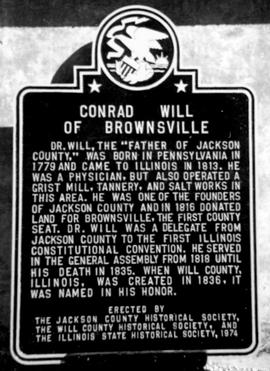
The Town of Brownsville, Illinois, was established in 1816. Doctor Conrad Will, "Father of Jackson County," offered to donate twenty acres near his salt works on the Big Muddy as a town site, and his offer was accepted. Thus Brownsville was founded.
It was not a favorable location for a town because it was off the main trail and challenging to reach. Nevertheless, regardless of this handicap, it was a lively place for years. Brownsville was said to be the third largest town in Illinois.
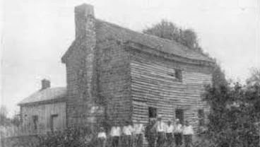
 |
| The only known photograph of Brownsville, Illinois. |
Brownsville was the first county seat of Jackson County from 1817 until 1843, when Brownsville's court house burned down on January 10, 1843, the twenty-seventh anniversary of the county's birth. Very few records were saved from the flames, the reason that so few records of Brownsville's pioneer days exist.
Brownsville continued to flourish until about 1835 when it began to decline. There were several reasons for this. Doctor Will, its leading citizen, died the previous year, and his various enterprises ceased operation. People began settling in the county's northern and western portions, demanding a more central county seat.
After the destruction of the court house in 1843, Doctor Logan offered to donate twenty acres as an inducement to relocate the county seat on his farm in Shieldsboro, Illinois (which changed its name to Murphys Borough), now where Murphysboro stands. His offer was accepted, and the new town was started. Many citizens of Brownsville moved to Murphysboro, some razing their buildings to move them to the new location. Other buildings were bought by various persons and removed from the Brownsville location.
Thus, in a few years, the town had vanished.
By referring to a map of Jackson county, it will be noted that the Big Muddy river swings northwestward at Murphysboro, flowing in that direction some two or three miles, then swerves slightly to the southwest for a considerable distance. It was on this stretch of the river that Brownsville was located, on the north bank of the stream, on the dividing line of sections two and three, Sand Ridge township, about five miles west of Murphysboro. Route 149 now passes within a short distance of the historic spot.
Compiled by Dr. Neil Gale, Ph.D.