Sunday, April 26, 2020

Naugles 24-Hour Mexican Fast Food Restaurants of Illinois.

Naugles Sign - Location Unknown
The fresh-made food at Naugles set them apart from other fast-food Mexican restaurants in addition to the drive-thru being open 24 hours. 

The Southern California chain was founded in 1970, closed in 1995, and was rebooted in 2015 when the original trademark expired.

There was a Naugles on the southeast corner Western and Addison in Chicago across the street from Lane Tech High School along with other Chicago stores. There were other restaurants in Orland Park, Addison, Hoffman Estates, Palatine, Joliet, Bolingbrook, Glen Ellyn, Elmhurst, Aurora, and one in southern Illinois in Belleville.

My sister managed the Orland Park Naugles from 1982 to 1984. Although the brownies were packaged, they were the best and in my opinion, the best item Naugles sold.

It was bought out by Del Taco in 1988. After the buyout, all the Naugles restaurants were co-branded as Del Taco/Naugles restaurants for a few months before eventually becoming only Del Tacos.

There is one original "Naugles Tacos" still in business at; 18471 Mt. Langley Street, Fountain Valley, CA. 

If you have any info on other Illinois locations or just a story about Naugles, please comment below.

INDEX TO MY ILLINOIS AND CHICAGO FOOD & RESTAURANT ARTICLES.

Compiled by Dr. Neil Gale, Ph.D.

Friday, April 24, 2020

Why the North-South Chicago Streets Don't Align at North Avenue.

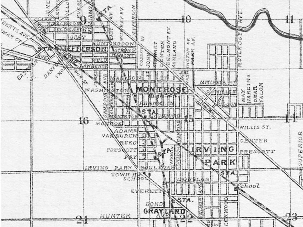
Chicagoans know that the north-south streets swerve abruptly on crossing North Avenue (1600N) from Kedzie Avenue (3200W) on the east to Oak Park Avenue (6800W) to the west, a distance of 4½ miles.
CLICK FOR A FULL-SIZE MAP
THE MYTH
Chicago's streets are a grid pattern that is then overlaid on a spherical map of the Earth. All grids overlaid on spheres create an issue. They converge as the meridian's lines (north/south) approach the poles.

A surveyor laying out a grid has two choices. Either let the streets get closer together as they head towards the North Pole, meaning the building lots get smaller and thus would be sold for less money, or readjust the grid at intervals so that the lots and the profits don't shrink.

Chicago opted for the second choice. The abrupt readjustment, or so the story has it, is manifested most conspicuously at North Boulevard, which was at one time the northern boundary for the City of Chicago.
Looking North on Pulaski Road (Crawford Avenue) towards North Avenue, Chicago - 1947
MYTH DEBUNKED
Different people surveyed the townships to the north and south of North Avenue at different times.

The surveyors who laid out the city south of North Avenue were inaccurate. Harlem Avenue, the city's western border at that time, is 1/16 miles west of where it should be at Madison Street. That's 330 feet. If one had to hide a 330-foot mistake, they might parcel it out in small increments along the 5-mile width.

It's not like this is the only surveyor's error in Chicago. The whole city is 1.3° off true north. As a result, it doesn't square with the survey grid between the Wisconsin border and Central Street in Evanston, which was laid out independently.

EVIDENCE
Central and Golf Road are supposed to be parallel. However, if you follow the lines in a Street map or atlas, you'll find Central and Golf are 1½ miles apart in Hoffman Estates but only ½ mile apart in Evanston.

Who cared about such a slight difference at the time of the survey? They thought they were surveying farm property lines. They couldn't have imagined what the future would bring.

THE HISTORY OF TRUE NORTH VS. MAGNETIC NORTH
U.S. surveyors in 1800 did not know that the magnetic North Pole moves constantly. While there were observations of compass deviations from true north throughout history, the concept of a continuously moving magnetic pole wasn't widely understood or accepted until the late 19th century.

English seafarers observed discrepancies between geographic and magnetic north in the 16th century.

Edmund Halley observed that the magnetic pole wasn't fixed and proposed its movement over time in the 17th century.

By the 18th century, scientists had observed that the compass needle didn't always point directly to the true north. This deviation, known as magnetic declination, varied depending on location and was attributed to local magnetic anomalies.

Scientific data on the magnetic North Pole's movement was still limited and largely based on single expeditions by 1800. Many surveyors and scientists believed the magnetic pole had a fixed location or followed a circular path. Surveyors in the 1800s primarily relied on compasses and declination tables to adjust for local variations without necessarily factoring in long-term movement.

U.S. surveyors in 1800 observed discrepancies between magnetic and geographic north but lacked a complete understanding of the cause. The concept of the magnetic North Pole's movement was still emerging and not widely accepted during their time.

Increased data from expeditions and more precise instruments started to solidify the evidence of the magnetic pole's continuous movement in the Mid-19th century.

The concepts of "secular variation" (long-term movement) and "diurnal variation" (short-term changes) gained wider acceptance in the late 19th century.

Carl Friedrich Gauss (1777-1855), the renowned mathematician, made significant contributions to our understanding of Earth's magnetic field, particularly regarding the location of magnetic north. In the 1830s, Gauss participated in the first global survey of Earth's magnetic field. This required accurate measurements, which led him to invent the magnetometer, a device to measure the direction and strength of magnetic fields. Gauss recognized that the location of the magnetic north is not fixed but drifts over time. Gauss's work on Earth's magnetism extended beyond just the north pole. He also studied magnetic declination, the angle between true north and magnetic north, and its variations across the globe.

ADDITIONAL READING: Chicago's Eastside Begins at North Boulevard (1600N)

Compiled by Dr. Neil Gale, Ph.D.

Thursday, April 23, 2020

The History of the Irving Park Settlement.

Major Noble purchased a 160-acre tract of land from Christopher L. Ward and started farming in the 1840s. The boundaries of Noble's farm today would be Montrose to the north, Irving Park to the south, Pulaski to the east, and Kostner to the west.

Noble sold his land to a New York family (Charles T. Race and four other relatives that comprised the Irving Park Land and Building Company) and moved to McHenry County to farm in 1869. 

With the land so close to the Chicago & North Western (C&NW) railroad, Race realized there would be more profit in beginning a settlement instead of overusing the land for farming and began building houses. 

The original name chosen for the new suburb was "Irvington" after the author Washington Irving. It was discovered that Irvington was a village in Washington County, Illinois, had already used the name first, so the name Irving Park was adopted. After Race paid for a depot, C&NW agreed to stop at the settlement, which was soon renamed Irving Park.
An 1888 Rufus Blanchard map showing Irving Park before annexed to Chicago in 1889. The easternmost streets cropped in this map were Irving Avenue (Keeler), St. Charles Avenue (Kedvale), and Greenwood Avenue (Keystone). These original names were used until the City of Chicago renamed and renumbered the streets in 1909.
Race built himself a three-story brick house with a basement and “French roof.” Joined by associates, he organized the Irving Park Land Company, bought additional land, and subdivided it into lots. Advertisements promoted the area's easy access to downtown via hourly trains. Boasting an idyllic setting comparable to that of suburbs such as Evanston and Oak Park, the ad pointed to Irving Park’s “shady streets, fine schools, churches and stores,” and homes of varied designs. The Irving Park subdivision was followed by Grayland, Montrose, and Mayfair subdivisions.

Grayland, a suburb of Chicago annexed in 1889, was created by subdividing John Gray's 80-acre farm. Gray deeded the land that he had already built a depot (the second one) on the Chicago, Milwaukee & St. Paul Railroad line. In return for the property, the R.R. promised to maintain and service the depot, thus ensuring that the inhabitants of Gray's subdivision would have easy transport to Chicago and back. The station was opened in 1873 to service Grayland.

The commuter suburb attracted many wealthy residents who sought larger homes of between seven and ten rooms and amenities that included closets and drinking water from artesian wells. Race and his associates garnered a 600% profit on the land. Other residents who were less affluent came to the area to remove their families from the dangers of the city. Rich or middle-class, the population of Irving Park was generally native-born, Protestant, and white-collar. They participated in community events and activities of a literary and musical nature. Both men and women were active in neighborhood organizations. The Irving Park Woman's Club was formed in 1888 with an agenda of cultural and reform activities.

Suburban paradise was not without problems, however. In the 1880s, heavy rains produced floods, and poor drainage turned unpaved streets into mud. In 1881 complaints were heard of raw sewage floating down Irving Park Road from the Cook County Poor House and Insane Asylum in Dunning.
The Irving Park Tea Store at 3613 Irving Park Road in Chicago. 1910
Although the annexation of Irving Park into the city of Chicago as part of Jefferson Township occurred in 1889, in the 1890s, streets were still unpaved and unlighted. As improvements were added, the main thoroughfare became a construction zone; streets were updated, and public transportation was created. A residential boom between 1895 and 1914 added more than 5,000 new buildings, of which 1,200 were multifamily residences. New structures changed the housing composition of the area, leading to concerns about community standards.

Irving Park was annexed to Chicago in 1889.
Germans and Swedes had begun arriving around the turn of the century but, in the 1920s, were largely replaced by Poles and Russians. The population peaked at 66,783 in 1930, and commercial interests sprang up along the major roads, but until 1940, construction was mainly residential. Most notable architecturally were the bungalows of the Villa District; Old Irving Park with Queen Anne, Victorian, and Italianate houses, farmhouses, and bungalows; and Independence Park with many homes of turn-of-the-century vintage.

Compiled by Dr. Neil Gale, Ph.D.