
 |
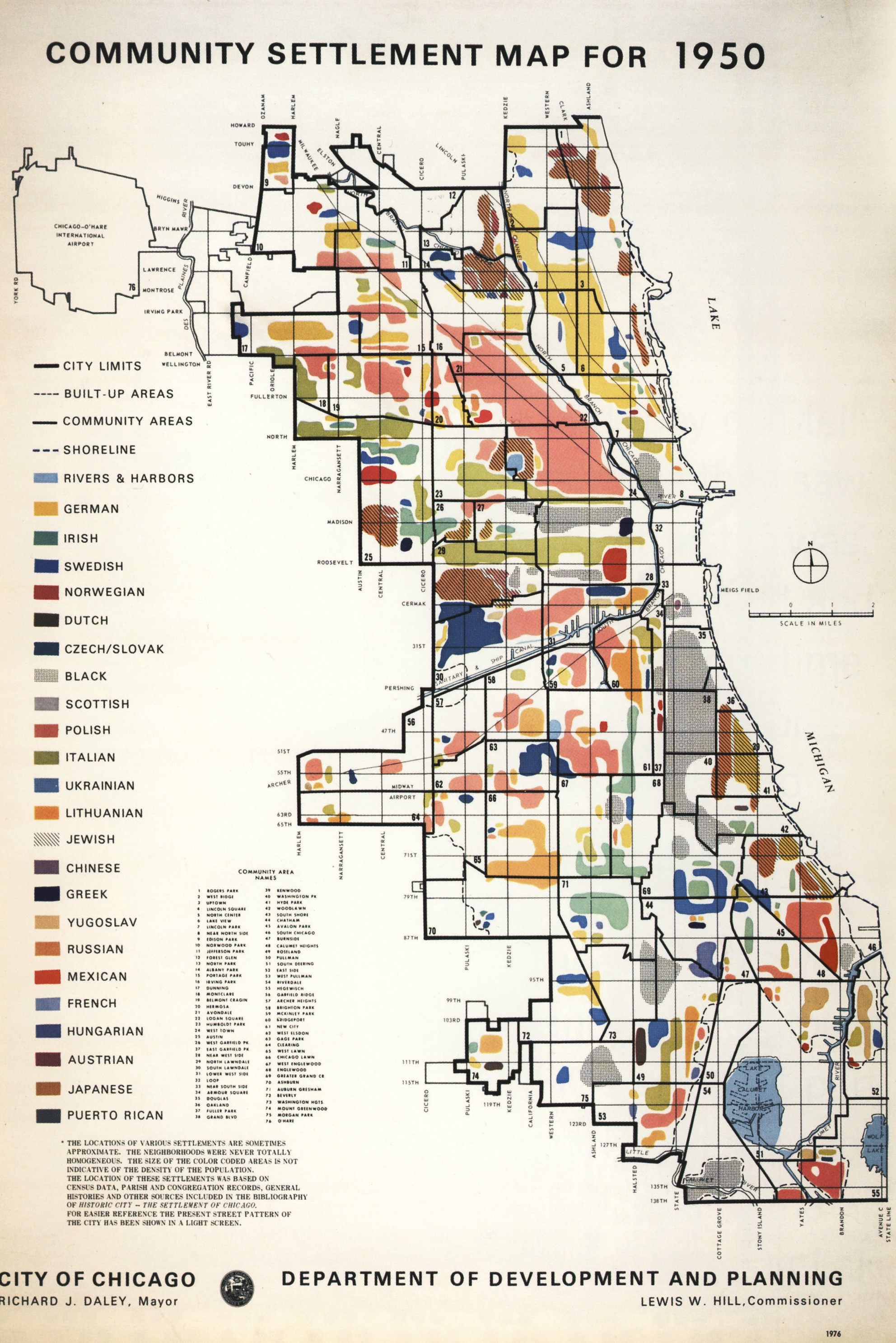
| CLICK MAP FOR A FULL-SIZE VIEW. |
Notice how its boundaries of O'Hare International Airport in the upper left of the map aren't bordered? That's because O'Hare wasn't annexed into Chicago's city limits until 1956. And the use of the term "black" to describe African-American settlements wasn't common in 1950—the standard nomenclature at that time was "negro."
This map was printed by the City of Chicago Department of Development and Planning to highlight Chicago's place in American history during the nation's bicentennial celebrations of the American Revolution. So Mayor Daley ordered the map reprinted to show Chicago's growth into a "world-class city."
Compiled by Neil Gale, Ph.D.
Well, I was 1 year old when this map was originally drawn, so I'm surely not an expert. Having said that, I would question some of the ethnic groupings as represented.
ReplyDeleteNo doubt that the data came from the 1950 Census.
DeleteThank you for this! And I appreciate all your research.
ReplyDeleteThe Chicago History Museum has this map side-by-side with a more recent ethnic mosaic from 2000.
ReplyDeleteThank you Brendan for the information.
Delete