Monday, March 1, 2021

My Photographs and Story about the Lincoln Funeral Reenactment on May 2, 2015, in Springfield, Illinois.


I attended the Lincoln Funeral reenactment in Springfield, Illinois on May 2, 2015. The funeral reenactment began with the amazing replica of the funeral train hearse car with a replica of President Lincoln's coffin, and an exact replica of the original horse-drawn hearse.
The Staab Family Livery of Springfield, Illinois, in association with the lead builder and recreation craftsman Jack G. Feather, of the Tombstone Hearse Company in Tombstone, AZ. Feather had gathered historians and expert craftsmen to recreate this historic vehicle. It was the centerpiece of the 150th Anniversary commemoration of Abraham Lincoln’s entombment and celebration of his life and legacy.
I was given a VIP pass by Dr. Samuel Wheeler, the Director of Research and Collections for the Abraham Lincoln Presidential Library Foundation in Springfield, and later the Illinois State Historian.
I was given this brass 1865-2015 Lincoln 150 Year Funeral Reenactment, Lapel Pin.
Arriving early, I was able to gain entry to the staging area allowing me to take some photographs away from the gathering crowds.
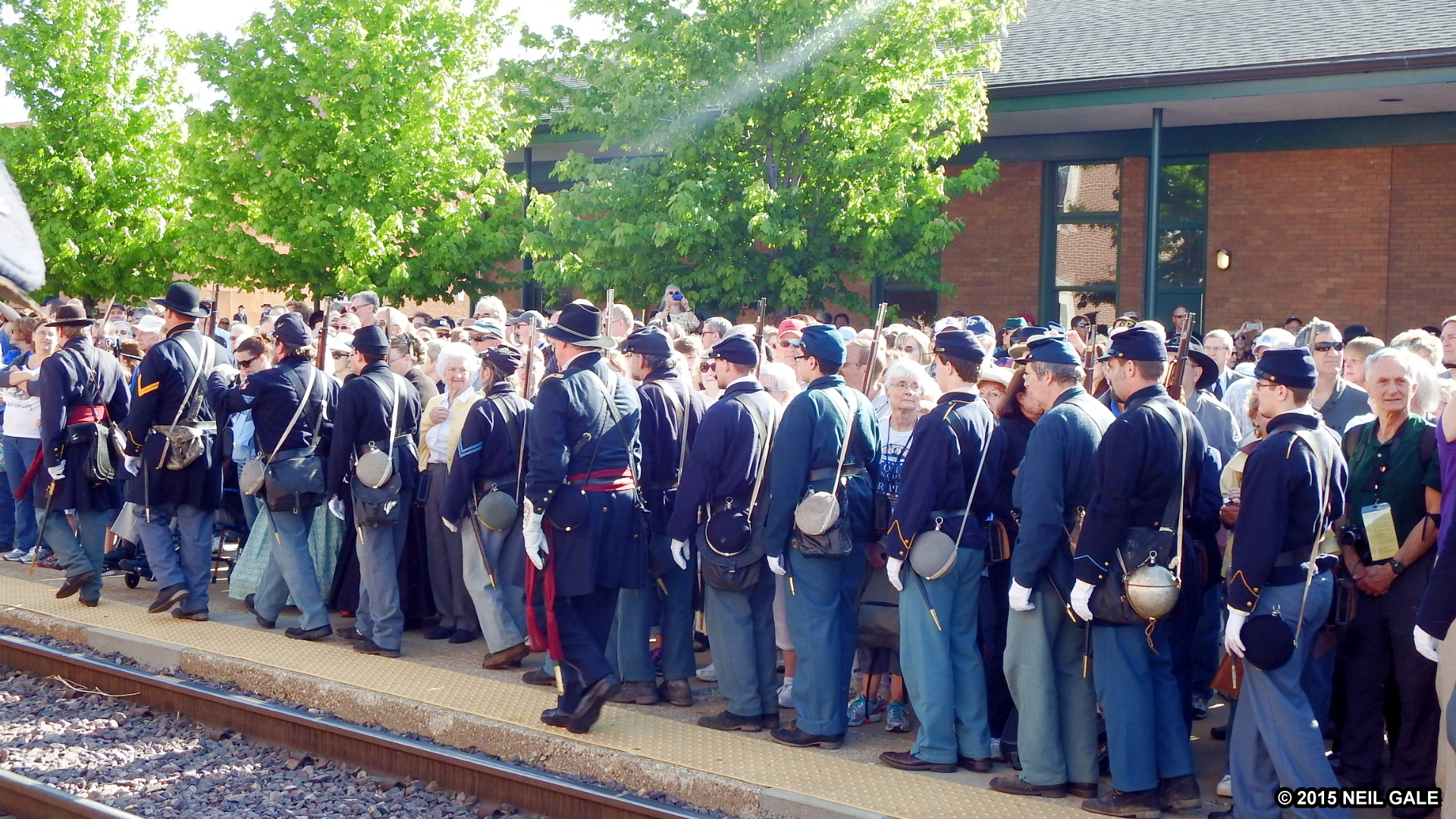
In order to be historically accurate, all military participants will be in Union uniforms. Reenactors from the Confederate States may attend but they were asked to come as Union soldiers or to portray civilians. Special permission was needed to portray any historical person. There must have been at least 10,000 people, both reenactors, and civilians. 
I spoke with photographer Robert Taunt, a historical reenactor from La Crosse, Wisconsin, representing the Mathew Brady Photographic Studio. He was using an authentic 1860s stereo camera to document the funeral procession, along with the modern 3-D camera on the tripod. I gave him my business card to send me some of the photos he took.
Robert Taunt shooting stereo photographs that produce stereoscopic view cards. Stereograph photography became extremely popular in the 1850s. Cameras and view cards were sold commercially in the thousands. Their popularity waned slightly in the 1880s but commercial companies such as Underwood & Underwood repopularised them in the 1890s.


Abraham Lincoln Springfield Funeral Stereograph. A very rare stereoview on an orange mount, identified as "Funeral of Lincoln at Springfield Ill." The image shows the coffin being carried in a six-horse wagon, surrounded by a cordon of soldiers on May 2, 1865. Soldiers with rifles line the parade route, keeping spectators back. Flags are furled or flown at half-staff, while people stand on roof-tops to get a better view of the procession. Lincoln was buried on May 3rd.


A young boy volunteers as a street sweeper, following horses in the precession.
Copyright © 2015, Dr. Neil Gale, Ph.D. All rights reserved.

Sunday, February 28, 2021

The Prehistoric Old Stone Fort, Saline County, Illinois.

The Stone Forts of Illinois.
One of the unique prehistoric phenomena of Southern Illinois is the ruins of stone walls which have traditionally been known as "stone forts." They appear in the rough east-west alignment across the hill country and appear to form a broken chain between the Ohio and Mississippi Rivers. These ruins have similar geographic site characteristics. They are generally located on bluffs, which are often finger-like promontories of land with steep cliffs on three sides and a gradual incline on the fourth. It was across these inclines leading to the top of the bluff that these stone walls are most generally located, hence the theory of a pound or game trap, has been advanced.

Many of the walls have long been torn down and removed for building purposes. Early settlers, in most instances, removed the better slab-like stones for building foundations, leaving only the rubble. These early white pioneers saw the walls and thought of them in terms of their own experiences, particularly from the standpoint of defense against the Indians. Though they called them stone forts, these sites would be very poor places to carry on prolonged fights.

If a small band took refuge behind the wall, they might be pushed over the cliff by a larger attacking force. Or a larger force could lay siege to the place, and the band would be cut off from both food and water and soon starve to death. Although they called them "forts," many people did not accept such a theory, and speculation continued.

Archaeologists believe that particularly in Ohio, the Hopewellian Indians probably were responsible for some of the walls, but the identity is not known. These walls represent a major accomplishment for a people who had only primitive digging implements and methods of carrying or moving heavy stones. These unknown builders piled rock completely across summits, leaving inside enclosures sometimes as large as 50 acres, depending upon the size of the bluff.
The Old Stone Fort in Southern Illinois lies between the Ohio and Mississippi Rivers.


Another fort built almost exactly as the Makanda Fort is the fort that lies southwest of Carrier Mills in Saline County. The old fort site is found four miles east of the present town of Stonefort in Williamson County and seven miles east of Creal Springs, Illinois. Its area is almost the same as Makanda's Fort and research into the Archivo General de Indias at Seville, Spain (the repository of extremely valuable archival documents illustrating the history of the Spanish Empire in the Americas) shows that such a fort was spoken of by DeSoto in 1542. 


This old fort is on top of a hill, which is almost inaccessible. The walls are constructed of large stones and the whole reminds one of the ruins of a once well-constructed fortification. It has gone to ruin more or less within the past one or two years. The first house in the vicinity was one built in 1831 by J. Robinson. The village of Stonefort is situated atop a ridge that rises above the South Fork Saline River valley to the north and the Little Saline River valley to the south. The village of Stonefort was established in late 1858 and was originally located about a mile to the southeast, near the edge of the bluff. There were houses there earlier. 
Some scholarly visitor named the ruins Cyclop Walls, but most people simply call it old Stone Fort.


When the Cairo and Vincennes Railroad was completed through the area in the 1870s, Stonefort's public buildings were dismantled and moved to the village's present location, which was adjacent to the railroad tracks. The former site of the village is now listed as "Oldtown" on maps which is 1.8 miles northwest of Stonefort.

Compiled by Dr. Neil Gale, Ph.D.